1211m - 38.1 km (Pont de Gueydan via Péone)
956m - 17.3 km (Guillaumes)
956m - 18.5 km (Guillaumes via Péone)
319m - 10.1 km (Beuil)
1181m - 23.8 km (Sinne turn-off)
1423m - 31.8 km (Le Pont du Cians)
The real climb here is Col du Quartier (Col de Valberg) (1674m). Col de l’Espaul is a nearby pass reached on an almost flat road from this pass. The western climb from Guillaumes (792m) is the most interesting one and there are actually two climbs from Guillaumes, as one could climb “straight” up to Col de Valberg or go via the nice little village of Péone (1172m) to the pass. I did the later in 2004, but the direct road should be very nice too. Valberg is a ski resort and more known as such, rather than as a mountain pass (a bit like Sestriere in Italy). From Valberg on should try and find a little road that goes north. The asphalt runs out at this pass.
The climb from Beuil (1442m) is not much of a climb and merely a nice little ride on a varied road. However, if you start from Le Pont du Cians (338m) you will have a nice and long climb through the Gorges du Cians. You could conceivable start the climb just before the nice section up the Cians road (580m) if you come over the Col de la Sinne/Sine/Sinna (1438m) from the Tinée valley (which is a nice road too).
If coming from the south one would have a choice of going up either of Gorges de Daluis or Gorges du Cians – two very interesting gorge roads with plenty of tunnels! The highest road pass in the area is now Col des Huerris (1765m) along the road to Col de l’Espaul. It has been asphalted since they built a golf course at the location, but then also disallowed cyclists from cycling there and they have placed a pass sign by the parking just below the pass.
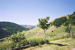
There are some other passes accessible by a road bike in this area as well: Col de Sainte-Anne (1550m) shortly after Beuil on the main road to Valberg and Collet du Guérin (1638m) which is on a side road (Bergians) going south near Col de Sainte-Anne (turn right at the first choice and the pass is where the asphalt ends). From Beuil one could go up the impressive (on the east side) Col de la Couillole/Col de Cogliola (1677m). The photo is taken from La Colle (1787m) at the end of the gravel road that continues from Col de l’Espaul toward this pass. (The are also some other gravel road passes reached from Valberg that could be tried, but I cannot recommend them with a road bike.)
[FR-06-1748]