1109m - 14.6 km (Le Bochet to Lac de Pramol)
1079m (Le Moulins)
1157m (Le Moulins to Lac de Pramol)
[FR-73-1652]
|
Height | Climbing height - length |
| 1653m | 1031m - 13.5 km (Le Bochet (Pont des Anglais)) 1109m - 14.6 km (Le Bochet to Lac de Pramol) 1079m (Le Moulins) 1157m (Le Moulins to Lac de Pramol) |
|
| Difficulty | Beauty | |
| 3-4 (5) | 3-4 (5) | |
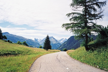
| How to get there | This climb starts by a smelly and noisy metal industri at Le Bochet (Pont des Anglais) (630m) or if coming from St-Jean-de-Maurienne at Le Moulins (574m). The climb is very nice up the long serpentines to Montricher. Above Montricher you get a road choice and you can climb via Les Karellis (1600m) if you so want on a somewhat steep road or just continue ahead on the direct road to Albanne. If you go via Les Karellis (ski resort) then choose the road that goes high up to Lac de Pramol (1731m) and you will cross the pass at a higher point at ca. 1685m on the way down to Albanne. I believe both roads from Les Karellis are asphalted throughout (see map). The lower road is rather flat from Les Karellis to the pass (14.5 km). | |
| Other comments | There is a hotel in Montricher, but nothing much else on the way to Albanne. You will see a big modern hotel up at Les Karellis, so you will know where that is. The road continues down the other side, but eventually ends at Albannette (1420m). At the bend in the road before this village a gravel road continues straight ahead to Valloire and the Col du Galibier (2642m) road. This gravel road is, however, since long destroyed by a landslide and you will have to walk for half a kilometre and for a stretch of maybe 100m the path thorugh the landslide can even be a little dangerous. When I came to the other side there were signs that one were not allowed to use it, but walkers go here daily. If you decide to take this short-cut to the Galibier, then you should go up the nice little road to Le Poingt Ravier (1644m) (and this is arguably also a little pass). [FR-73-1652] |
|
| Map |
||