641m - 12.4 km (Challand-St.-Anselme); 858m - 16 km (Challand-St.-Victor)
1058m - 14.6 km (St. Vincent (south)); 1090m - 16.4 km (St. Vincent (north))
1205m - 16.7 km (St. Vincent (station)); 474m - 6.9 km (bivio Tzecore/Joux)
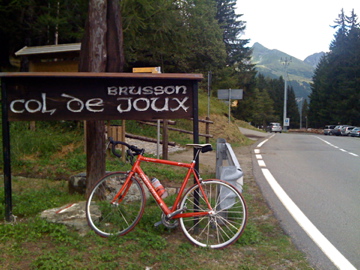
The longest climb to Col de Joux starts from Verrès (389m) at the start of the Val d’Ayas in Aosta. You can take a little short-cut at the highest point at Brusson (1311m). The climb is long but not particularly hard. If you come down from the Ranzola road (1889m) and La Croix (1700m), the climb starts in Brusson at 1276m. One could start in Challand-St.-Anselme (1034m) or Challand-St.-Victor (Châtaignère) (817m) if coming via Col Tzecore/Col du Mont-Tseuc/Colle di Zuccore (1608m) or Colle di/Col d’Arlaz (1030m) respectively.
The climb from the Aosta valley starts in St. Vincent (essentially either north, south or at the train station). It is a harder climb from this side. The short-cut used on the map for the ride from the station and the south side looks a bit steep and narrow (I cheated and did it only from the Tzecore turn-off, but then I did all the passes on the maps in the same day).
[IT-AO-1658]