1074m - 18.0 km (1048m - 17.7 km) (Bassa)
1113m - 17.8 km (1087m - 17.4 km) (Bassa (La Bottaz))
1143m - 17.7 km (1117m - 17.5 km) (Lachat)
1172m - 17.9 km (1146m - 17.6 km) (La Verdasse)
1234m - 18.6 km (1208m - 18.4 km) (Grésy-sur-Aix (Moulin Collet))
1243m - 19.1 km (1217m - 18.9 km) (Grésy-sur-Aix)
1292m - 20.3 km (1266m - 20 km) (Aix-les-Bains)
1259m - 21.3 km (1233m - 21 km) (St-Alban-Leysse)
1048m - 18.6 km (1022m - 18.3 km) (Thoiry)
1005m - 22.1 km (979m - 21.8 km) (Le Pont)
There are many road variants up to Mont Revard, and I made a selection showing the most direct climbs from various places. The hardest climb is from Grésy-sur-Aix (Moulin Collet) (302m) and La Verdasse (364m) are the steepest climbs at 6.6% and since the first climb is a bit longer it should be the hardest, but the other climb is on narrower roads at first. Some other climbs may have some rather steep sections, like the short-cut through Les Gérards up from St-Alban-Leysse (309m) or the bridge below Thoiry (520m). The longest climb is from the train station in Aix-les-Bains (244m) bassed on height metres with 1292m to climb it is a considerable climb, but all climbs involves over 1000m of climbing.
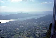
The views from the top are outstanding, so the passes up here are mostly uninteresting check points at best. Col de Plainpalais (1172m) is a really nice pass though. Golet de la Pierre (1510m) is apparent located on the detour road just below the mountain and should be located at a 1505m point where a path takes off this road (low point on it is 1496m), but it make little senase as a true pass there, while the parking just at the start of this little road is actually the highest obvious pass here, and we may just as well think of that place as the pass here. The lower Golet du Taisson (1492m) at the end of another detour road a little earlier is a more obvious pass on its own and connected with this one via a path.
Other possible starting points for this climb are Cusy (548m) with some little ups and downs at first. Bassa (493m) (which might have been the way I took). But better to descend below Bassa to take a small road from La Bottaz (449m) for more climbing. Lachat (393m) is another good starting point, just as well as the aforementioned La Verdasse (364m) below. From Grésy-sur-Aix the hardest climb starts at the Moulin Collet (302m) as mentioned, but many would likely start the climb at the satrt of the D49 via Grésy-sur-Aix (293m). All these climbs as well as the Aix-les-Bains climb meets up before Col de la Clusaz (1184m) on the way to the top.
If you wish to climb from as low as possible the start should be around Aix-les-Bains (244m) or if coming from the south (Chambery) you start in St-Alban-Leysse (309m). You could start higher up here on the south side if coming down from Thoiry (520m). If you come here from Annecy, you would start from Le Pont (585m) and climb via Col de Plainpalais (1172m). All the southern climbs takes you via Pas du Rebollion (1440m) to the top.
[FR-73-1508, BIG 267]