643m - 7.9 km (Le Moulin de St-Firmin)
661m - 7.8 km (St-Firmin (N85))
695m - 9.4 km (Le Motty)
541m - 9.2 km (Croix d’Aspres)
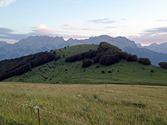
Same description as for Col de l’Esparcelet (1509m): This is not a particularly impressive climb, but it is nice up near the top here, so if you are in the area it is a nice detour. The climb from the south starts blow St-Firmin at the entry of the nice Valgaudémar valley where a road climbs up to the Chalet du Gioberney (1642m). If coming down that valley the climb starts at the D58 turn-off before St-Firmin (885m). If you come on the nice alternative road from the south to the main N85 (route Napoleon) over Les Blachus, you start at the little bridge at Le Moulin de St-Firmin (835m). If you come down the N85, the climb starts soon after you turn off to St-Firmin (N85) (817m).
These three roads meet up and join the two northern approaches from Le Motty (783m) and Croix d’Aspres (937m) at Col des Festreaux (1105m), where you turn up the mountainside. At Les Préaux you should turn off this road and climb up to the left, and not continue on to the l’Esparcelet group of houses that I thought I should continue to, but then I could go up the other side of Les Préaux. Now it is getting a bit steep, but also nicer.
At the next to last curve on the road there is a short 220m long and flat gravel road to this pass, but you should most of all continue up the road to the end of the asphalt road and that is the location for Col de l’Esparcelet. Same way back.
[FR-05-1478]