1100m - 19.9 km (Le Pont du Cians)
1008m - 14.2 km (Ilonse road)
1137m - 22.6 km (Pont de Clans)
1205m - 27.7 km (Pont de la Lune)
1251m - 32.2 km (Tinée valley)
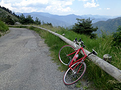
This is a tough pass considering it is not very high, but the climbing options up here nearly all invlolves over 1000m of climbing and it can be quite hot in this area in the Summer. I believe the Ilonse side (from the Tinée valley) is the slightly harder climb. This side is more consistently steep, while the Pierlas side from the road up the Gorges du Cians is more varied and could perhaps offer a little shade in a few places.
From the Tinée valley you start at the turn-off (430m) for Ilonse if coming from Col de la Lombarde/Colle della Lombarda (2350m), Col de la Bonette (Cime de la Bonette) (2715m (2804m)), Col de la Couillole/Col de Cogliola (1677m) or Col de Saint-Martin (1502m).
Otherwise you would start the climb lower down. You could start at Pont de Clans (301m) if coming into the valley via Tournefort. You could have visited Col d’Andrion (1684m) or travelled over the road passing by the famous Madone d’Utelle (dangerous road down to La Tour). If so, then you start at Pont de la Lune (233m). You could finally also have started at the start of the Tinée valley (187m).
From the Cians side you start at the turn-off for Pierlas when coming down from Col du Quartier (Col de Valberg) (1674m) or Col de la Couillole (1677m). Otherwise you start from Le Pont du Cians (338m) down in the Var valley.
[FR-06-1437]