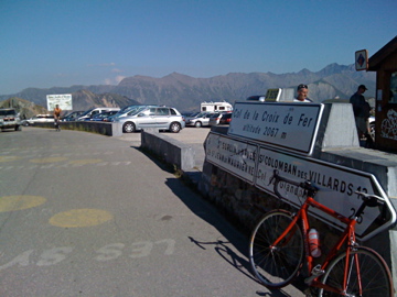
Sign 2067m
1455m - 32.2 km (Rochetaillée/Bourg d’Oisans)
1629m/1608m - 28.9 km (St-Jean-de-Maurienne)
1645m/1624m - 28.4 km (St-Jean-de-Maurienne via Saint-Jean)
1925m - 37.2 km (St-Jean-de-Maurienne via Mollard)
1885m - 38.2 km (Villargondran via Mollard)
1597m - 22.7 km (St-Étienne-de-Cuines)
Not far from the village of Bourg d’Oisans at Rochetaillée (711m) starts the climb from the south of this famous mountain pass. One could also start a bit higher up on this side if coming from the Alpe d’Huez road down to the Barrage du Verney (791m). This pass is not very steep on either side, but it is a very irregular climb on both sides, where the south side has some steeper sections than the north side, while the north side is a bit longer. The irregularity and comparable length of this pass makes it quite hard from either side.
From the north the climb starts in Saint-Jean-de-Maurienne (568m), with two variants, where one variant goes through Saint-Jean d’Arves and has better views than the road down by the river (also two variants after start with a little less climb/descent on the minor road). The hardest approach is via the Col du Glandon (1924m) pass. This is also from the north but starts in Saint-Étienne-de-Cuines (485m) and has gradients of up to 15% close to the Glandon pass. (For this latest approach see profile here.)
There are also two more northern variants that goes via Col du Mollard (1633m) to the pass. The first starts at the same place in Saint-Jean-de-Maurienne and climbs on a road that goes perfectly straight up the valley for some time before many curves up to Le Collet d’en Bas (1141m) (a minor pass) and later to another minor pass, La Cochette (1355m) before it joins road version number two to climb the Mollard pass. The second road starts more eastwards below Villargondran (586m or 574m) and you can climb up the road Google maps suggest or the normal D80 road (I have not done this climb/descent myself). There is a 413 height metres descent from Col du Mollard (to 1227m) before joining the main road to Croix de Fer.
[FR-73-2064a, BIG 287]