1218m - 11.10 km - 11.0% (Thal Römerweg)
1206m - 13.39 km - 9.0% (Thal)
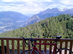
This is a demanding climb near Lienz up from the Pustertaler Höhenstrasse. The classic climb starts in Leisach-Gries (705m) just a little way out of Lienz in the direction of Toblach/Dobbiaco and is steep at once, but there is a flat stretch before reaching Bannberg where the three possible starting points meet up for the final climb to Hochsteinhütte. It is very nice just over Bannberg, but then it is mostly a steep and good road through the woods up to a car parking where the asphalt ends at 1978m. The gravel road to the hütte is easy and short and going up there is the only way to get some good views up here.
The hardest approach might be to start at the Thal Römerweg (811m or 805m) that I did back in 2010 as it is the only consistent climb without a resting place and with 11% on average, but it does not really feel as steep as numbers say as it is fairly evenly steep. If coming from Italy through the Pustertal you could also start earlier in Thal (817m), which is makes it easier up to Bannberg.
[BIG 629]