1757m - 21.45 km - 8.2% (Fusch)
1419m - 14.60 km - 9.8% (Toll station)
|
Height | Climbing height - length |
| 2572m (2402m) | 1817m - 28.45 km - 6.4% (Bruck/Krössenbach) 1757m - 21.45 km - 8.2% (Fusch) 1419m - 14.60 km - 9.8% (Toll station) |
|
| Difficulty | Beauty | |
| 4-5 (5) | 5 (5) | |
| How to get there | From the north you start in the area of Zell am See at Bruck and Krössenbach (755m) and follow the Großglockner road through Fusch (815m), where the real climb begins or later after the toll station (1153m). The north side of the Großglockner is the steepest side with many curves. This side could also be directly climbed without any downhill section to the highest paved point in the area, the Edelweißspitze, which is the 5th highest paved road in the Alps. When you eventually reach Fuscher-Törl (2402m) you turn off and follow a minor cobblestoned (“setts” really) cul-de-sac road (1.75 km) where it is steeper still, but the climb is short and the views rewarding in good weather. | |
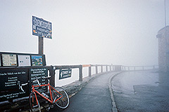
| Other comments | There is a restaurant at the top. The manager kindly gave me a book to see how it could look here in good weather while I had a cup of tea to warm up. For further comments read about the main pass here, the Hochtor (2504m). |
|
| Map |
||