871m - 21.52 km - 4.1% (Pont (La Durance))
792m - 18.04 km - 4.4% (Pont (La Gyronde))
A nice climb, but not particularly demanding. It is interesting as on of the few roads into the huge Ecrins massif that is not from the west and with the sight of a glacier at the end. One normally starts in the centre of L’Argentière-la-Bessée (979m) and after a short climb, the road is fairly flat for a while. Just before a bridge over La Gyronde (1081m) a road comes down that one could take if coming from Briançon via Villard Meyer (1235m) to avoid the main road down to Argentière. One could possibly also start on the minor road from La Bessée du Milleu on the main N94 and cross La Durance (1002m) at the first bridge upstream from Argentière.
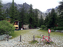
There are at least three other paved road above 1600m, the one up the Vallon de Chambran is paved just above 1700m. However our road here is the highest one. At Vallouise the road becomes nicer and it starts to climb more, but it gets more exciting after reaching Ailefroide (1509m) where the road zig-zags up the Vallée de St-Pierre a bit steeper with quite good views. The last stretch is flat to the end.
[BIG 293]