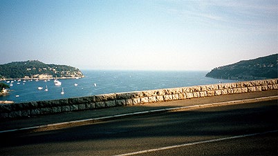
I arrived at the airport in Nice in the middle of the day before the 14 days trip. Eventually, I arrived at the hotel and decided to go out for a little ride in the evening to check out the area of where I planned to go the next morning. I went on the Corniche Baisse (lower) in the direction of Monaco for some time but turned around after a while near Beaulieu-s-Mer. On the return I took the first photo here. Soon thereafter I cycled up a climbing road to Col du Caire (180 m), Col de Villefranche (149 m) and then I decided to try a road without a sign that I suspected would take me up to the Col des Quatre Chemins according to a more detailed map I had not brought with me. That little road going straight up from Col de Villefranche is probably one of the steepest roads around Nice with some stretches of around 16-17% inclination. Well at Col des Quatre Chemins (321 m) I went back to Nice on a long nice sloping road. I went out and had some indian food that was a bit too expensive for what I got (bad choice).
|
Some facts about the trip and other useful information: I travelled for 14 days and climbed 53173 m (which is 3798 m on average per day). It was 2277,75 km (which is 162,7 km on average per day). It was between 4 and 38 celcius. The maximum speed was (probably) down the Nufenen Pass at 79 km/h. The maximum inclination up a pass road was probably at around 19% (Col du St. Bernard). I had rain on several days, I had a wheel damaged, and a rib fractured. I visited around 75 passes. Click this link for a pdf file of all the passes. The packaging weighed around 3 kg. My bicycle weighs all-in-all (with waterbottle and tiny saddlebag) around 10 kg. I weigh 87-89 kg. I have 39/53; 12/25 rings to choose on. Shimano Dura Ace 9-speed. Michelin Pro Race 23” tires. HAC4 cyclocomputer (which is nice when it works …). Click here for packaging list. Go to cycloclimbing.com for links to sites with more information and help for planning your trip. A few photos on the pages have a bigger photo version you can see if you click them (they open in new windows). |
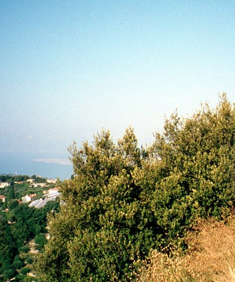
I was up early in the morning and had no breakfast included in the room price. It did not much matter as I just wanted to get going this morning. Away at just after 7 a.m. is pretty good for me! I found my way out of town nicely now and was soon on the Moyenne Corniche (there are three roads going parallel from Nice to Monaco at three different levels above the sea and this is the middle one). I followed it up to Col de Villefranche (149 m) and now continued perhaps two kilometers before the more obvious (than the one I took the day before) road up to Col des Quatre Chemins (321 m). On the way up there I met some nice people in a car handing me a big croissant, and thus had breakfast on the way – great! The Grande Corniche (the highest road to Monaco) continued up to Col d’Eze (507 m) and near the top I took a photo of the view back to Nice (which is hard to see any of on the photo). Also took a photo in the direction of Monaco (below). There were a few cyclists up here, though the asphalt was not always so good. The views were superb and I was happy that I took this road to Monaco. After crossing the road (D37) at La Turbie I was going to take up here again, I soon reached a road going straight down to Monte Carlo. Nice narrow streets with pink houses, but it was difficult to get down to the harbour as they had closed one of the very few roads down there. Eventually I passed by the casino and had a coca-cola soon thereafter; went down to the harbour (no photo as I guess most have seen the place on TV or in movies) and then back through some old tunnels to Cap-d’Ail. It took me some time to find the road back up to La Turbie.
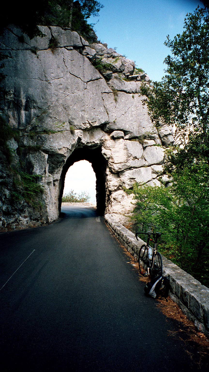
A real climb up to La Turbie and Col de Guerre (555 m) – now the serious business had begun! Less steeply the road winded up to Col de St. Pancrace (672 m) and then I passed the inviting road going in the direction of Ste Agnes (which is supposed to be a place to visit, but one cannot do everything). There were some sweet tunnels just before the tiny village of Peille – the first you can see here. Here I had planned to go up a very narrow road that is not marked as paved on any map I have seen, but it turned out to be paved (and extremely steep 13-19% all the time) all but the last two meters where a track begun and went in a few directions.
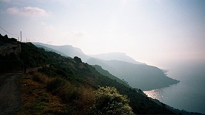
While thinking of taking a photo here at Col du St. Bernard (738 m), I heard some voices in the woods and waited a bit and then two MTBers showed up on one of tracks and I talked with them about the practicality of going down the track to the small road on the other side that I had planned to use anyway. They did not think it was a good idea and I went back down to Peille and around the woods instead on the extremely small (but paved) road on the other side, where I met the two guys again (they took the path). On the photo you can see (perhaps) in the distance the road I was going to come to eventually and one of the MTBers.
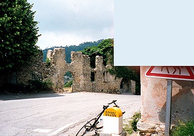
The small long road to l’Escarène from Peille was paved all the way, even though ”paved” is an overstatement. I even met two other cyclists there (local I believe as it said something about Monaco on their cycling shirts). There was of course another pass (col) on this road, namely Baisse de Malamoullier (663 m) (it also said so on another sign near to the one on the photo). Lovely places, but it took a long time to go here and I was worried I would probably not get as far as I hoped to this day. (And I was right, and for good reasons as we shall see.)
Somehow it seemed like I was lucky taking the long way to l’Escarène as the shorter road appeared to be closed. Had a soda and a pastry and then went on to Col de Braus (1002 m) on a sometimes rather steep road, but the worst thing by far was the extreme heat and still air. I was very tired when I eventually came up to the top. Here I had to edit out my finger from the photo. Actually the only warning sign for horses that I have seen in the alps. From here the nice road went down to Sospel where I had lunch (a hot sandwich and water). A nice little village where many cyclists passed by.
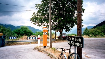
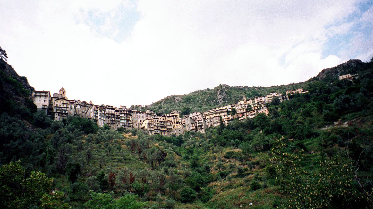
I felt like time was running away from me, but I was after all on holiday, so I did not care too much about the time. Eventually got up the next passage at Col de Brouis (879). The weather was turning more cloudy, but the road up here and down was very good – not much traffic and not steep either. Now I was down in the Roya Valley coming from down in Italy and going up to the italian border at Col de Tende. The road up here was much busier, but also good. It went really fast at first when I had the wind in the back, but then it turned around and I soon had a little rain, just after Saorge. Saorge really looked very spectacular when I approached it from down below – it is the hanging village with old buildings you can see below.
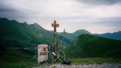
I stopped at Tende to eat some more – a fruitcake and some sodas. It started to rain heavily during my stay there and I spent time buying postcards that I sent two days later. After a while I decided that it had been enough raining for the day and went away just after the rain stopped and happily did not have any more rain that day. Tende was a small town somewhat in the style of Saorge (very old and peculiar). Well on I went toward Col de Tende – the first really high pass. Cars passing me by probably was a bit curious about where I was heading as the only paved road ahead was through the Tunnel of the Col de Tende, which is prohibited to cyclists and one car even honked at me to warn me. However, just before the entrance to the tunnel there is a really spectacular hairpinned road going up to the real col and it is paved here and there, but for the most part not. It might be the most tightly hairpinned mountain pass road around (at least where you could see the hairpins). It is possible to cycle up the road with a road bike, only a few passages might be tricky. It is not very steep, but not easy either. Very recommended! The road down to Italy is paved all the way also (so it is a good idea going in the direction I went in). After the Col de Tende (1871 m), I went to the left up to the nearby Colletta (1907 m) from where I had a very good view of the hairpins, as you could see here. (Looked even better in reality, as always … .) The road going left looked at first very bad, but soon was a very nice unpaved ridge road. Then I went to the right of Col de Tende, taking a stupid way up to the fort and down further right to Col de Canelle (1882 m). The road right of Col de Tende first looks fine, but then turns rather bad. I went a bit further and thought to visit the next col too – Colletto Campanino (2189 m), which would had brought me over 2000 meters on the first day already. However, the road was almost not possible to use with my road bike and it was late now (eight in the evening), so I saved the other cols for another time.

I simply had to go down into Italy and find a nice place to stay for the night. I stopped at the lowest laying little village where I had planned to go west/left. This was Roccavione and had a very anonymous (no idea of what it was called or if it had any stars) old place to stay at in the town, but it was really quite good and also cheap. Older places usually have bigger showers (or bathtubes, which is not so nice), more hangers and bigger rooms than more modern hotels. They also had a pizza restaurant in town!
Day1 – Day 2 – Day 3 – Day 4 – Day 5 – Day 6 – Day 7 – Day 8 – Day 9 – Day 10 – Day 11 – Day 12 – Day 13 – Day 14 – Day 15