It was a bit difficult to find the correct road to Granier from Valezan. I skipped stopping and looking at my map and soon realised that I had remembered to go straight at la Bergerie, but in fact one should descend there for a while and then take off to the right again. Otherwise you will soon start to cycle straight up and a little later you might be able to get through fine on a gravel road to meet the road coming up from Granier toward Cormet d’Arčches, but I am not sure it is good enough for road bike cycles (but if it is, it should be shorter and quicker). I did not want to take a chance on the gravel road there and decided to get over to Granier (which is visible from Valezan in the distance).
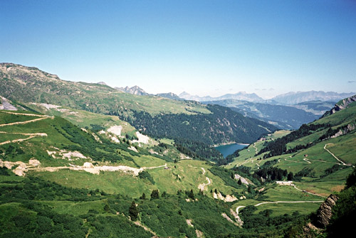
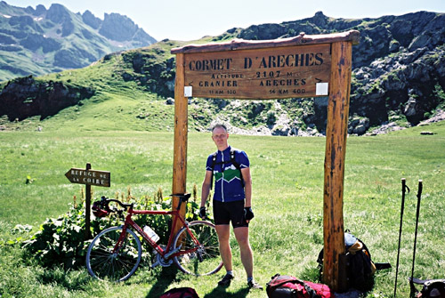
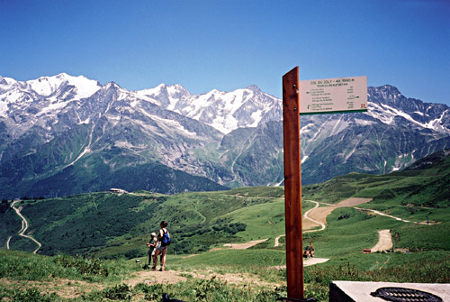
Granier is very well-situated too and with great views! One simply cycles through the village and in a bend one comes above the village and the road is almost straight for the most part until the asphalt runs out (sometime after a very steep section). From the start of the gravel road one climbs a road that winds its way up to Cormet d’Arčches (2109m). It is not very good and sometimes it is only just about cyclable with a road bike, but it is not as steep here as lower down. The gravel lasts for perhaps 5 km until you reach the pass height. From the pass height a much better gravel road (no problem with a road bike) descends on the north side in very beautiful landscape above the Barrage/Lac de St.-Guérin (1558m). The asphalt starts again after only around 3-4 km of gravel and earlier than half-way down to the dam. From there the road is narrow but good down to Aręches (1055m).
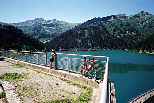
The passage over Cormet d’Arčches is a nice alternative to the also very nice Cormet de Roselend (1968m) and here you escape most traffic including all the cyclists, but I met a few mountainbike cyclists and one with an old-fashioned touring-bike (audax) just above Granier. There are many people walking up at this pass in good weather. A trip over Col du Pré (1703m) between Arčches and Cormet de Roselend is very much recommended for the best views of the Barrage du Roselend and getting a glimpse of the Mont Blanc range in the background (Col du Pré is best climbed on the steep side from Arčches). I went over here in 2002, but not this time.
I decided to find a grocery in Arčches, and found a tiny one after a while. I bought some fruits, Coca-Cola etc. Then I descended to Beaufort (745m). From Beaufort I went out of the village following the main road up toward Cormet de Roselend and after just 200m a road takes off up the mountainside to Col du Joly (1989m). It is a bit steep at first, but then goes almost level along the valley until it meets up with the alternative road via Hauteluce – one could get over to Hauteluce, but it is better to continue on the same road until it ends higher up where it meets the other road. (This less used road is actually a little better and little less difficult.)
From where the roads meet, it is around 10 km to the top with an average gradient of close to 8%. It was also very hot on the climb this day. I ordered an ice-cream and water at the bar at the pass (even though quite expensive) and I was surely the only one sitting inside – sitting outside in the sun on mountain pass heights is not exactly what any somewhat sane cyclist would want to do, unless it is warm, not windy and not sunny. The road to Col du Joly is mostly good, but on the other side there is only a gravel road down (and from what I have heard it should be bad enough that one would have to walk long stretches). On the road back down I was descending slightly too fast in one narrow bend and was braking hard enough that I lost the grip of the road shortly, but I got through fine – this made me become a bit more cautious though. I only know I do not get as fast down such roads as is possible by professionals, but it is mostly a question of technique and a little stupidity, I guess (as German cyclist Erik Zabel acknowledged in the Tour de France movie ‘Höllentour’).
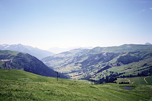
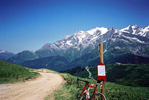
Just before Hauteluce (1104m) the climb starts up to Col des Saisies (1633m). You pass under a building on the road through Hauteluce and just after you will find water. The climb to the Saisies is a moderate climb where you can enjoy the good views you had at Col du Joly, but now seen from further away, which doesn’t make the views much less good. The next to last photo is taken on this climb. After passing through the tourist village at the pass height, but just before the sign for the Col des Saisies, one could take a small road to the right going to restaurant Mont Blanc (I think it was). The road is asphalted to this restaurant and the pass that you arrive at there – Col de la Lézette (1786m). This road is really only asphalted in theory – in practice it is covered with asphalt to around 65% with the rest being big holes that you will have to zig-zag around. (As if to prove that this road was no problem, someone walked down there with a pram/perambulator.)
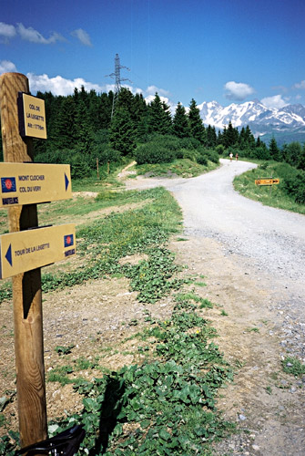
The road continues on the ridge in the direction of Col du Joly, but does not go there as there is a somewhat long section in between where no road could be drawn anywhere very high up. It goes to Col de Véry (1962m) from where only paths continues further (or a non-cyclable gravel road continues). I had originally planned to go to this col and descend on some partly walkable stretches toward Megčve (1107m). I continued only to the nearby Col de la Légette (1776m) on a much better road even though it was gravel (with some odd pieces of asphalt underneath).
The road down from Col des Saisies toward Megčve is extremely bad for cycling, with many long really dangerous cracks in the road that no one had tried to mend at all. (No problem for cars, more than avoiding to smash up with cyclists doing desperate maneuvers to avoid the cracks.) Hopefully they fix this road sometime soon or else I suggest you go cycling in some more cyclist-friendly place.
The road over Megčve (which is also a pass – Seuil de Megčve (1107m)) is very busy with cars. After I took off down to St.-Gervais-Les-Bains on a nice road, the traffic lessened a little (and I kept a higher speed). A local cyclist passes me by and he really knew the road as he went very fast down, but I managed to keep up with him (hoping he knew what he was doing …). (He turned off up on a small road just before the village – as I suspected, he was from the area.)
Afer a short stop I continued down to Le Fayet (570m) and crossed the big flat valley floor as one is not allowed to use the main road up to Chamonix with a bicycle. I was going to stay with my sister and her boyfriend who had actually moved down here over a year before and they rent a cheap small house in the outskirts of Chamonix (as they enjoy skiing, walking and such). However, I had called them from Valezan the day before and now it looked like I would be arriving slightly too late at their house. I had really wanted to be there around 19, but it was already past 18. It turned out that the alternative road up to Chamonix for cyclists is really quite difficult and invloves around twice as much height metres to climb as if one had taken the main – and straight – road up. I was going really fast, but the road just kept climbing high above the valley until finally one wheels down to Les Houches and Chamonix (1017m).
Having no phone with me I could not call them and I had a hard time finding the right road and then the right building, but got there before it turned dark anyway. I had something to eat and after discussing the trip for while went to sleep, deciding I would make the next day less ambitious.