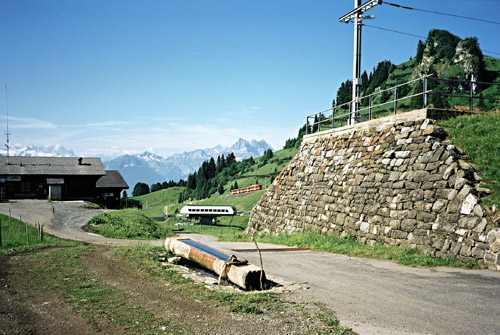
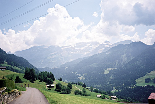
I had very fine weather this day (apart from a short shower). I continued up to Col de Bretaye (1806m) on the sometimes very steep and narrow road. The train were coming up for the second time this day (I think) just as I had reached the pass and managed to catch it in the photo here.
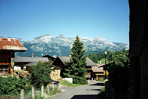
There is a restaurant and hotel at the top and there are several paths leading off in many directions. The road becomes gravel just after the top, but it is pretty good (and actually gets better further down). The views from here are quite good, but I am sure you will get even better views by following some of the paths. I took the gravel road down to a lake, but it ended at the lake. It turned out that I should had taken the alternative road taking off just before going down to the lake (and a restaurant there). The road goes around the north side of the lake and then climbs up over an unnamed saddle before the real descent down the north side starts. The road soon becomes tarmacced well before reaching La Forclaz (1261m), which is a little village and a pass (at least in name). I had my second photo here – you can see a little girl down on the road with a skate-cycle(?) and in the distance you see the mountains around my next goal for the day, namely Col de la Pierre du Moëlle (1661m). The lady at the restaurant (hotel) at Col de Soud told me there would be no hotel at La Forclaz, but she was indeed wrong there as I saw a tiny one! (I think I would have managed to reach that hotel the day before, but who knows if they had any free beds and food … .)
From La Forclaz a wide and very well surfaced road goes down to Les Planches/Le Sépey (943m). At Le Sépey I stopped for pastry and Coca-Cola (there is a small grocery and a pastry shop). When climbing out of Le Sépey one soon joins a bigger road, but at the next bend one road takes off to Les Diablerets, while the other climbs up toward Col des Mosses. I knew I should turn off this latter road just before Ormont-Dessous (1348m), but for some reason I suspected that a road that took off in the right direction at the next bend would work too and it turned out to be a good choice, letting me escape the busy main road. This road is irregularly steep, but sometimes quite steep and continues this way to the pass. (It joins the Ormont-Dessous road much higher up.) There might even be a connection directly from Le Sépey bypassing the main road altogether (as I saw an asphalted road descending a bit in that direction), but no map shows such a road (well there seems to be a road via Les Esserts, if you zoom in on the viamichelin.com map). The road I took (le Matelon) is very narrow and there is some local traffic.
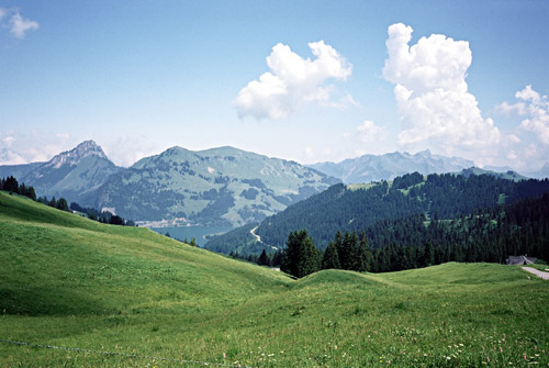
The area seems popular with mountainbike cyclists and I saw a big bunch coming toward me on a track. The road is fully asphalted and in good condition to Col de la Pierre du Moëlle (1661m) and over the pass. At the pass there is a restaurant. There is a road going higher still at the restaurant and it is paved at first and seems rideable, but I do not know where it goes. You should take the main road going down on the north side. This was (2006) very well asphalted apart from 150-200m where it was good gravel but somewhat steep. Down by the big Lac d’Hongrin, I took the road going back toward Col des Mosses. This road is marked as a very minor one, but is in fact a very big road with impressive bridges – not that they look impressive, but the number of them! I think I passed at least one bridge per minute for the next 30 minutes to La Lécherette (1379m). I went in the opposite direction of what I had planned, for some hundred metres just to check out another not so very obvious pass, which has no name (1388m). Then I went back and up to Col des Mosses (1445m), which was very easy from here, of course.
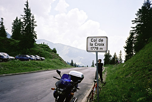
I had no photo at Col des Mosses as it was comparably a rather dull pass. After just a little descent toward Ormont-Dessous, I turned off the main road to the south on a very tiny road which go over a ledge and shortcuts down to Les Diablerets (1188m). This road reaches its high point just before Les Voëttes (1401m). Here I took a photo in the direction of Les Diablerets, catching two cyclists climbing up toward me. I stopped again in Les Diablerets for a sandwich and Coca-Cola. Here I wanted to get up to Col de la Croix (1778m) as my plan was to climb as many of the cols above 1700m as possible in the Alps that I had not already climbed before, but had to return back the same way again. This climb was not very exciting and I went quite fast up the road.
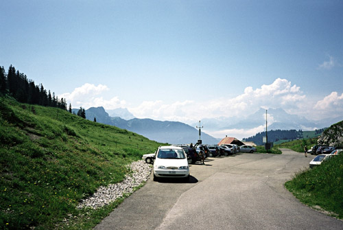
Even if the climb was only supposed to be 600 height metres (to Col de la Croix) it felt as if it was longer. At the pass height I was almost back where I had started the day which felt a bit awkward, but at least I knew that from here on it would be a rather straight journey east. One stupid motorcyclist had decided to park by the pass sign and spend half day there. I was waiting for him to get out of the way, but he did not and after a while I just decided to take a photo anyway and now he was just about to do the same in the other direction and seemed like he thought I was in the way, so I just took a photo and went back down again … .
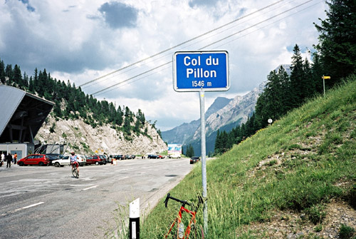
Back in Les Diablerets, I had another Coca-Cola and then climbed up the Col du Pillon (1546m), which was a nicer climb. You get very close to the high mountains here and it is a somewhat peculiar pass. It is also a somewhat steep, but not very long climb. I had a photo at the top just as another cyclists came up after me. There should be a gravel road up here that could take one to a nearby higher pass (but I did not know). There are lifts going up to the glacier-covered high mountains to the south. I continued down to the german speaking part of Switzerland that this pass separates from the french speaking part.
From Gsteig (1184m), the road is almost flat down the valley to Gstaad (1050m). At Gstaad I stopped by a little shopping mall and got some fruits, sandwich and something to drink. When I came back from the shop, the bicycle was nowhere to be seen! I got worried, but quickly found it parked outside – apparently it was very bad to park it just inside the mall, despite not being in the way for anything there. Well, things like that could happen at home too, even if very annoying. I was taking a short-cut on a small narrow road that starts just after this shopping centre. It is a steep ramp up the first part, then it is very narrow and they go by farming vehicles that just exactly passes between the fences on both sides of the road, thus I had trouble making room when I met one such vehicle. This little road takes you directly to Schönried (1230m) just before Saanenmööser, which is also an unnamed pass.
This area is quite nice – rolling green landscapes with mountains nearby. After descending for a while to Zweisimmen (947m), I took off the main road up to Lenk. Actually it was some rain in the air here also, but I escaped it upon approaching Lenk. The valley is almost flat until Lenk (1068m). At Lenk there is a road going up to the left to Bühlberg (1659m) and it is well signposted so you will not miss it. The climb is on a narrow and rather steep road. It took quite some time to reach Bühlberg, but I enjoyed this section very much – nice atmosphere here and a nice climb, and I heard church bells from down in Lenk for a long time.
At Bühlberg the road ends, but there is a private road that continues up to Hahnenmoospass (1950m), which is not possible to use with a car as you need a key to pass the bar across the road. The road is mostly paved with concrete (in the steep sections). It would have been rideable all the way if it had been less steep. I had to walk around 2.5 km. The road is a bit bad only where it is more flat. It is totally ashpalted on the east side. It is only steep in the highest section on this side, where they have stupid signs warning cyclists to use their brakes – as if you did not think so ;-). There is a restaurant and hotel at the pass height. If coming from Adelboden, you go straight until you have to turn over a little bridge (if memory serves me right).
I stopped for the night at Adeloden, but was a bit worried that I would not find any cheap place to stay at. There was a sign on a cheap looking hotel that I should visit a bar or some place to find the owners, but did not find it. I went through the village and started getting down from it when I stopped to ask for a cheap place by a cheap looking bar. Here someone at the bar suggested I could stay at that place and why not, I thought. It was cheap all right, but perhaps a bit too cheap ultimately … . They warned me of a disco night event that night and even though I thought that would not be a problem, considering that I was tired, I still could not sleep until 2 am. I had a pizza at two different places in the village – the first one on the main square was not as good as it looked, the other was more italian in style and much better. I had a few beers at the bar where I stayed and they only served one type of beer and nothing else, but I watched some cycling on the TV and read in the newspaper about a rock slide in Grindelwald (to where I was heading). The bedrooms and corridors looked like it was Soviet military style standards (or perhaps worse), but it was cheap! (–Who said Switzerland is expensive?!)