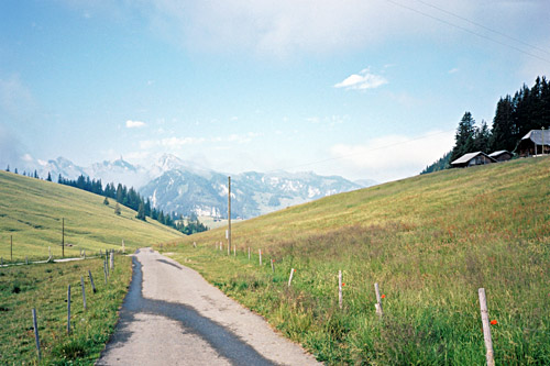
This day started out with great weather just like the previous three days, but now as I started to move east, the weather got less reliable and shifted a lot over the coming days. The day did not quite start like any other day though. At (or before) 6 am the cows started to make noises and prepared for moving outside. There were like 50 cows living in the same building at the bottom floor, but it did sound a bit as if they were actually up on the same floor as me running around and it sounded more like there were a few hundred of them. So the lady was right to warn me as no one not completely dead would wake up to this. Still I slept on a bit longer after they eventually all got out half an hour later or so.
The breakfast was worth noting as it was clearly the best I have ever had anywhere (even if I had great breakfast this year at a few other places too). All kinds of locally produced things and very nice assortments for making one’s own müsli and it all tasted very good. I am sure some others could imagine more like cooked foods etc., but for me this was an ideal breakfast (I think I also got an egg, etc.). In came the nice owner and we had a little chat before I left. I could truly recommend Rinderalp for a visit and it was the nicest memory from the place I stopped at during this trip (next one would be the place in Soboth, Austria).
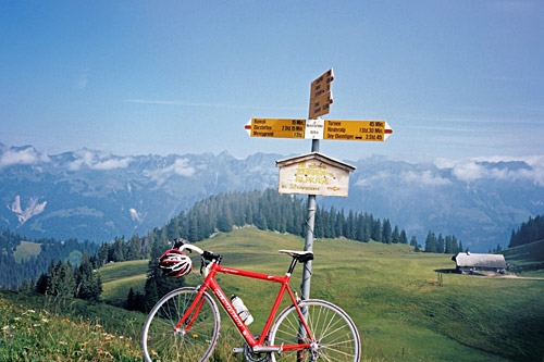
First photo here (also posted on the day before to get a sense of of all the places I came by that day) was taken just below Rinderalp (good views in other directions here too). Rinderalp (1702m) is also a pass and I discussed it with the girl (female – never know what word to use with younger females …) there. She wondered if I should not try the road down the other side and there is actually a sort of a road/track down there as I had noticed by careful studying of satellite images, but as she also confirmed even mountain bike cyclists complained that it was too bad to be usable even for them). I went back down only to the last road crossing and then continued up the other steep road here to Hintertärfeten (Chrindi)/Hinder Tärfete (1824m), which is very much a pass, but there is also only a path going down the other side below Schwarzmoos (1781m) (the ridge could be crossed a bit further ahead too at Ramsli (1736m) after a little ascent to 1847m.
The climb up to Hintertärfeten is really the most fun climb in the area, I believe, and also slightly harder than the Gestelenpass and Seeberg from Oey. The last little stretch of ca. 175m is smooth gravel and I had thought it was asphalt from photos and satellite images. No problem at all and lovely views from the pass! It felt a little tiresome to go down to Oey and knowing I would be going on low altitude for quite some time this day. Actually I did not quite know this as I had planned to possibly climb the Männlichen mountain from Grindelwald once again, hoping to get there in good weather. However, it was good weather, but at the same time clouds gathered all around in the skies up in the mountains, so the chances of having good weather at Männlichen looked rather unlikely as I continued toward Interlaken.
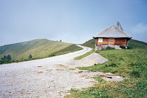
I stopped at a café in Wimmis (635m) and had a coffee and cake. Then toward Thunersee, but I turned up on the ridge overlooking the see and continued up to Aeschi (862m), where I turned down to Thunersee and then followed the road to Interlaken (one takes off the main road at one place and later rejoin the main road later again). I found a good place to wash the bicycle upon entering Interlaken, seemed like I could wash it forever with only one coin (must have been malfunctioning). These car washing treatments may explain part of why I sometimes have squeaking sounds from the bicycle on climbs … . I had stopped in Aeschi for a coca-cola and banana, so did not need to stop again. I looked up the Grindelwald valley, but it seemed like Männlichen were in clouds and it would likely not get better, so with some regret I decided to skip it and move on and save time in my schedule.
So, after much confusion in how to get out of Interlaken onto the other side of the next lake, the Brienzersee, I eventually found the proper way and got on my way along this lake where I have cycled in the other direction once before. On the other side there is really only a motorway and as far as I know, no other fully asphalted road that can be used to get up to Meiringen on that side. But there is a cool road that climbs up to Fangisalp (1921m) below Faulhorn (2681m) on that side that I would have liked to try out, but also skipped this time. If there only would have been a connection over to Chüemad (1802m) above Axalp (also an interesting climb), then it would have been a very nice way to over to the Meiringen area, but there is hardly even a path.

I continued in good speed to Brienz, where I stopped again for a coffee and cake. When I went down here last time from Brünigpass (1008m), I just stayed on the main road, but I now noticed the signs saying one had to turn off and use another road with a bicycle and decided to follow the advise. On the descents it does not make much sense to make detours for short stretches like this when one anyway keep the same speed as the rest of the traffic, but on ascending the same stretch it is sometimes better to follow advised road choices (also to avoid troubles with the police). The alternative routes avoids some tunnels, is nicer and about the same distance and steepness.
I kept a good speed up to the pass, knowing it is not so long, but of course it now felt a bit longer than I had thought and this side is a little steep. Then there is a nice and fast descent to Lungern and the Lungerersee. Then it continues down to Giswil (492m), where I turned off on the road toward Glaubenbielen/Glaubenbüelen Pass (1611m) and after some confusion I went back a little and went off down the west side of the Sarnersee. The road is here fully asphalted even if no map shows this, but it is narrow on one part. One crosses some bridges and then comes to a first narrow asphalted road that turns off up the mountainside at Brand (487m) (no sign), where there is also a bus stop and a bus came there stopping just as I had stopped to look at the map. Also two cyclists, to whom I said it was possible to get up this road, but apparently they were not on their way up to the Glaubenbergpass (1543m), which was all I was thinking of.
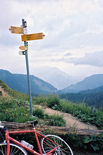
There are several starting points between here and Sarnen to climb up to Glaubenbergpass (see the Sewenegg (1742m) in the High Alps pass list). Actually the normal road (or a variant thereof) might be slightly steeper on average than by starting here, but the climb up from here is on a very narrow road with more varying steepness and of course less traffic, so if coming from the south this is a better starting point for the climb. I took another more southern road on the way down here, which was the nicest alternative. (You go the the left at the first choice of roads here if you want to take the road I took down or else you can go right here, but then left etc. (well, I mostly guessed my way up, but it was more or less the road I had planned to take).
When reaching the main road one thinks it would now be an easier climb as it was rather flat at first, but soon it started to get pretty steep again. The road is quite wide and does not have much traffic, which is probably due to the fact that it is very much used as a military road and half the vehicles on the road were military. They have a big military centre and training ground up here. There were also rather nasty cattle grids on the road, which I have never seen on a road as wide as this before. (It is not like they usually have cattle grids on highways … .) I found some water along the road and decided to fill up as I was getting tired and did not feel too well either. The weather was slowly getting worse and this road is bloody boring in the higher regions.
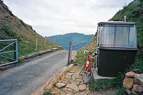
However, there were a little excitement that had made me climb the road from start. It was a long detour to go back and forth over Brünigpass only in order to climb a very obscure pass above Glaubenbergpass (1543m), which is Sewenegg (1742m), that I had found out to indeed be asphalted on the Sarnen side from a website dedicated to how to get up high points in the Alps by motorised wheelchairs! So, I thought that if you could get up there with a wheelchair, then surely it would not be a problem with a road bike.
Just before reaching the top of the Glaubenbergpass a small road descends to the left and I knew that it was the one to take. Soon it starts to climb irregularly and with some ramps up to close to 20% and then there were 3 unpatched 10m gravel stretches and when I arrived at the crossroad for the last leg up to Sewenegg (someone passed me by in a car here, probably the owner of the only alp house up there at the end of the road going ahead). It was gravel here too for something like 50m, but then it was poor asphalt pavement to the top on a quite steep little road. So you better have loaded batteries in your wheelchair and a strong guy behind you! It was thankfully a bit nicer up at this pass where I took some photos before descending back again. The road only continues down to a lake and chapel on the other side. Apparently a track/path may take you down the valley here, but it is not to be given any thought if you have a road bike (well, there will be walking (on the other side of the lake) and probably a long stretch of gravel road down later).
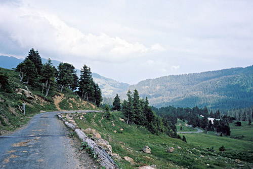
After getting down past the military installations and wooded area, it all becomes very nice, but it was now also clear that bad weather was quickly moving in (just like when I descended down here from Glaubenbielen another year. I took the first asphalted road going off the main road a little higher than were I had come onto it on the climb. This road actually goes up a little at one or two places, but it is still a very nice alternative with great views!
I managed to get down to the Sarnersee before the rain came, which was good as I hate to descend in rain on wet roads as I get dirty, cold or have to go extremely slow. I sometimes go very slow to avoid getting wet when encountering rain, which is never a problem when climbing, but is a drag when going on flat roads and worse on descents. Most cyclist just keep the same speed as usual as they are typically on their way home for a shower anyway, but I have to care a bit more as I never know for sure when the day is over and it is often wise to try and stay as dry and clean as possible (boring as it may sound). When I get wet enough I usually do not care much either … .
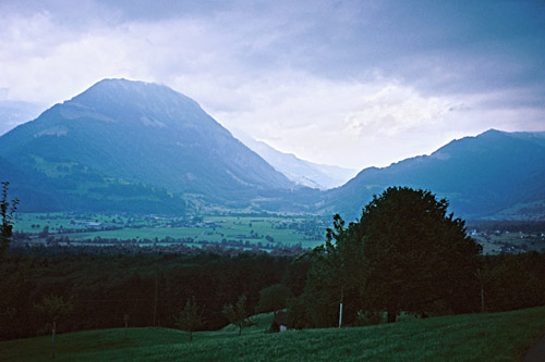
On the way back on the narrow road to Giswil the rain came and I had to take shelter and found a perfect one in a memorial to some Polish people who had died here during the 2nd world war, I believe. Then I continued a bit further and had to take shelter again a kilometre later or so. I still hoped to get back over the Brünigpass before the end of the day, but the weather wanted something else and eventually I just had to continue, but again it started to rain ever more as I climbed up to Kaiserstuhl/Bürglen, where I stopped by the first and obvious hotel by the roadside. The hotel was three stars I believe, so thought it would be a bit too expensive for me, but decided to ask as I anyway needed to get out of the rain a little. The man said something like 85 SFr, which I thought was a bit too steep, but then he said, “well, you came here by bicycle did you not?” “They get a special price for 60 SFr,” to which I agreed. Anyway the man was nice and helped me with his wife’s iPhone charger so I could finally get my iPhone charged which it had not been since Chamonix. (I only had brought a USB cable for charging as I only have a heavier charger for the old model, but often I can borrow a computer and charge it with the cable).)
I had some good food and slept well.
