The reason for visiting Moûtiers once again was of course since there happens to be two +1400m passes I had not yet visited nearby, namely Col de la Coche (1434m) and Col du Pradier (1456m). Both of these climbs actually starts in Moûtiers (480m) and goes up opposite sides of the mountains in the crossroads town.
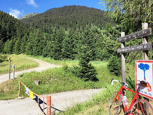
First it had to be the Col de la Coche (1434m) as I were going to try a short-cut road from the second one up towards Bourg-Saint-Maurice. This climb starts with taking the bigger more used road to Val Thorens. At the last hairpin bend on this road one takes off on the first entrance to Fontaine le Puits. The sign here only says Le Puits and Barrage de la Coche. The road now becomes much more narrow, but it is a nice road and after a while it goes rather flat for some time with good views before climbing up to Le Puits. After the Le Puits the road climbs through the woods to the pass. Here is the only pass sign (1434m) (another pass sign says only Retenue de la Coche (1440m), while the map has it at 1432m and the measuring facility on IGN says it is at least 1435m).
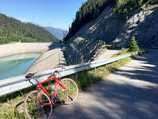
The road down the other side to the dam is closed to traffic, but one can pass over with a bicycle. I never went down to the dam and there is only a gravel road and then paths down the other side.
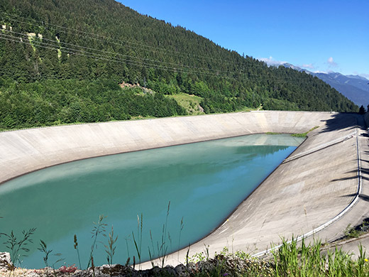
The dam walls looks like a nice velodrome and if you fall you might have to swim back up on the track again! Seems like a ladder down there in the middle but otherwise it does look a bit inviting to try out. How nice of them to build a velodrome up here ;-). Wonder if anyone has ever tried to bicycle there … .
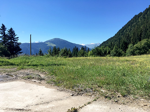
Here is the only little view back from the pass.
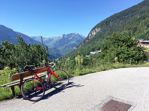
Down at Le Puits were the best views to be found on this climb and it was quite lovely this morning up here.
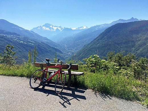
Said hello to a lady in a house behind me here. She certainly had good views from her house.
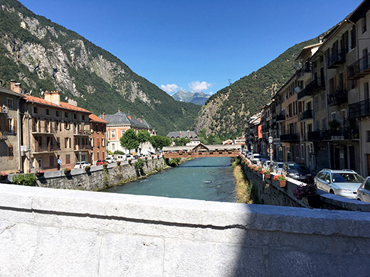
Then a nice ride back down to Moûtiers and had a photo from one of the nicer places in the centre here. Also stopped for a pastry and coca-cola before continuing up to Col du Pradier. The road to take starts just before exiting Moûtiers if going up the normal road to Bourg-Saint-Maurice and is sign-posted for Hautecour. This road is quite nice and can be recommended even if you are simply taking this road to get further up toward Bourg-Saint-Maurice as the road over to Montgirod from Le Villard is indeed all asphalted and possible to use (apparently it was closed for some years due to rock falls, but has been opened again, but it is not much advertised as it is a private road).
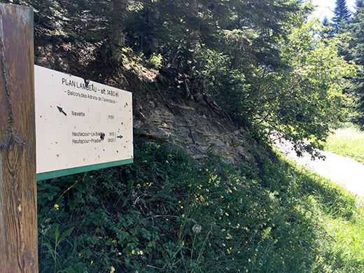
The road becomes quite steep only after Hautecour (Le Villard) and also very narrow up via Pradier to the pass. The pass has no sign (that I know of, but could be somewhere off the road at the pass and the pass is perhaps a little in on a path there). So I stopped instead at the track in the next bend above which would work better as a pass for mountain bikers, but it was not a good track. No views at all from this pass unfortunately and also a reason few knows about it.
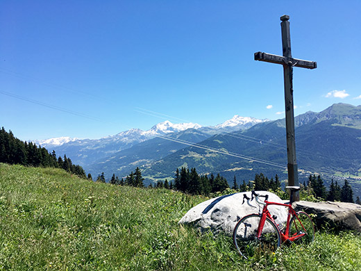
Seeing that the nice asphalt road continued up I could not resist going a bit further to see if I could get some better views for a photo and also to find out how far it might be asphalted. And as usual I went longer and longer even though I started to get some nice views and eventually the asphalt ended, but the gravel road ahead was still ok, so thought I go a bit further and eventually I got to Chalets de la Faverge (1750m) where the good gravel ends.
I was pleased by being greeted with great views here! So not all in vain. Unfortunately some cables in the way of the views, but still nice. Here looking up over the area around La Plagne.
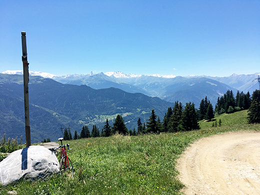
Here I look back over where I went up earlier and the valley to Val Thorens.
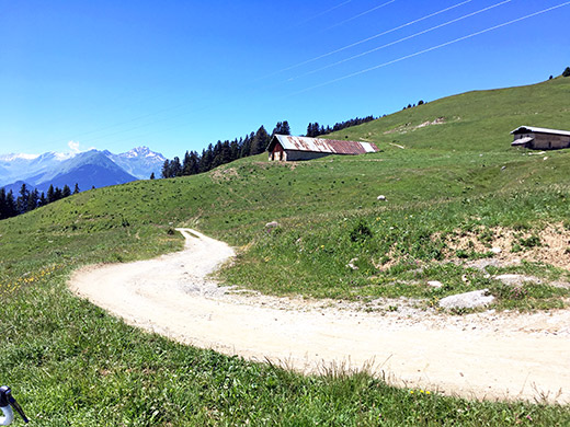
One of the chalets and the last part of the gravel road.
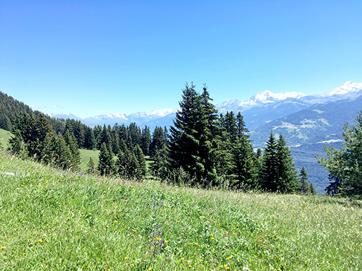
Back down on the asphalt road I stopped again to show that road bicyclists might go up here and have decently good views without having to climb the last gravel part if they do not like to.
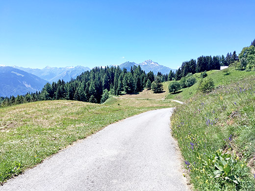
But the views higher up at the Chalets de la Faverge were better. The asphalt ends at 1699m.
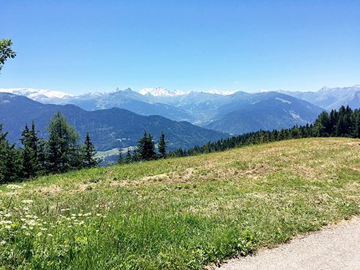
And one more photo looking up toward Val Thorens.
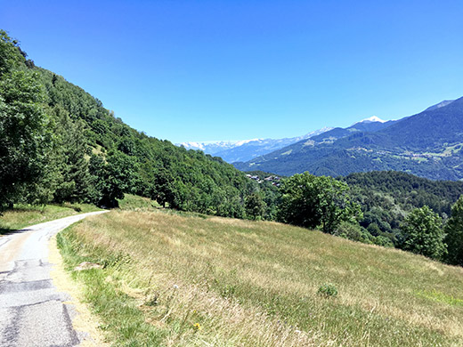
Here is the last steep part of the narrow road from Pradier down to Le Villard, where another narrow road takes you over to Montgirod as it was. The height of that passing over Plan des Nays is 1253m, while avoiding the main road on the other side of the valley up from Moûtiers goes over Col du Tra (1308m), so similar climbs and not exactly saving you any time. (Above Col du Tra there is also an asphalt road up the woods where asphalt runs out at ca. 1831m, that I haven’t visited.)
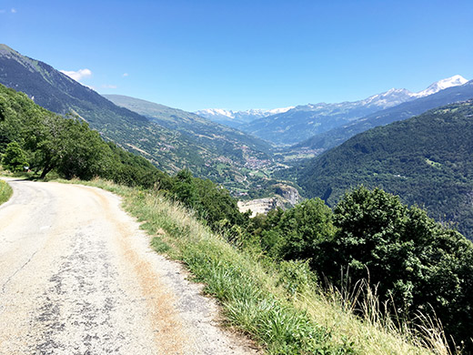
And this is near Montgirod and now we get a more clear view up toward Bourg-Saint-Maurice and the mountains near Col du Petit St. Bernard/Colle del Piccolo S. Bernardo (2189m) on the border to Italy. From here it was a nice and fast decent, but it felt a bit hard going down to meet the quite hot weather dwn there now in the middle of the day.
I recognised a short-cut road when I saw it and decided to take that to Vilette and it is a good choice that should even be faster too even if the pavement was not perfect on this original Napoleon road up the valley. You eventually get out on the main road below Vilette at 672m height. The road then goes a bit up and down and then more consistently slowly up to Bourg-Saint-Maurice (812m) (after a decent into town from 846m).
Again I was very disappointed with this place. I was at my first 2-3 visits to this hub among the great passes I was irritated that I could not find any good small grocery shop, but then stayed at the nice old Hostellerie du Petit St-Bernard and thought this was a nice place after all. But now I saw that this the only nice place in the village had closed down. Went to that McDonalds to eat something and was irritated again by the bad service there (as before). But lightened up when I was able to lend a pump for the bicycle at the sports shop, where they at first could not understand why you wanted to use a foot pump (but that was probably since the one they had was a bad one and told them they should get a real SKS rennkompressor instead ;-)).
I had to move on as I still had a long way to go (which was in part why I stopped at the McDonalds as it should be a somewhat quicker stop for something to eat, but maybe not – next time I will avoid it and maybe I find some other nice place).
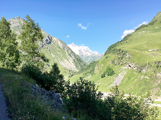
Finally on my way up to another great pass. I di not have to go this way as I have already done the passes now left on my way back, but clearly more fun climbing nice passes than going on low altitudes in the heat. Here I am on my way up to the great Cormet de Roselend (1968m) on the Route des Grandes Alpes at Les Chapieux with a glimpse of the Mont Blanc mountains (the tour de Mont Blanc goes up this valley, but for walkers and mountain bikers only). The mountain seen here should be the Aiguille des Glaciers 3816m). When up here the worst is done which is a steep part on narrow road up through serpentines earlier and the road surface early on was quite bad now (almost worse than most roads in Italy), but maybe they fix it eventually as it is such an important touristic road.
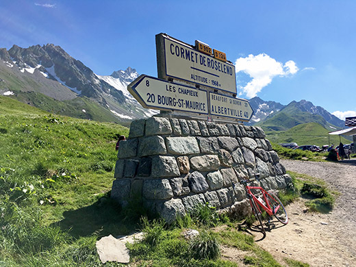
The road is a little flat before the turn-off for Les Chapieux, but then it becomes steeper again, but it varies a bit. The road surface was better again and eventually I reached the pass tired but happy to get up as it felt I had then done the hardest parts of this day. Time to try and get some more and better photos of this pass than on my previous visit. Here is the nice classic pass sign.
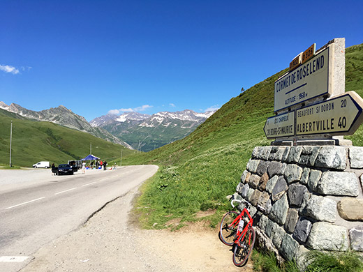
Here I am looking back from where I came up. (I tried to stay ahead of a guy approaching from behind and managed to do that.)
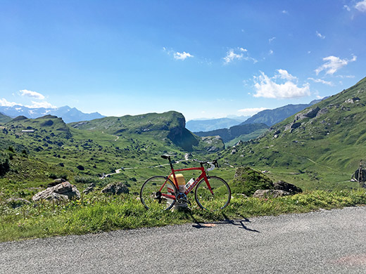
Here is the start of the descent on the north side and it is quite lovely up here.
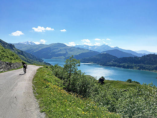
And here the fantastic Lac de Roselend with a cyclist just passing my by. Slightly bad place to stop for a photo, but had to try and find the best place before coming down to the lake.
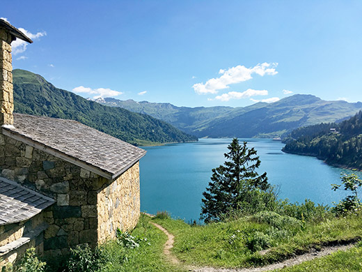
I stopped by the lake for an ice cream and coca-cola (quite expensive) sitting inside one of the small restaurants along the lake. Here is the view by a chapel just after the restaurant.
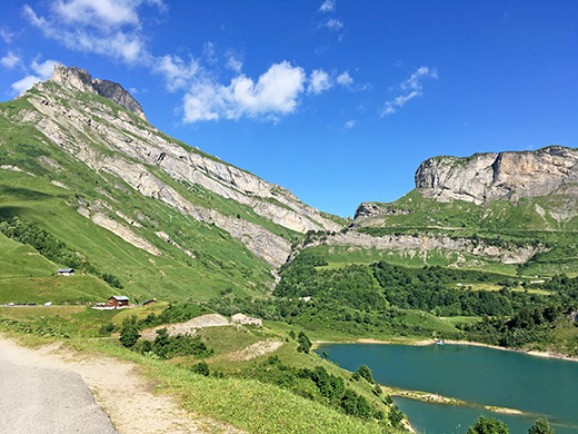
A view back of the restaurant and the road that I came down from the pass.
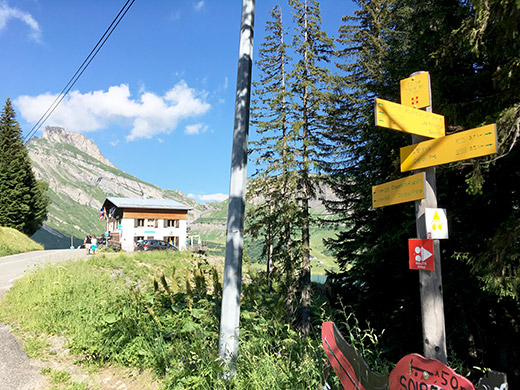
Just as one leaves that area one crosses another vague pass and had to get a photo there too as I had none before of this pass – Col de Méraillet (1607m).
Since last time I was up here many years ago (in 2002) I went over the nice and steep Col du Pré (1703m) on the other side of the Roselend dam/lake, so the descent on the normal road to Beaufort, was now new to me. It turned out the road was rather uninteresting apart from some serpentines where one had take some caution. It was almost only through the woods, so I would very much recommend the nicer Col du Pré road!
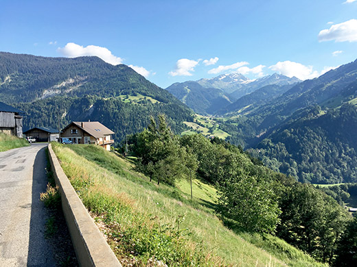
Just before reaching Beaufort I turned off on a smaller road going up again and here stopping at the small village Les Curtillets for a photo back in the direction of where I came down.
All of a sudden I realised I had many cyclists around me and it had seemed like there was some kind of cycling event on the way up the Roselend pass as I saw a stand with sport drinks when leaving Bourg-Saint-Maurice, but it was not all clear as most people were scattered along the road that I saw and some passed me by while others not, so it did not quite make sense. Now it was more clear that it was a cycling event, but still strange that some went faster than others and mostly on their own, but maybe they had not started at the same time.
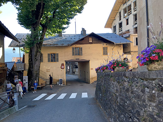
That helped me going on a bit better and I even talked a little with a girl riding up to Hauteluce that somehow understood I was not in the event (while she was, but she mostly wondered where I came from so I forgot to get clear on what the event was), while some bystanders seemed to think I was in the event :-).
I stopped in Hauteluce to have a last stop and something to drink. No coca-cola at the shop and no cold sodas, but had a warm orangina – anything is better than nothing. Called my sister as she had just left a message wondered where I was. I was still hoping to go out and eat something this Saturday evening in Chamonix, but it was starting to get late.
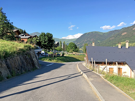
It was lovely going up the Col des Saisies this evening and had to stop for some photos back in the direction of the Mont Blanc mountains. It would have been great if the Col du Joly (1989m) road had been asphalted on the other side too as it would have made a very convenient short-cut this evening and would have loved by many cyclists going here so that they all do not have to go through Megève every time.
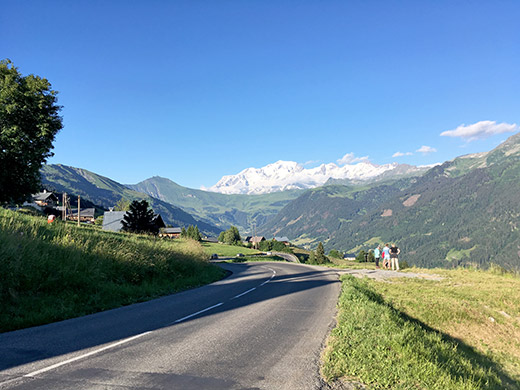
Here a bit higher up you see the ridge where Col du Joly is located and where you of course have an even better views of the Mont Blanc massif than from here. Still quite a nice view from here and now I realised why Col des Saisies was so popular.
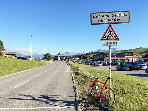
Finally up at the last real pass for the day at Col des Saisies (1658m) which is a little higher again than the sign says. (The geographical pass is a bit lower reached on a small asphalt road.) The cycling event ended up here just near to where I stand, but guess most riders had already arrived by now.
Ok, now just to go back home to Chamonix, but I had to hurry to enjoy the sun and light as long as possible. I had indicated that I would probably take the train up from Le Fayet instead of cycling up, so now I was mostly trying to hurry on to catch a train while they were still running. The road down the Saisies were not all down though I noticed contrary to my memories of it. One somewhat long flat stretch and even slightly uphill on the main road (maybe I should have tried the Crest-Voland road instead but thought it would be slower as it should be more narrow, but see now on salite.ch that there is even longer/steeper uphill section on that road).
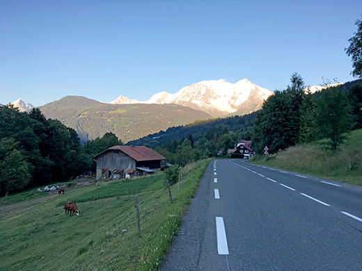
Eventually I got up to Megève and then over the long saddle I was on my last stretch for the day down to Le Fayet, taking the main road down there. On the way down took this nice photo (similar to one used in my book at the same place). I catched the last train just in time in Le Fayet. I cannot remember now if we went out to eat or if we decided to eat at home, but I think we stayed at home this evening.
This had been a long tough day and it felt very much like the end day of the tour now. I had originally planned to do some day rides in Switzerland on the last three days, but had to cancel those plans after the two rest days and eventually also decided to skip the planned cycling on the last day to spend a little time in Chamonix instead.
