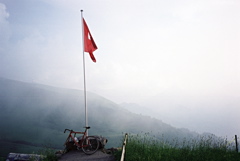
Signs 1956m, 1950m, 1954m
601m - 9.3 km (Adelboden)
1178m - 24.5 km (Frutigen)
The climb from the west is not possible to cycle all the way due to the steepness of the gravel stretch above BŁelberg (1658m). But if you do not mind walking 2-3 km I would very much recommend going up this side from Lenk (1064m). The road up to BŁelberg from Lenk is very steep, narrow and sweet, with some local traffic. The gravel road from BŁelberg is a private road, but there is no one complaining if you come with your bicycle here. The road is good in it’s very steep ramps and less good when flatter, so it is only toward the end of the roughly 3 km gravel road that you can hope to bicycle.
From Adelboden (1350m) and further down from Frutigen (802m) the road is fully asphalted to the top of the pass (not one inch of gravel any longer). You should go straight ahead when in doubt and you will hopefully find the right way to the pass. The road from Frutigen that bypasses Adelboden on the map below is likely all asphalted too, but I cannot confirm it. The steep part toward the end on this side is rather short.
[CH-BE-1950b]