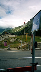
1008m - 135 km (Landeck)
13m - 11.3 km (Silvaplana)
[CH-GR-1790]
 |
Height | Climbing height - length |
| 1815m | 1490m - 31.5 km (Chiavenna) 1008m - 135 km (Landeck) 13m - 11.3 km (Silvaplana) |
|
| Difficulty | Beauty | |
| 1 (5) (East); 3-4 (5) (West) | 3-4 (5) | |
| How to get there | This pass is a bit special in that it really has only one side with a climb. The other, eastern, side is rising extremely slowly all the way down from Innsbrück in Austria – it is only notably rising on the stretch from Landeck (807m) to Susch (1412m). The western approach up Val Bregaglia from Chiavenna (325m) in Italy is a regular high Alps pass climb where the road is steepest at the end from Casaccia (1458m) (some short stretches are around 12%). From the Swiss border at Castasegna (686m) this is a 1129m climb. | |
| Other comments | Inside the Swiss border (on the western climb) I could recommend to climb the 3 km to Soglio from Spino. You will have splendid views from Soglio. Spino is at 794m and the serpentines up to Soglio (1097m) are steep (around 10-15%). If you continue through Soglio on the nicely cobblestoned main street, the narrow road eventually stops at a farm (1121m) from where you have the best views. Chiavenna lies at the start of the southern and really hard climb up the Splügenpass/Passo dello Spluga/Pass dal Spleia (2115m). At Maloja there are shops and restaurants. From here you have the nice and easy upper Engadin valley to cycle through to Sils, Silvaplana, St. Moritz, etc. The mountaintop on the north side of the pass – Piz Lunghin (2780m) is known as the main watershed in the Alps separating some of the biggest water systems in the Alps. So this pass could be looked upon as a very central Alps pass. (I guess Reschenpass/Passo di Rèsia/Pass dal Raisch might be the geographically most central pass from just looking at the map … .) [CH-GR-1790] |
|
| Map |
||