1561m - 35.5 km (La Giandola)
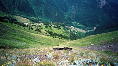
The absolutely most fun climb is the southern climb which includes a long series of tight hairpins (less tight higher up) and the road turns to gravel (R1) half-way up, but it has been used many times with road bikes. I count them to 62 if you take off the main road a little early and take the old road up instead. (It looks like some more serpentines have been asphalted since I climbed the road in 2002.) This is a truly fascinating climb in good weather and the Italian side is then easy to descend. The climb starts very gradually to climb and it is never very steep even on the last part.
The Italian side was fully asphalted to the top in 2019 from reports! Hopefully the French side will also get all asphalted one of these days. The climb is slightly steeper on the Italian side, I believe, but still easier as it is on asphalt. You should not take off to Limonetto, but continue until the next turn-off to climb the asphalted road to the pass.
The tunnel under the Tende pass is not allowed for bicyclists. For the best views of the serpentines on the French side, you should take right (if coming from Italy) and follow the gravel road for a little while toward the nearby Col de Pernante/Colletta (1906m). You can also easily get to the nearby Col de Tende Est (1885m) and Col de Cannelle (1885m). If you are in the mood, you can also explore the road after Col de Pernante/Colletta and visit the Baisse de Peïrefique/Peirafica (2036m) in order to catch a +2000m pass which is actually asphalted, but the three roads going there all have long gravel sections, so it is more of a gravel pass then the gravelled Tende/Tenda pass … .
The road to Casterino is pretty bad half-way down unless it has improved since I visited it with a tunnel and maybe some water over the gravel section, but I managed to bicycle it all. I have heard that the road over Baisse d’Ourne (2040m), should also be rather bad in some places, but these things can change both ways. The very exciting and famous road continuing along the border after the Tende fort will eventually become too bad for use with a road bike.
[FR-06-1871, BIG 686]