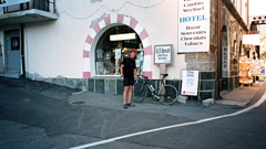
Sign 2473m
1970m - 40.9 km (Martigny)
1756m - 31 km (Sembrancher)
1590m - 25.3 km (Orsières)
This is one of those very classic Alps passes. It is long, it is hard and it is beautiful. It is a north-south crossing that has perhaps become a little less busy with the Mont Blanc tunnel in operation. It is not steep until after having passed by the tunnel under the pass that the heavy traffic use (since 1964). Thereafter it is of standard steepness (on either side) for most high Alps passes, which is around 7-8%. It has some of the widest serpentines (on the south side) of all Alps roads, only challenged by the north side of the Col de l’Iseran and the south side of the Pfitscher Joch/Passo di Vizze.
In the south the climb starts in Aosta/Aoste (591m) in Italy. In the north the climb starts in Sembrancher (713m) in Switzerland. One could start the climb even lower down in Martigny (499m) or Le Brocard (556m) if taking a short-cut down from Col de la Forclaz (1527m).
The pass is famous for the monks and their rescue dogs, as well as having been used by Napoleon and his army in 1800. There were recent news (2004) that those dogs would no longer be afforded to be kept here by the religious order, but as you can read here: Rescue dogs rescued. On the south side there is a little bar just before the last serpentines. On the north side there might be some place to stop above Orsières (887m), but I am not totally sure (the hotel in Sembrancher is closed down).
On the south side you can take off for lovely climbs up to Champillon (2078m) in 25 km from Aosta and Lac de Places-de-Moulin (Valpelline) (1990m) in 31.2 km from Aosta. On the north side, you can climb up the nice Val Ferret from Orsières and I continued over the Grand Col Ferret (2537m) to the Val Ferret in Italy with only 1 hour and 45 minutes between cycling and cycling again (with a quick walk and a dangerous steep descent on the Italian side). See also: Col de la Croix de Cœur (2174m), Col du Lein/Pas du Lin (1686m) and Col de Champex (1497m).
[CH-VS-2469a, BIG 737]