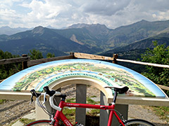
Signs 1672m, 1662m (later for the viewpoint)
1137m - 34.1 km (Pont de Gueydan via Péone)
882m - 13.3 km (Guillaumes)
882m - 14.5 km (Guillaumes via Péone)
245m - 6.2 km (Beuil)
1107m - 19.8 km (Sinne turn-off)
1349m - 27.9 km (Le Pont du Cians)
The western climb from Guillaumes (792m) is the most interesting one and there are actually two climbs from Guillaumes, as one could climb “straight” up to Col de Valberg or go via the nice little village of Péone (1172m) to the pass. I did the later in 2004 & 2015, but the direct road should be very nice too. Valberg is a ski resort and more known as such, rather than as a mountain pass (a bit like Sestriere in Italy). From Valberg you could try and find a little road that goes north to Col de l’Espaul (1748m) – just off that road is now the highest asphalted pass in the area located: Col des Huerris (1765m).
The climb from Beuil (1442m) is not much of a climb and merely a nice little ride on a varied road. However, if you start from Le Pont du Cians (338m) you will have a nice and long climb through the Gorges du Cians. You could conceivable start the climb just before the nice section up the Cians road (580m) if you come over the Col de la Sinne/Sine/Sinna (1438m) from the Tinée valley (which is a nice road).
If coming from the south one would have a choice of going up either of Gorges de Daluis or Gorges du Cians – two very interesting gorge roads with plenty of tunnels! There are some other passes accessible by a road bike in this area as well: Col de Sainte-Anne (1550m) shortly after Beuil on the main road to Valberg and Collet du Guérin (1638m) which is on a side road (Bergians) going south near Col de Sainte-Anne (turn right at the first choice and the pass is where the aspahlt ends). From Beuil one could go up the impressive (on the east side) Col de la Couillole/Col de Cogliola (1677m). The photo is taken from La Colle (1787m) at the end of the gravel road that continues from Col de l’Espaul toward this pass. (The are also some other gravel road passes reached from Valberg that could be tried, but I cannot recommend them with a road bike.)
It should be noted that the pass signs are placed a kilometre down the direct road to Guillaumes at 1662m where a viewpoint area is found. This place is not the pass. The old road took off up the woods (near the road sign) to Col de/du Vasson (1705m). This pass is reached easily by a road bike from the other side (route du Garibeuil) that is the first to the right after the pass and is asphalted at first and then easy gravel for 190m to Col de/du Vasson. It is a separate pass as the road from Péone went over Valberg at the new location back then. This pass was called Col du Quartier before the modern village of Valberg replaced the name with simply the village name of Valberg in 1936 and it is now often referred to as Col de Valberg. But as the road to Guillaumes went over the Col de Vasson on the other side of the Garibeuil, while the road over Col du Quartier went to Péone, the name Col de Valberg is best associated with the Quartier pass and the Vasson name should be left for Col de/du Vasson alone.
[FR-06-1673]