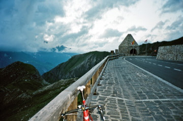
1587m - 19.71 km - 8.1% (Fusch)
1249m - 12.86 km - 9.8% (Toll station)
[AT-5-2406]
 |
Height | Climbing height - length |
| 2402m | 1647m - 26.70 km - 6.2% (Bruck/Krössenbach) 1587m - 19.71 km - 8.1% (Fusch) 1249m - 12.86 km - 9.8% (Toll station) |
|
| Difficulty | Beauty | |
| 4-5 (5) | 4-5 (5) | |
| How to get there | This is the first pass on the Grosßglockner road coming from the north. There is only a path going down the valley on the south of this pass (which goes back north, but in another valley). From the north you start in the area of Zell am See at Bruck and Krössenbach (755m). First after Fusch (815m) or later after the toll station (1153m) the real climb begins. The paved road continues up around Törlkopf and rises to 2428m at the end of the climb (Fuscher Törl 2) before it descends to a café at Fuscher Lacke (2262m) where it again rises to the Hochtor tunnel (2504m) via the Mittertörl (tunnel) (2327m). See the Hochtor pass description for full details. | |
| Other comments | The part up to Fuscher-Törl from Fusch is the hardest climb on the Großglockner road. It could be made even harder by going up the cobblestoned (“setts” really) cul-de-sac road (1.75 km) to Edelweißspitze (2572m) from the Fuscher-Törl. [AT-5-2406] |
|
| Map |
||