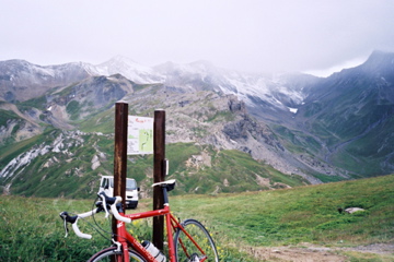
1857m - 32.1 km (St. Michel de-Maurienne)
[FR-73-2406]
 |
Height | Climbing height - length |
| 2405m | 1006m - 15.2 km (Valloire) 1857m - 32.1 km (St. Michel de-Maurienne) |
|
| Difficulty | Beauty | |
| 3-4 (5) | 3-4 (5) | |
| How to get there | The climb starts properly in Saint-Michel-de-Maurienne (715m) and passes by Col du Télégraphe (1566m) where it is downhill, via Le Col (1535m), to Valloire (1399m). This pass is really just on the way to/from Col du Galibier (2642m) and merits no special comments on its own. The pass is located around the place where the photo here is taken (on the north side of the Galibier climb). (A footpath goes down another valley here.) | |
| Other comments | It is a short distance to the Col du Galibier from here – see the description of Col du Galibier (2642m) for more information. [FR-73-2406] |
|
| Map |
||