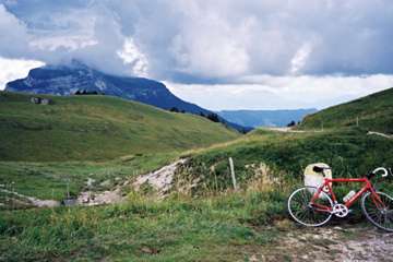
 Charmant Som (Alpage du Charmant Som) Charmant Som (Alpage du Charmant Som) |
 |
Height |
Climbing height - length |
| 1669m (1640m) |
1456m - 22.5 km (1427m - 22.0 km) (Grenoble)
1456m - 23.3 km (1427m - 22.8 km) (Grenoble via Col de Vence)
1437m - 20.1 km (1408m - 19.6 km) (Grenoble (La Tronche))
1372m - 19.8 km (1343m - 19.2 km) (Grenoble Northeast)
1254m - 23.2 km (1225m - 22.7 km) (St-Laurent-du-Pont)
874m - 13.3 km (845m - 12.8 km) (La Diat)
782m - 12.8 km (753m - 12.3 km) (St-Hugues) |
| Difficulty |
Beauty |
| 4 (5) South; 3-4 (5) North |
4-5 (5) |
| How to get there |
Whatever you do, you should not go via Col de la Charmette (1261m), as I did, as you can go lost and even if not, then there is a long path to drag your bicycle up along. This is most obviously regarded as a mountain climb, but there is a pass from the Charmette col and over a place near the top called Alpage du Charmant Som. The road continues up to 1669m before a short descent to the Chalets du Charmant Som just below the mountain top. The climb from Grenoble is a long and hard one either way you go. I list three alternatives in the map. You can take pleasure in collecting some other passes on the way to the top. From the north it is an easier climb. |
| Other comments |
This is the ‘home mountain’ of Grenoble and is a great climb (they have many to choose among nearby). Col de Porte is a bit bleak pass, so going up the Charmant Som really adds a lot to the experience and makes the climb a lot harder. Hardest is actually the shortest climb from Saint-Hugues, because it suggests you have done the Col du Coq (1434m) climb before and it is harder than the Col de Porte (1326m) climb. Very nice at the top and at the Chalets they have a little restaurant.
[BIG 269] |
Map
|
|
