818m - 15.6 km (Mittersill)
|
Height | Climbing height - length |
| 1632m/1606m (road height 1650m) | 953m - 41.9 km (Lienz); 813m - 22.9 km (Huben) 818m - 15.6 km (Mittersill) |
|
| Difficulty | Beauty | |
| 2 (5) | 3 (5) (South); 2 (5) (North) | |
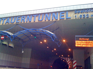
| How to get there | This is a tunnel pass that one is not allowed to cycle through or even to reach the actual highest point which in this case happens to be in the middle of the tunnel at 1650m. You can get to 1632m on the south climb to the tunnel which is quite a long climb from Lienz (679m) or Huben (819m), but then also not so steep. The north side is a little steeper, but still not steeper than mountain roads in general, with up to 9% over some parts. The south side should be nicer, while the north part is wooded, but with open scenery. | |
| Other comments | Traffic is not being so used to bicycles on the climb higher up on both sides, but the road is wide, so there is no big problem. There is a shuttle service available for cyclists to get through the tunnel (seems to make most sense for small groups). It can make sense if the weather is too bad to go over the Grossglockner road or if you have come over the Staller Sattel/Passo Stalle (2052m) or the gravel road over Klammljoch/Passo di Gola (2288m) and wants to have a look up this valley. |
|
| Map |
||