Sign 1546m
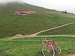
Not a very obvious pass and likely hardly used as a pass and hence no pass name that I know of. However, there are tiny valleys and paths in both directions as well as higher mountains on either side, so what else should we call it? Well, an alpe of course, but also a pass. Thus we have here the highest asphalted pass in Germany on this quite obscure little road ending just after the pass by the Obergelchenwang-Alpe (which is also the name on the sign here).
Leiterberg is the little mountain you go around from the Scheidwang-Alpe/Pass Scheidwang (1315m) on the other side, where the nice, long and easy road up through Aubachtal from Bihlerdorf (729m) near Sonthofen ends. At Scheidwangalpe there is a restaurant. Here a very narrow, less good and most of all, steep road, quickly winds its way up the Leiterberg. This road is unevenly steep and troublesome! It almost looks as if the pavement would disappear before we eventually see our goal, which is reached on a good asphalted ramp down to the geographical pass (1554m).