997m - 10.4 km (Tschötsch/Scezze)
1073m - 15.2 km (Vilmöss/Funes)
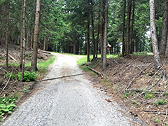
This is a hard climb from Bressanone/Brixen (562m) (close to the railway station). Above Tils/Tiles it becomes quite steep, but it eases off as you gain altitude and the road even dips slightly as it contours the mountainside to Masitter Hof, from here there is a narrow little forest road that does not look like asphalted, but is indeed asphalted all the way to the top of the road (the little pass), where asphalt ends for good. The asphalt is broken on this last stretch and there are two nasty drainage gullies early on here and it is plain gambling to try and cross them with a road bike.
You can also start the climb south of Bressanone/Brixen and climb via Tschötsch/Scezze (558m). This is the shortest and thus the steepest variant on asphalt. Finally you could for a nice and longer climb start where the Vilnösstal/Val di Funes (537m) starts (on the opposite side) and climb via Feldthurns/Velturno. This road has some small ups and downs from Feldthurns to Tils (therefore some metres more of climbing making it into a +1000m climb).
[IT-BZ-1534]