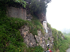
1135m - 15.7 km (Arsiero west)
1193m - 16.6 km (Barcarola)
The normal climb starts in Arsiero (308m) (or just above (361m) if coming from Passo Xomo (1059m)) and goes via Tonezza (and Sella (1110m)) after which you come to the turn-off for the Vena road. You can also go back down this road from the main road, which would be easier, but not as fun (what I did on my first visit). This road continues after this first pass with a war monument to the Passo di Vena di Sopra (1545m) before you join the main road again, where you can choose to go straight to Passo del Sommo (1342m) or turn off and go via Bocchetta degli Alpini (tunnel) (1566m) to Valico di Valbona (1781m).
Most fun and for a more consistently steep climb you should take the small road from Barcarola (303m), which has no sign-posts, but there is only that road going up here. It has 24 numbered hairpins and seems like it is only used by the occassional cyclist. You come up the main road just as you approach Tonezza.
[IT-VI-1496]