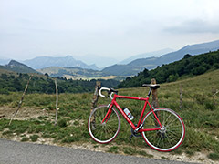
Sign 1471m
1131m - 17.1 km (Bellori)
1352m - 25.4 km (Negrar)
1440m - 24.8 km (Fumane-Monte Pastello)
1394m - 24.8 km (Fumane-Manune)
1326m - 15.7 km (Peri)
1318m - 13.7 km (Sdruzzinà)
This pass could be reached from Stallavena (246m) or higher up from Bellori (339m) in Val Pantena straight up from Verona. You go via Fosse (930m) (also a pass) and above Tommasi the road turns to gravel for ca. 1.3 km which is manageable but a bit disappointing. The asphalt returns again before reaching the pass.
From the south you could also start in Negrar (192m) and climb via Sant Anna d’Alfaedo and Fosse, which looks like a nicer alternative than the previous road choice.
You can finally start from Fumane (186m) in the valley just next to the big Alto Adige valley up to Bolzano and Austria. Here you have (at least) two choices. Either cimb up to the ridge at once or continue up the valley to meet the Monte Pastello road at Breonio and then go via Fosse to the pass. Both roads are just as long, but the ridge road as I suggest it involves slightly more climbing.
From the west you can start at in the Alto Adige at the first road climbing to the east from Peri (144m). This is a classic climb and consistently steep with many hairpins up to Fosse, where you again follow the same road up the Val Liana to the pass.
From the north you can climb the pass without having to see any gravel. However, the climb from Sdruzzinà (153m) is really the hardest of the all. It is quite steep (up to 20%) up to Sega di Ala (1224m) on the road to Passo Fittanze (1380m), and then it continues much the same way on the minor road up the Val Fredda to the pass (very irregular and with some quite steep ramps).
[IT-VR-1470]