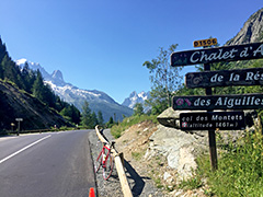
372m - 7.9 km (Châtelard)
1400m - 28.3 km (Martigny)
1400m - 25.8 km (Martigny via Le Fays)
1400m - 25.3 km (Martigny via Le Fays shortest)
1343m - 25.3 km (Le Brocard)
This is a somewhat easy pass, but it usually also includes the climb over nearby Col de la Forclaz (1527m), which makes it harder. The western climb from Chedde (589m) is varied and a bit cumbersome in that one has to climb over Vaudagne (1119m) before descending to Les Houches (991m) and continuing up the valley via Chamonix. Apart from the climb through Vaudagne (that I draw in an even harder way than the normal road) there is only a short pass-like section after Argentière to the pass.
If coming over Col de la Forclaz the worst part is getting up to that pass. From the border it is then a nice and easy climb to the top.
[FR-74-1461]