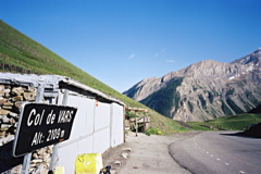
Sign 2109m
973m - 31 km (Barcelonette)
888m - 21.8 km (Jausiers)
800m - 14.5 km (Les Gleizolles)
[FR-04-2108, BIG 305]
 |
Height | Climbing height - length |
| 2109m Sign 2109m |
1072m - 18.8 km (Guillestre) 973m - 31 km (Barcelonette) 888m - 21.8 km (Jausiers) 800m - 14.5 km (Les Gleizolles) |
|
| Difficulty | Beauty | |
| 3 (5) | 3-4 (5) | |
| How to get there | From Guillestre (1037m) in the north the road up to Col de Vars is found at the D902 road outside the city centre. It is is never very steep and there is an almost flat stretch in the middle among the boring and expensive tourist villages higher up. Near the pass it is, however, quite nice with a little lake. The much nicer side to climb is the south side. This is a little harder higher up, but also shorter and never above 11%. It is just lightly uphill all the time from Barcelonette (1136m) and through Jausiers (1221m). After Les Gleizolles (1309m), where one could alternatively take right and go over Col de Larche/Colle della Maddalena (1993m) to Italy, it soon becomes steeper. | |
| Other comments | This is a beautiful pass, mainly because of the quiet and charming south side. Though I did find it enjyable to descend on the north side late in the evening in 2010 with nice views in the distance. Lodging is available at the Napoleon hostel by the lake on the north side, otherwise try Jausiers on the south side or Guillestre on the north. St-Paul (1468m), the only village on the south climb (after starting on the Vars road), might have something to offer, but I am not sure. There is a bar at the pass. [FR-04-2108, BIG 305] |
|
| Map |
||