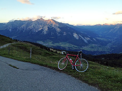
1463m - 19.7 km (Sils)
This is a hard and very rewarding climb. The climb from Tiefencastel/Casti (751m) goes on a good and wide road to Stierva, but from here it is only a very narrow road that varies a lot in steepness. There is a short stretch (maybe 100m) with gravel early on, but then it is good asphalt up to the second to last building along the road, then comes another 75m of gravel and then asphalt again until the top alp with outstanding views over the area from Lenzerheide(pass)/Parpaner Höhe (1550m) and up toward Julierpass/Pass dal Güglia/Passo del Giulia (2284m).
If you come from Thusis, you start the climbing down in Sils im Domleschg (683m) and you can take a “short-cut” by turning of the new road up to Obermutten (1864m) at Punt da Solas (843m), where you soon take off to the left on forest road not open to traffic. This road actually have some old asphalt here and there, but you do not see much of it, so for all purposes it is only a fairly decent gravel forestry road up to Stierva. Just before Stierva, you can aim at the lower part of the village or like me take the higher road going to upper part of the village. From here it is the same way up.
Look out on the way for signs for Kathrin’s Hüttli (looks nice from photos) – that is the only thing signposted for along this road with many false turn-offs! It is just the last turn-off for the hütte that you should not take, unless you plan on going there to eat something (which you can do on the way down (have not been there though).