1097m - 20.9 km (Sinne turn-off)
1339m - 29 km (Le Pont du Cians)
1173m - 15.8 km (St. Sauveur-s-Tinée)
1201m - 20.6 km (Col St-Martin road)
1253m - 22.1 km (Ilonse road)
1382m - 30.5 km (Pont de Clans)
1450m - 35.6 km (Pont de la Lune)
1496m - 40.4 km (Tinée valley)
The hard climb is up the east side from St. Sauveur-sur-Tinée (504m) on a twisty road that climbs 1174m in less than 16 km. I have only descended this side, which is hilarious, but it would have been more fun to climb this side. You start here if coming from Col de la Lombarde/Colle della Lombarda (2350m) or Col de la Bonette (Cime de la Bonette) (2715m (2804m)). On a side road you could also visit the Col de Tournaeuro (1469m).
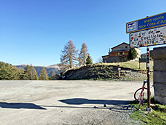
Otherwise you would start the climb lower down. If you come via Col de Saint-Martin (1502m), you start at the height of 482m down the Tinée valley. If you happen to come down the nice road over Col de la Sinne/Sine/Sinna (1438m), you start at 430m. You could start at Pont de Clans (301m) if coming into the valley via Tournefort. You could have visited Col d’Andrion (1684m) or travelled over the road passing by the famous Madone d’Utelle (dangerous road down to La Tour). If so, then you start at Pont de la Lune (233m). You could finally also have started at the start of the Tinée valley (187m).
If coming from Col du Quartier (Col de Valberg) (1674m), the climb from Beuil (1442m) is not much of a climb. However, if you start from Le Pont du Cians (338m) you will have a nice and long climb through the Gorges du Cians. You could conceivable start the climb just before the nice section up the Cians road (580m) if you come over the Col de la Sinne (1438m) from the Tinée valley.
[FR-06-1678, BIG 311]