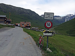
1579m - 39.27 km - 4.0% (Thusis)
You can start the climb down in Thusis (720m) and preferably use the oldest of the three roads up the first part, although there is no maintenace of the road unfortunately, so there could be much stones on it, but most of it is quite okay still. The motorway is no option and the other road that replaced this has a long tunnel and would be a good choice on the way down. The road goes a bit up and down to just before the turn-off at Roflaschlucht/Puntcrap (1112m) to Juf. This is where you start the climb if coming down from the Splügenpass/Passo dello Spluga/Pass dal Spleia (2115m) or the Passo del San Bernardino/St. Bernhardinpass/Pass dal S. Bernardin (2067m).
The road continues up a very lonely valley and is never steep. It is a little steep only in a few places higher up, but it is a long road. Once in Juf you could go up a very steep short concrete road to the highest paved point in the valley at 2186m (a new one, but the other that starts in the same place was ready when I was there up to 2150m). There is also an earlier concrete strip road now going to 2198m, so maybe there will be more (they go nowhere) (there is also now one up from Avers Cresta (Casol) to 2204m and maybe even higher as I write – not sure of the date of the latest Swisstopo images …).
What is most remarkable about the road are the gigantic bridges along the way and one wonders about the economy of building such a very expensive road for just a couple of houses up the valley. Especially the last Lezibrücke is impressive. Juf itself has been claimed as the highest village where people live the year around, but I think I heard that there was only one person left now living there the year around and it seems most houses up there have been sold as Summer houses or are run as hotels. The most genuine looking place up here where there seem to actually be some locals living the year around is in the nice Avers Cresta (1960m).
There is also an interesting side road climb up through a tunnel to Lago di Lei and Alpe del Crot (1962m) in Italy. The dam building itself is in Switzerland, but all else in Italy in this rather special drawing of the national border (logically the whole valley including the dam should belong to Switzerland, but there must be historical reasons for the sitauation). There is no road to other parts of Italy from here and also only the tunnel road to Switzerland. The weather turned bad and I got in hurry on my visit up here so no visit yet.
[BIG 598]