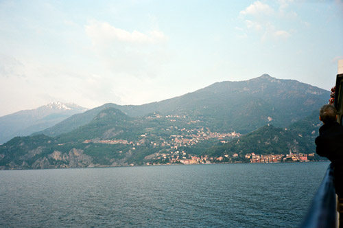
This day I had decided to rewrite plans for a day that was not planned and instead I trashed plans for another day that included a climb over a gravel pass at around 1400 metres, which would have been impassable anyway because of snow. I wanted to make up for missing to visit rifugio Venini with beautiful views over Lago Como and Lago Lugano two days before. So I took the train again to Como, but decided to cycle all the way back this day. I had a coffee at the station and then went up the busy, but nice, road along Lago Como to ArgÚgno.
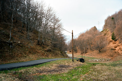
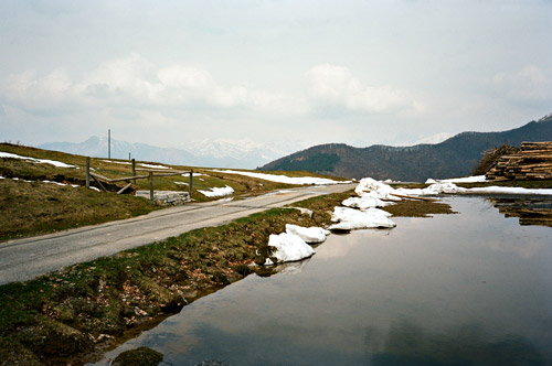
At ArgÚgno (221m) I climbed up the nice road to Torre/Castiglione, where I stopped for a sandwich and coca-cola lunch. Looking at the map I noticed a short-cut road directly up to Blessagno. This is a nice, narrow and asphalted road with many warning signs. From Blessagno (797m) the road winds its way rather flatly around the mountain to Pigra (881m). Just before entering Pigra, a small road takes off up the mountain and from here it is a steady climb on a road that soon becomes a bit poor, but always asphalted. The climb is 5 km at 9% on average, but it is evenly graded. It is a nice lonely road with some views over Lago Como far below. You eventually will arrive at Alpe/Bocchetta di Colonno (1323m), where my first photo was taken. It looked like it was a restaurant here, but the more popular restaurant is further ahead down at Rifugio/Bocchetta di Boffalora (1234m). The descent here was in the shadows through woods and it was very chilly and the snow had just disappeared from the road (it looked like).
There is a crossroad at Bocchetta di Boffalora, where the most used road goes down to Ponna. Straight ahead the road climbs abruptly up again toward rifugio Venini. It started out nicely and the terrain looked so open that I did not really suspect to meet much snow up here (I had been looking up the top from below and could not see any snow on this side of the mountain). I met some walkers looking curiously at me and I noticed there were some debris on the road. Soon enough I met some snow at practically the first bend at farmhouse, but climbed over it as the road was clear ahead. Soon I turned around another bend and noticed that the next 2 km or so seemed to be going in the shadows and then it was clear to me that this would not be easy.
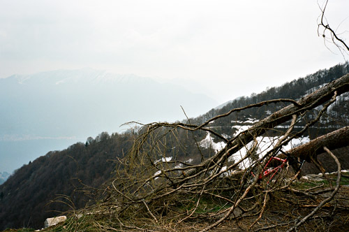
I was not in the mood of not succeeding yet again to reach my goal, so I walked over occasional snow fields (and I noticed that no cars had been going up the road this year). Then some trees blocked the road and I had to climb outside in the very steep slope on the side of the road, but some other had walked there so I just tried to be careful (since I had my bicycle with me it is not clear that it would not slide away if I tried to rest on it). It went fine and I could cycle some metres here and there, then I met another bigger obstacle with more trees over the road where I had to creep under them and lift the bicycle over (on the way back I managed to get the bicycle under the trees instead (see photo), which was not easier).
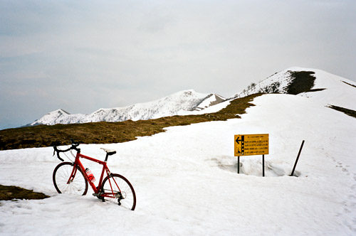
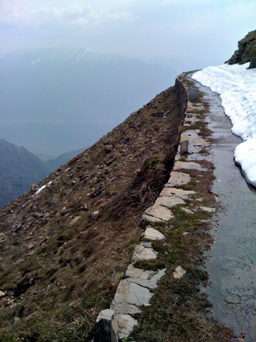
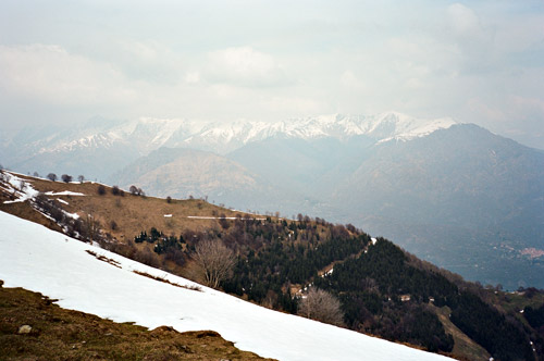
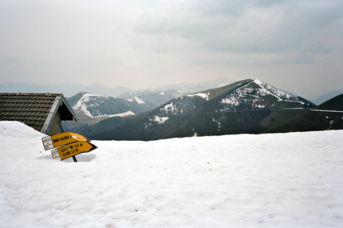
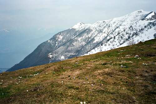
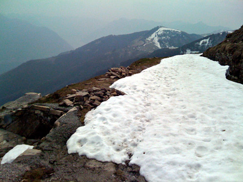
When I came to Alpe/Bocchetta di Lenno (1495m) I got out of the shaded forested part and now I could bicycle again. The last part up to Rifugio Venini/Bocchetta di Galbiga (1576m) was flatter, but the snow came back here, but mostly left me with 10 cm strip to bicycle on. The last 200-300m was good gravel pavement. At the rifugio there were only snow ahead and no visible road. A couple were enjoyed the nice weather and views. A little nervous at first I climbed up the snowy slope (nervous, because I saw some steep whole in it at the end of the road and it was now melting away). I had some photos at the height above the rifugio and it was partly free of snow as you can see.
The views are truly great from up here and I was happy I did take time to tackle the obstacles on the way here. It was a nice excursion. I notice now in the photos that it did not look very sunny and warm, but in fact it was quite perfect temperatures and weather up at rifugio Venini, even if it was a little cloudy. I took some photos of the narrow passages on the way back and add some of these photos here too.
Eventually down at Boffalora again, I decided to take the road down to Ponna even though I have read that it should be gravel in the woods and too bad to be used with a road bike, but I guessed it would be pretty easy in comparison to the obstacles I had already handled and moreover (to my surprise) it starts as a fine asphalt road down there and I would of course be thrilled to discover it had all been paved. I was also not very keen on taking the same poor road back down to Pigra, which would also be longer for me. I think that in retrospect that I may have earned a few minutes time by taking the road over Ponna (or Pona as they call it locally).
There were now snow down here luckily and when the asphalt disappeared, the gravel road was pretty good, but with many very big potholes, which may deter many car drivers, some of whom had parked their cars at Alpe di Ponna lower down. I thought the road was mostly fun. I was less happy with the asphalt when it reappeared down at Alpe di Ponna (1193m according to salite.ch) as it was rough. Down at the crossroad at Ponna the road is very good. I decided to go right down through Ponna, which I knew would be more direct but also much steeper. This road is often not marked as an asphalt road on maps, but it is.
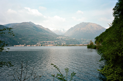
From Ponna superiore down to the river it is 3 km with ca. 12% on average, where the first section is very steep with ca. 20% on a narrow and not so good road. Then you get a short but very steep ramp (ca. 20-25%, my computer said only 20% this day, but this ramp felt like 25% at its maximum) back up to the main road down to Osteno and Lago Lugano. Porlezza and surroundings looks nice when coming from this direction (unlike when going on the main road from Lugano to Menaggio). I stopped for another photo along the lake.
I looked at my watch and try to decided what more to do for the day out of 2-3 possible climbs. I knew now that given the time spent up at rifugio Venini, I would probably only be able to do one more climb now. The plan was to take the ferry over from Menaggio to Varenna and climb Alpe Giumello (1536m) and/or Rifugio Roccoli dei Lorla/Monte Legnoncino (1456m) (both “BIG climbs”) and both should be very nice. But when I asked about possible snow on Alpe Giumello the first day while eating lunch in Cassina Valsassina (from where you could see this mountain), they said it would be one metre snow up there on the road, and I did not want to do another climb where I could not reach the intended goal. It had seemed to me that Monte Legnoncino (1456m) would have been more possible given its lower height, but anyway I decided to climb the closest pass from Porlezza now instead – Passo della Cava (1142m) – which ought to be snow free and see if there would be time later for something more.
Passo della Cava turned out to be a nicer pass than I had thought (as I had found very little mention of it on the Internet). Ok, this pass is not a very ”practical” pass as you more less come back to where you start, but it is a very nice local loop ride. The road up from Porlezza (276m) (and I think this is the way to go) is a bit steeper (8.5% for 10 km) than the other side and is a long climb with nearly 900 height metres to conquer.
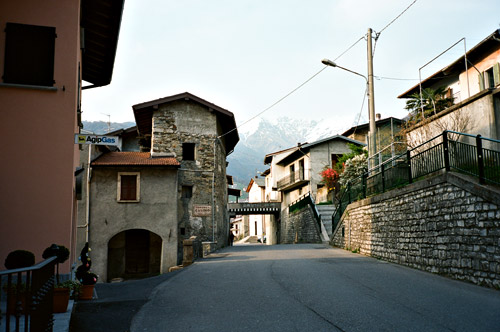
The road is narrow with nice scenery most of the way and feels like a real Alps pass climb. There is no sign at the top. I could see only a few signs of snow in the vicinity. a few people were picnicking at the pass and I took a photo of them before I went down the other side. There are several small villages up here. On the other side the descent is quick on a bit bigger road (and a very good road further ahead). But then comes a 100 metre climb again up to S. Nazzaro (980m) and then a smaller climb up to Cusino (794m), that I had forgotten about as I had never planned to do this pass at all during this trip to Bergamo. The views from Cusino were nice and I had another photo here. The descent from Cusino is fast and fun!
I cycled to Mennagio for the ferry over Lago Como. I managed to get an ice cream (pretty much the only thing they sold anywhere in Menaggio – boring touristy place with good views across the lake) before jumping on the ferry. It is a very nice ferry ride over here and it is not very expensive either. However, it was a bit late when I came to Varenna to try and do more climbing this day. It already started to get a bit after Lecco. I had also told myself to focus on enjoying the riding more than breaking any records during the last few days.
I think this was the day when I tried to take an alternative road into CittÓ Alta. I had noticed on my Kompass map that the most direct way into Bergamo’s CittÓ Alta coming from Lecco was by a road called Via Pascola dei Tedeschi and I managed to find it in the dark. I was a bit confused about how small and bad this road was and before I knew it I was jumping down the asphalt onto a quite bad gravel road, but I continued as I hoped it would not last for long. I became asphalt after a while again and the climb up to CittÓ Alta is quite nice on this road with a climb up on serpentines with nice views even in the dark. However, I got confused later on as I could not see clearly what road I should take and climbed up an extremely steep road to perhaps the highest place in CittÓ Alta and then after doing a loop at the top and asked someone I descended to Colle Aperto and the centre.
The plans for the last day was mostly clear but it turned out that the train schedule delayed me on this holiday.
