This morning offered good weather again (I almost take it for granted down in the Alps in July). I was off around 9 am as usual after having breakfast at 8 or slightly after. Even if you sometimes can get breakfast before 8 am, the standard is 8 am, and since I am not a morning person, that is fine with me. It was a long slowly climbing road with some ups and downs I had forgotten about on the way up to Winklern (882m) and several kilometres with concrete which can be a bit annoying with the edges.
At Winklern one turns around a corner into the valley that leads straight up to the most famous road in Austria, which means the Grossglocknerstrasse (built in 1930-35 for touristic purposes). I was going to get over there for the 3rd or 4th time now. But first I was about to do another climb and the highest climb for the whole tour that I had not done before. The highest asphalted road I had not yet been to was the Zirknitztal/Grosssee (2421m) (asphalted road ends at 2470m, but the last stretch was unpassable due to big stones/boulders and snow upon my visit). So this was one of the main attractions this year and it is also a BIG climb.
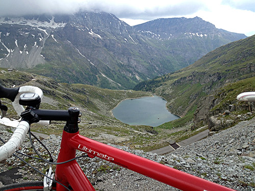
This climb starts in Döllach (1006m), where I stopped and had a soup and a beer, I think. After a while one turns off the road going up via Apriach to the Grossglockner road. The road is narrow and nice. After some climbing the road continues into a valley where it is not so steep and follows a river. At the final road choice on the way up, one goes right in the Kleine Zirknitztal and from here it is mostly rather steep up to the dam. Just before the dam there is another road choice for climbing up to the right or the left of the dam building. I decided to go to the left even if the road first descended a little here as that is the road that climbs up above the dam to 2470m.
I were a little worried beforehand that the road might not be clear from snow as there had already been some snow on the road on the way up here. After the short descent the road climbs steeply and it crosses a cattle grid with close to 20% where I had to sit down to not spin the rear wheel on the metal (steepest cattle grid around?). Just as I passed over it successfully I wanted to stand up again so that I could tackle the remainder of the steep section up to the final bend, but I had not noticed there were not only stones on the road, but also grass had grown through the cracks in the pavement and now I spinned loose with the rear wheel and fell to the ground, fortunately not hurting myself much or the bicycle.
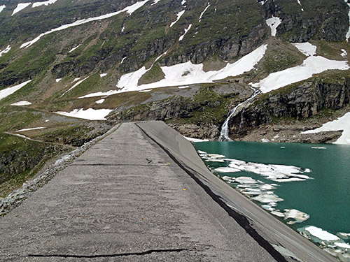
I was laying on the ground for some seconds reflecting on that there might not be another person coming up here this day and that I should perhaps be a bit careful in places like this. I had met a cyclist coming down and a man and boy walking down to a car parked a little below (or they were in the car …). There were also a man lower down trying to find precious metals (I believe) where one waterfall where coming down (he was gone when I was coming down again – maybe it was his wife and kids down by the river on the flat section I saw). Those were all the people up there this day and I met no one coming up as I went down.
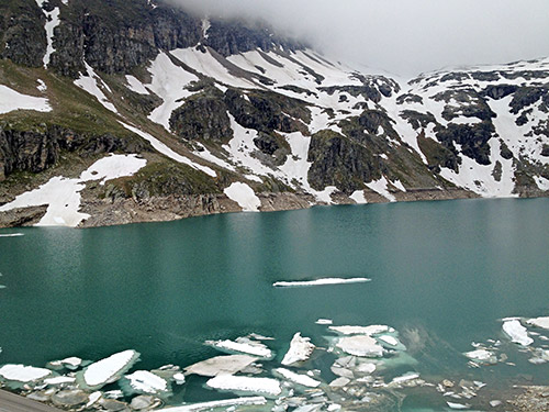
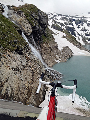
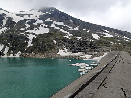
The dam building itself is not allowed to walk on, or bicycle on. But no one there, so I lifted my bicycle over the barrier. The continued road up the hill would have been difficult to walk up on, so I forgot about it and I am even skeptical they would clear it later in the Summer as the boulders on that road were quite big and many. The cycling on the dam building was a bit hilarious as there were no fences on either side and it was rather narrow (like 2-3 metres) and like 80% down each side (virtually free fall), so there were a reason to put up signs forbidding people using it, but it was just wide enough not to make me too worried. Icy and cold up here and I had to get going before I would start freezing. Also the weather looked very gloomy, even if it now looked worse down the valley.
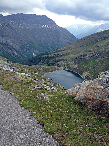
I were lucky not to have any rain on the way down and the road was dry.
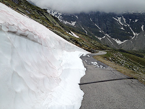
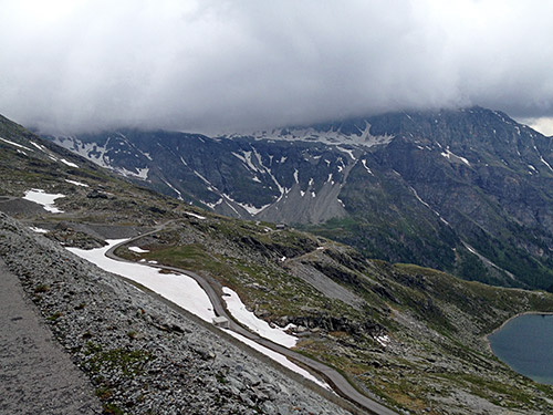
Here is one of the two passages with snow still lingering on the road. The car coming down must have been parked below here as I could not see any wheel tracks in the snow.
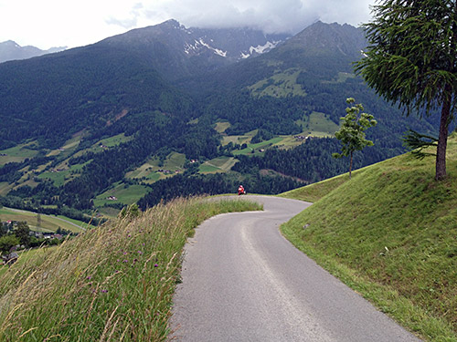
Here’s the very nice road above Döllach at Zirknitz.
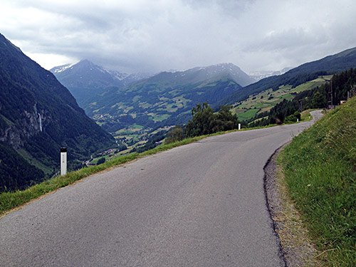
Just before Döllach I came to the main road going up to Apriach and followed it as it is a much nicer alternative road to get to the Grossglockner road than the main busy road via Pockhorn and Heiligenblut. You also have very nice views over the Heiligenblut area as in the photo here. This road climbs rather steeply up from Döllach and is clearly a harder approach to the Hochtor than the valley road, but then the flat section comes at higher altitude later (instead of making the flat section first to Pockhorn on the valley road). A little before reaching the Grossglockner road the rain were no longer possible to escape. I hoped to find a café along the Apriach road, but without luck. I decided to continue until I found a café or restaurant. Even on the Grossglockner road I had to wait until the toll station, by the time I had nearly got all wet, but luckily not quite. I stopped at the simple restaurant there, having a sausage and french fries waiting for the rain to stop.
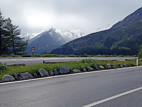
As the rain stopped after a while I took off soon catching up with the touring guy I had seen lower down and informing him a bit about the possibilities of stopping for the night along the way over the Grossglockner (he was from Torino, I remember). The weather still looked bad, but my experience told me that this was likely all there was to rain this evening. It was now like 17 pm and I had quite a stretch to do myself to be able to get down to Fusch on the other side. Especially as the main idea this time was to get up to the cul-de-sac at Franz-Josephs-Höhe that is the only road above 2000m up here that I had not been to before and it is a famous cul-de-sac road part of the Grossglockner project and giving the road its name as here is where you can see the highest mountain top in Austria – the Grossglockner (3798m). Photo here is the location of a dubious little pass called Kasereck (1909m) from where there is a short descent (1859m) to the road choice between the Hochtor and the Franz-Josephs-Höhe.
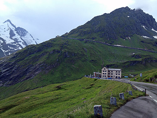
As I started out on the road to the Franz-Josephs-Höhe and the Franz Josef-Haus (2413m), I had no big hopes of getting any nice views as the clouds still lay thick in at altitude here. I was lucky though that the weather constantly improved as I went on and even the sun was coming back. There were very few cars and motorcycles on this most popular tourist road in Austria and after seeing the Torino-guy (who might have returned back the valley as I never saw him again) I never saw another cyclist this day. And people say there are so many cyclists on the Grossglockner! Ha! Most cyclists only wants to cycle a few hours in the morning from what I can tell.
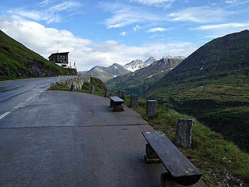
It was lovely going up here in solitude and rapidly improving weather!
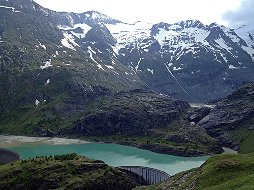
I took my time going up and stayed up there until it started to get a bit cold as I hoped the road would dry up to make the descent faster, which proved to work out my way too.
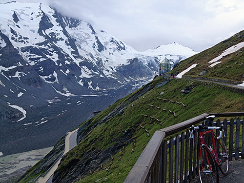
I had figured out before that near the end of the road there is a serpentine narrow road up to the Franz Josef-Haus (2413m), which is the highest asphalted point up here and managed to climb it all despite being quite steep and with narrow bends. Had there been more people up here it might not have been easy to get up this last part.
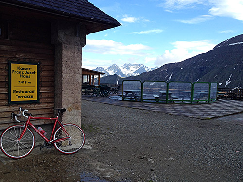
Great views all around and I took a lot of photos as you can see here.
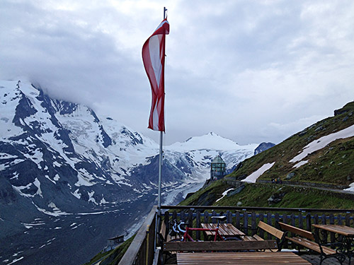
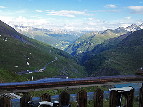
Here is the view back the valley I had climbed up in rain, now looking all sunny and sweet.
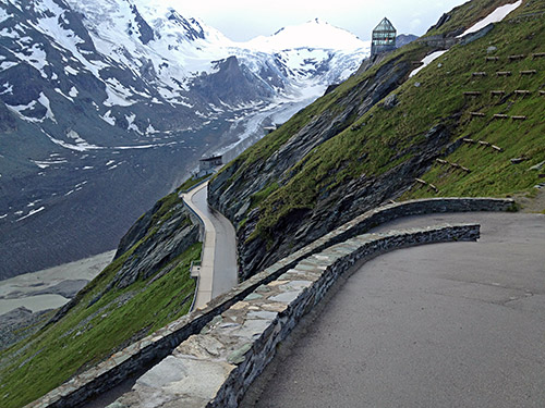
Here’s one of the steep bends on the last part up.
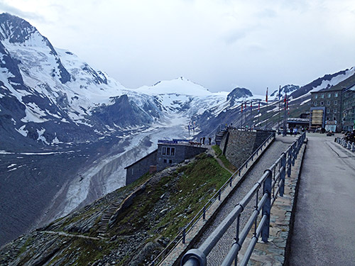
I also went up to the big house at the end of the main road and then back down again.
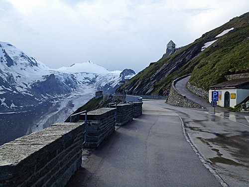
Here you see the start of the steep final part to the Franz Josef-Haus and it looks a bit terrifying.
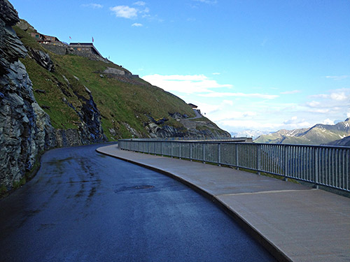
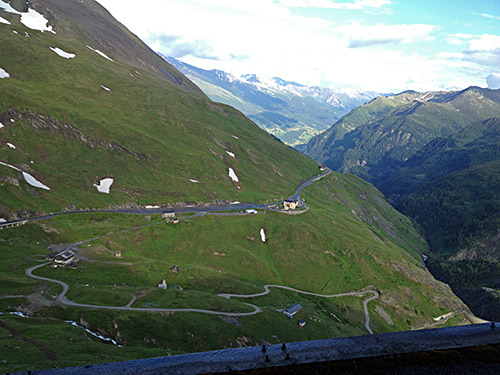
On the start of the descent (very cold for a while here in the shadows).
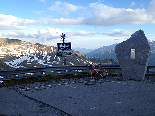
Then back to the crossroads and up the normal pass road to Hochtor (2504m) (highest asphalted pass in Austria with asphalted approaches on both sides, otherwise it is the Tiefenbach gletscherstrasse tunnel pass under the Seiter Jöchl at 2820m, which is also the highest asphalted road in the Alps). It is always hard climbing this high up late in the evening after a lot of other cycling in the day and today was the same. I was merely trying to keep a decent speed not to get too late to the top as I started to feel it was getting late. I guess I was up at Hochtor just before 20 pm.
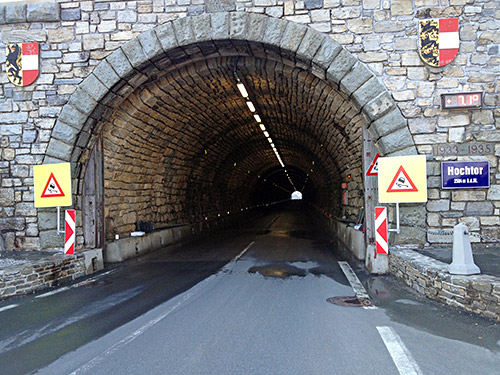
Very nice (and cold) tunnel at the top here! You see the temperatures on the wall (7.1 C) and luckily I did not have it colder than that this year. Very few cars here too (one at the parking place).
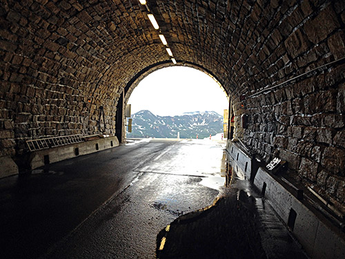
I stopped to have some more photos along the road to try and catch some directions I had not taken photos of before and to document similar places from visit to visit.
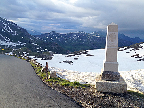
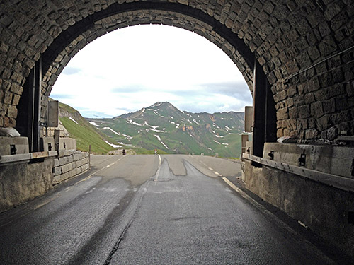
This is the next tunnel going north – the Mittertörl tunnel (2328m) (had a photo of the sign for the tunnel and a photo of the Elendboden sign (2337m), that I thought were a suitable name for the area when visiting Hochtor the first time with +1 C and snow all around, but the photos are not too interesting otherwise, so skipped them here). I thought that Mittertörl was to be counted as a real pass as it has a pass name and tunnel passes are fine to count by my standards, but upon reflection there is a real pass above the tunnel at 2375m, but the tunnel itself does not really count as a pass here as there is simply no real climb from either side when using it as a road cyclist, so for all purposes the tunnel here is not signifying a pass and is merely lending its name from the pass above. (Oddly enough Club des Cent Cols recognizes this as a pass, but not the Seiter Jöchl tunnel pass, the reasoning is obviously French post-modernism, where language is more important than reality, and they think that proper names are of more importance than reality. They may change this eventually when they come to their senses, but not sure when that might be.)
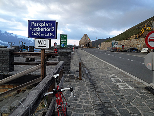
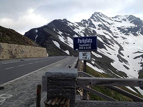
Fuscher-Törl (2402m/2428m), the sign here is really correct in stating Fuschertörl2 (2428m) as this is really another pass than the Fuscher-Törl (2402m), which is by the first parking below north and where the road up the highest surfaced point on the Grossglockner roads goes – the Edelwessspitze (2572m), but this is also really just a variant of the first pass (but used as a walking pass it would be quite a different pass, as the valley on the north side is different then).
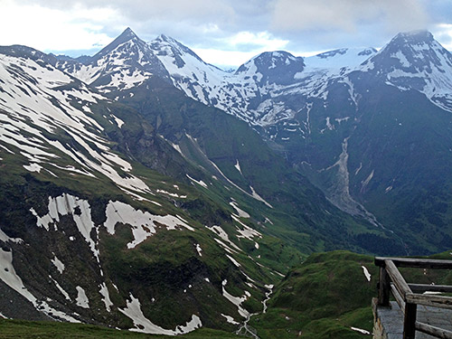
This is the valley that would make Fuscher-Törl2 a different pass from the Fuscher-Törl in the photo below.
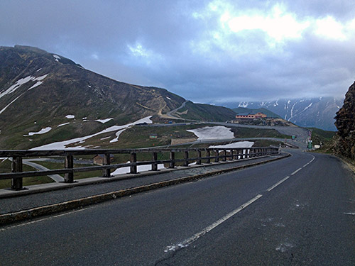
Here you see the road leading up to Edelweissspitze, which is steep with cobblestones in part. It was too late for me to get up to Edelweissspitze again. I would have wanted to get there in fine weather once (only been there once in bad weather).
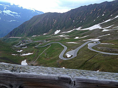
It is a really nice and fast descent on the north side, but also the hardest side to climb up. I kept a great speed down trying to get as far as possible before it got dark. It was still cold in Fusch, so I continued full speed down the valley to Bruck (755m) and Piesendorf (780m) and one of the two hotels there I had meant to stop at for the night according to the plan. It was more expensive than previous places and therefore also less good as we know by now. I had originally planned to also climb the Stausee Mooserboden (2043m), which is strictly forbidden for cyclists at all times, but was hoping to get there between 18-19 long after the buses had stopped going there for the day and maybe manage to climb up and down without a problem, but the idea of also managing this in one day was a little too much to be expected from a mere mortal like me. The road is very dangerous with long narrow tunnels if you meet with someone, so if you also think of exploring it, be careful! (Not even sure one could get up there, but believe some locals have done it. Anyway not to think about during bus hours!)
