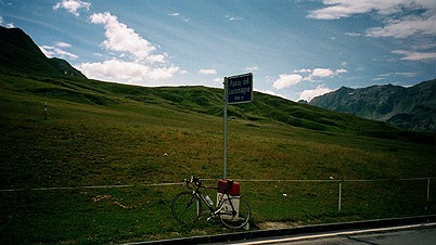
I talked for some time in the morning with the old lady and she showed me where she had been travelling on a round globe and I pointed out where I came from, and the man wished me well for my ride. I was first to climb up to the Lukmanierpass (1916 m), but with easy gradients. The road is also somewhat wide, good and very calm, with few cars. I guess it is that this pass is simply located awkwardly for the main traffic going south and north in Europe. One would have to go up from/down to Chur, but going via Chur makes it more sensible to use the San Bernardino pass instead (or perhaps even the Splügenpass). Otherwise this could have been one of the more obvious passes in the central alps for the heavy traffic.
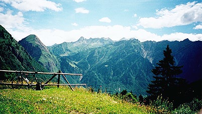
There was a long lovely road down from the Lukmanierpass. First I arrived at Olivone. I took the second photo here just before the sharp descent to Olivone (perhaps the only steep little section on this side). The mountains in the background are just over 3000 meters high. I had real problems getting the photos on this day look good on the web site (and you can see that I have tried to change some parameters, I am afraid (the first photo is not much changed though)).
Olivone is a nicely located little village in the italian speaking part of Switzerland. I had an early lunch at the (second) grocery shop in town. Bread, salami, fruit and soda as usual. Then I wheeled down the valley and all I remember is that it was a very pleasant ride at least until around Biasca, where the road went almost flat down to Arbedo-Castione (260 m) (which is just before Bellinzona and where the road goes left up to the Passo del San Bernardino). It was thankfully not so hot this day. At Biasca there is a sign telling you cycles have to go left there, which is probably not true as there is a similar road down the Riviera valley on the other side of the motorway that one meets here (that comes down from the Gotthard tunnel).
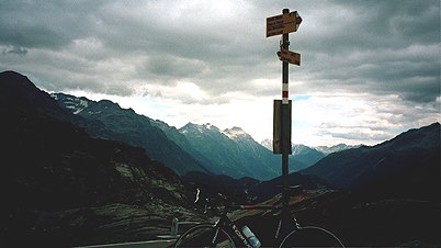
I stopped again at a small supermarket where the road just meets the one going up the Valle Mesolcina (San Bernardino pass road). From here it is 50 km until one reaches Passo del San Bernardino (2065 m) – an 1800 meter climb. The road to the pass is almost flat until the point of the castle you eventually will see. Here the valley gets rather narrow, even though they just here managed to locate a soccer/football arena between the roads. The road is pretty steep up through Mesocco and is in fact the steepest part of the climb. When you reach the houses at Pian S. Giacomo, the road is flat for a little while again before it continues at easy gradients up through woods to San Bernardino (1631 m), where the road drops and you like to think that this is the pass. This is one of those passes with hideous false summits! Here the other big road goes into a tunnel (that you had thought it had disappeared into long ago, but, alas not for good). You on the other hand go up the real pass road section, which is nice and fun, but a bit too much like a labyrinth in its windings around in the mountainside, perhaps.
The top of the pass is not very attractive, but the view south is quite majestic nonetheless. (It is a rather special pass in many ways, but so are also many others.)
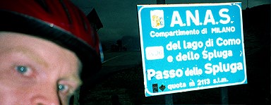
Now the weather got bad again, and that is probably why I simply had to add lightness to the photo. It got slightly chilly at the top and it got much worse down the road to Splügen. When I got down to Hinterrhein it was raining a little and it was cold. I also got irritated that I was not welcome to cycle down on the main road and the other looked very much closed as there were much road work on it and it was unsurfaced for some time with a lot of muddy passages, that made me go back to the main road, but then back again. Well, I went carefully over the bad section and went slowly down the road – partly because I was so cold on my hands and partly because I wanted to avoid to get too wet by water from the road.
The road soon begun to dry up and just then a local cyclist passed me by in full speed. I tried to catch on to him and he apparently had no problem with the chilly air. We went over stretches of cobblestones in high speed and eventually I got slightly warmer again. I just said a few words to him before he turned into his house in Splügen. Down in Splügen center, the shop was closed, but a nice man gave me a banana – almost as if he had anticipated my arrival there. He could not recommend me to get up to the Splügenpass as the weather had been bad up there when he had earlier gotten down that way, but he confirmed my suspicion that the weather was quite all right on the other side of the pass.
Well, I did not want to stay in Splügen as it was all too cold there. I started immediately up the Splügenpass road. It went very fast up there and I was rather lucky of having nearly no rain and decently dry surface despite looming clouds and near darkness.
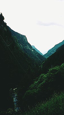
I had heard that the Splügen road should be very nice and spectacular, but was a bit disappointed. The summit of the Splügenpass (2113 m) was a rather bleak spot with a big dam below on the italian side. I took left further down the road where there was a choice of roads, as I believed the longer road was the old road (that rejoined the other road a few kilometers later again. From this road I took the photo here, that also looked a bit too dark on the computer. It is quite a narrow and pleasant valley down into Italy. It would probably be a somewhat stiff climb up to the pass from the italian side as the road is occasionally steep down here.
I was soon down in Chiavenna (325 m), but I wanted to get back up into Switzerland before I stopped for the day as I still had only Swiss francs on me. I thought it was only a few kilometers to Switzerland from Chiavenna. It was however 10 kilometers and with quite some climbing (at moderate gradients) involved. I asked the guys at the customs of the nearest hotel into Switzerland and they said it was in Spina, so I went there and found the one they probably was talking of. It is located just where the road up to the nice little village of Sóglio starts.
I had a little dinner at the hotel and sat down as usual for some time to mark down on the maps the roads I had travelled over since last time. The hotel was fine, but not so cheap.
Day1 – Day 2 – Day 3 – Day 4 – Day 5 – Day 6 – Day 7 – Day 8 – Day 9 – Day 10 – Day 11 – Day 12 – Day 13 – Day 14 – Day 15