The man running the hotel in Bassura di Stroppo was nice and served a very good breakfast in the nice restaurant himself. There were no other guests that I could see. (It seemed as if there were fewer tourists in the alps this year than in previous years (also according to comments made by people who had actually been there earlier years) – good for those of us going there, but not so good if some places will have to close down. The hotel is called ’alla napoleonica’ and could be reached by: tel. 0171-999 277; fax. 0171-999 814; e-mail: locandanapoleonica@libero.it; www.leterredoc.com . I promised him I should mention his place! (Single rooms are ordinarily at 40 euro.)
I was asking him about whether it was impossible to go up the closed road via Elva to the Colle di Sampéyre. His answer was rather long and interesting. He talked about the odd people living up in Elva that he thought should be left to themselves (even though most tourists coming by seems to want to go and see that curious little village high up in the mountain). Apparently they looked down (in both senses) on the people down in the valley and he would never ask them for help unless he was desperate, he told me. They nowadays ease up a bit in the tourist season and even have a small hotel there too (open only in the summer), but then in the fall they get back to their old attitudes again. Apparently there is something special about the place, but I resisted going there (anyway it was tourist season ;-)) – they even sold a book on the village (with only 40-50 habitants) at the little shop in Stroppo. Oh well, I guess it must be that they have hardened by the climate and so I thought. So, what did all this have to do with the closed road. Well, apparently only the people of Elva uses that road (and some tourists I suspect) and they use it no matter what. It is closed off when there are obvious risks for ravines and when the weather is bad as it is supposedly extremely narrow in places and very steep – up and down, but also on the sides. The people in Elva always carries with them a shovel in the car and they simply go out and clear the road from the regular rock falls so they can pass all year around. Well, he definitely thought I should avoid that road and take the other one going up in Stroppo. I thought I should listen a bit more to advices after not following advices last year in the Pyrenées that made me get into real troubles (see here). So, I took the easy way up – not exactly ”easy” though at an average inclination of around 9% and 1400 m up.
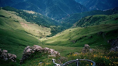
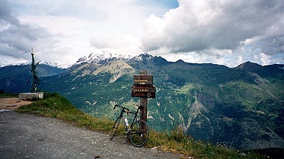
I passed by the Colle della Cavallina (1950 m) where the road met up with the one coming from Elva, which one could see down in that direction. Today I wanted to go a bit longer than the previous two days, so I decided against a detour down there. I eventually reached the Colle di Sampéyre (2284 m) and had a little problem with fleas up the last part.
I went to the closest laying col along the ridge road crossing the Sampéyre road at the top – Bassa dell’Ajet (2310 m). This was in the south direction and the unpaved road was slightly more cyclable in this direction. I could cycle all the way – ideally the road should had been a bit more dried up though. Quickly after I took the photo I returned to the paved road again as a few rain drops appeared. The road surface down to Sampéyre was not very good and it was not as beautiful on this side.
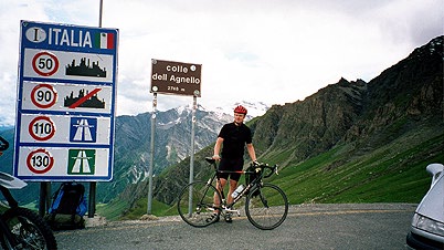
The road up to Col Agnel (2744 m) was fine and had only a few somewhat steep sections until one reaches Ponte Chianale/Chianale where the real pass road begins. The remaining 10 km to the pass height is a true struggle and one of the steepest paved pass roads in the alps with inclination of around 14-15% for a long stretch and otherwise around 10%. This was the only pass where the visitors at the top applauded me and were curious about how long time it had taken to get up there. True cycloclimbing here!
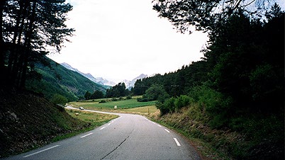
It was rather easy getting down to the Queyras valley. I had originally some plans on getting to see the much talked about village of St. Véran which is one of the highest laying villages in the whole alps at just above 2000 meters. I decided to skip it and try to get as far as possible this day instead.
Soon I was down on a narrow street through Château-Queyras, which had a small and nice-looking castle, but it was only a tiny village. Shortly thereafter, just when another cyclist catched up with me I made a cool turn up the Col de l’Izoard (2360 m) road which he apparently had no plans to take. I stopped just shortly thereafter to take the photo here up the valley to the Izoard.
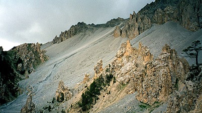
I had researched rather well and planned for a long time, so it was again no real surprise to me that I passed this col in the best direction. I stopped for some fruit and snacks in Arvieux just before where the real climbing commenced and exchanged a few words with an old man there. It started pretty steep, but was still the easiest climb by far for the day. The road surface was not perfect on this side, but that was no problem in ascending. Then I eventually reached the famous Casse Desserte which you can see in the photo here. A very odd landscape and it is difficult to see the proportions correctly in the photo. (I had to adjust the colours a bit, but it still does not look quite as it did when there – as always, the site looked even more impressive in reality. The road actually dropped a few meters here, before it went up again the last stretch to the top.
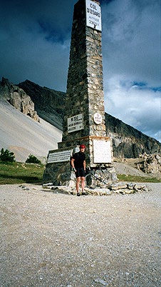
A busy german kindly took a photo of me and the obelisk, that he just managed to get into the photo. The ride down to Brianšon was a real pleasure with a perfect and somewhat wide road. One arrives just in the middle of the center of the town. The town is rather busy, big, dirty and boring for the most part – I had thought it should be a charming little town, but it looked more like it was a suburb to Paris. Maybe I did not get to see the better parts of the town. I got irritated on the extremely heavy traffic around town. Since it did not seem like a nice place to stay at I continued in the direction I had planned and wanted to see if I could possibly get over into Italy before the dark arrived.
Somehow I was rather irritated at this point and the constant small bumps on the main road out of town towards Col de Montgenevre did not make me more happy. When I reached the road taking off up the Vallée de la Clarée, I was relieved again. But the road surface through the village of la Vachette might had made me come up with the idea that the french deliberately keep some roads as bad as possible to look more ”genuine” to tourists and thought it was a deliberate plan by the tourist departments of France (just like they put cobblestones on streets in (formerly) modern cities in Sweden). I still think there is something to this! (Just think of Fontgillard (or perhaps I was thinking of Pierre-Grosse) on the road down from Col Agnel and such small villages.)
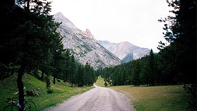
Well, the road improved, but the weather turned less good and when I came around the corner of the valley going to (tourist village) Névache it looked really ominous. Happily I was going to get off the road and over into Italy. I just got a few rain drops and some heavy wind before I could escape it.
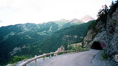
The road surface up to Col de l’Echelle (1762 m) was a bit rough and the road was all along going through woods. One curious thing was that there were no buildings along the road apart from an abandoned old small customs house (not quite by the road). I took the photo just after the pass, which was easy to climb. Very impressive scenery up here and on the italian side (drastically better than on the french side, which is curiously the side that is exploited by the tourist industry).
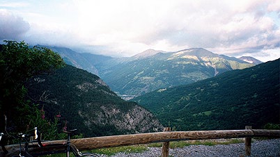
Just before going down to Italy, one passes over a very small pass called Le Mauvais Pas (1779 m). Just after it I took the last two photos for the day. The panorama that opens up on the italian side was not possible to capture in one photo. In the first photo you could imagine the destination town of todays journey – Bardonècchia. Just right across and in the distance you can see the valley of Sommeiller that I were going to explore the next day. On the last photo I am not quite sure which is the high mountain you can see there, but maybe it is Mount Chaberton, which should have a path (or bad unpaved road) to it’s top.
I reached Bardonecchia just before dark and it was rather cold down there, but it is after all at 1300 meters height. Apparently I came into town from the most expensive side of the town and it looked as if there was only very expensive hotels around the town. I did not give up though and went through a tunnel and came up on the other side of the railway that divides the town. The railway was built by a man called Sommeiller and there was also a hotel there on the other side, just at the beginning of the road to Col de Sommeiller that was also called Sommeiller and had it’s name in nice old iron letters as the front door-handles. It was a big and old hotel that looked worn down by time. Inside only old people moved around as if it was an alternative home for the aged (which might be the case). However, both the hotel and the man running it had a real charm over them as if both he and the hotel were still believing we was living in the 30ies. No computer booking there! Even the prices was in terms like 36,65 euro or what it was. Well, I see they have e-mail on the visiting card I got: portulano@libero.it . Big good rooms and good breakfast! One of the best places I stayed at during this trip.
I went out to have a pizza at a place the man recommended almost across the street (with an entrance that looked as if they served thai food). Here I had the best pizza I think I have ever eaten and had to order an extra (I could have eaten a third too, as the servant jokingly suggested, if I could have afforded it). It was with chorizo and it was not looking special in any way, but I think it was spiced up by fresh virgin olive oil and so.
Day1 – Day 2 – Day 3 – Day 4 – Day 5 – Day 6 – Day 7 – Day 8 – Day 9 – Day 10 – Day 11 – Day 12 – Day 13 – Day 14 – Day 15