This was an interesting day with some surprises. I had planned to go over a gravel road (in part) to the Leadner Sattel (close to Hafling). I asked the nice old lady serving the breakfast (with egg even) and she told me that I would find it a nice way to go. It was easy to understand where to take off (just after getting back on the main road and go to the left and forward). It soon becomes a gravel road which is quite fine, but later has some less than good passages. A bit oddly you will find concrete sections in the woods and most steeper parts have concrete, but one was missing unfortunately. At the Leadnersattel (1455m) you reach the tarmac road that you could descend on to Jägerheim (very nice landscape here) or you could go up to the Leadner Alm where the tarmac should end and give several gravel road continuations.
The paved and narrow road that goes up and down toward Passo Schermer is very enjoyable. Before Passo Schermer (1453m) it first steep down and then one should not going left down, but steeply up to the pass. I knew there should be some minor short-cut path or gravel road toward Jenesier Jöchl and since I did not bring the Tabacco map with me turned on a tarmac/gravel road just after the pass. It was a short steep stretch up to a house or two and then it was gravel and rather flat. There were different directions but I was pretty clear that I should try and get right ahead. This was a gravel road much used by horses and cows! Soon I came to a fence which I had to open to continue and the gravel was sometimes too bad to be ridden in places. Then came another fence and when I opened that it fell to the ground I could not get it back properly since it was too heavy, but closed it anyway. Then I met with the gravel road to the Jensier Jöchl Alm, which seemed to be a somewhat popular place to go up (many cars and walkers).
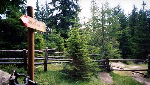
This gravel road is rather easy and you could really cycle all the way until a path leads up the final couple of hundred meters to the pass (cyclable with an mtb). At the wooded pass you see the sign in the first photo here, suggesting the Jensier Jöchl is in the direction you came from. This is not really true – they mean the Jenesier Jöchl Alm, so this pass has not been given any proper sign. (Another name I have seen for the pass is Jenesinger Joch, which is probably wrong. A Michelin map also suggests there are two passes here, but that is not true, there is only one. The Tabacco map does not think there is a pass, but notice the same height of 1822 m.) You then lift your bicycle over the fence ahead and walk down 100 meter carrying your bicycle or lead it around a bit to get to the gravel road just below. There I met 2-3 mountain bikers, who thought I must be lost, but I told them they had no business using their bikes on a typical road bike road! ;-)
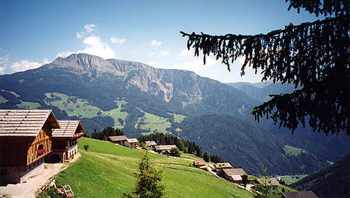
The gravel road was level here an was okay to cycle on (a forest road), but it soon got very steep (up to 20%) in many places and was just about cyclable then. It is very nice lower down just before you come down to a paved road leading down to Sarnthein/Sarentino and you see a photo here from one of the first places giving a free view of the area. Another possibly easier crossing between Hafling and Sarentino would be to go over the Leadner Alm and over the Auener Jöchl from there.
Down at Sarnthein (966m) I got a bit confused about where the road up the valley to Penser Joch went and first went in the wrong direction, despite that I had tried to make out from up above where to go down in the village. I guess such confusion would be impossible coming from any other direction. They were building up plenty of beer tents for a coming festival in the village. The road up the valley almost imperceptibly rises slowly and first when you reach Weissenbach (1342m) does the real climb begin. It is still a 900 m climb and is not easy, but it would be much harder coming from Sterzing/Vipiteno (948m). The road up to Penser Joch is very good.
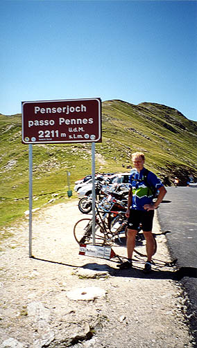
When I arrived at Penser Joch/Passo di Pénnes (2215m) there were plenty of cyclists coming up from Sterzing and there were also many motorcyclists up there, one of whom took a photo of me. Motorcyclists are often easier to ask about photos than cyclists for some reason.
It was a nice and quick trip down to Sterzing. Now I was getting slightly sceptical of my proposed plan, which included going up two cul-de-sacs (one could go over both Pfitscher Joch/Passo di Vizze and Sandjöchl/Passo del Santicolo into Austria, but both include following paths for quite some time). The time was running away and in my original plan I would have been at Sterzing the day before to start out on these cul-de-sacs in the morning. I had promised myself after the horrible adventure in the Pyrenées in 2001 not to try getting up to unsurfaced passes late in the day. However, I wanted to at least do one of these passes and the most exciting seemed to be the Pfitscher Joch, so I started somewhat reluctantly (getting rather tired at that point) to climb up that road. It was steeper earlier on than what I had remembered from looking at the maps, but after some climbing I eventually reached the valley floor where the road goes rather level for many kilometres, practically until the tarmac ends.
I stopped at the last village (it was rather hot still) St. Jakob/S. Giacomo (1448m) and bought something to refresh myself and think things through. The time was about 18 when I started on the gravel road (at Stein) and just at the beginning I met some walkers coming down and hoped they could convince me it would be too difficult to get up there and back before the dark, but no hope there – they thought I would be fine. Well, then I had no excuses and just hoped the gravel would not be too bad or that it would be too steep (marked as 10% on Michelin erroneously). It was in fact never steep, it was up to 8% perhaps at first, but then it was ridiculously easy to climb with unending serpentines with gradients often around 2%. The gravel was pretty fine all the way too. The serpentines up there might be the longest/widest serpentines in the alps – they almost went around the mountain before coming back again. It was a rather pleasant ride up there all in all, so I cheered up along the way.
The Pfitscher Joch is somewhat famous, since it was crossed by D.H. Lawrence in 1912.
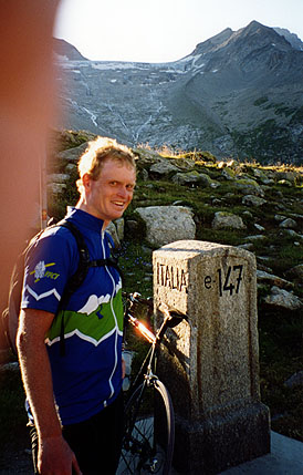
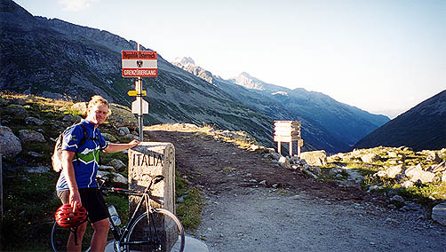
At Pfitscher Joch/Passo di Vizze (2251m) I had quite fine views both into Austria and back down the valley I came up from. A motorcyclist took a photo of me against the glacier, he got hiss hand slightly in the way as he was trying to block out the sunlight (somewhat successfully). I then cycled up (yes, it was a short difficult little slope up) to the Pfitscherjoch Haus (2276m) and had dinner there (sausages and German beer). I tried to get a lift down, but there seemed to be only one car more going down that evening and they had no place left for me.
I cycled back down again and when I was going down the last stretches toward Sterzing it got dark. After some confusion about where to look for a place to stay for the night, I eventually saw a little sign in Wiesen (just before Sterzing) saying Haus Ellen? (something like that) and asked a man outside a house, which turned out to be house. It was a quite good place to stay at and reasonably cheap at 26 euros (if you find it).
Day1 – Day 2 – Day 3 – Day 4 – Day 5 – Day 6 – Day 7 – Day 8 – Day 9 – Day 10 – Day 11 – Day 12 – Day 13 – Day 14 – Day 15 – Day 16