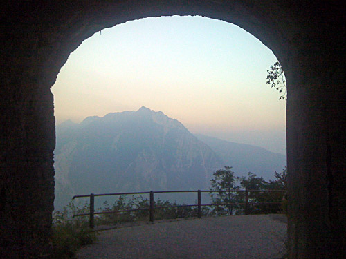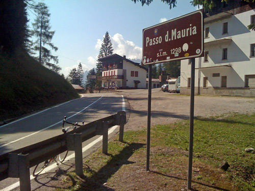
I was taking for granted that this morning would also have splendid weather like every other day before during this Summer and this was of course correct. The climb up to Passo della Mauria (1302m) is relatively gentle and therefore a bit longer than usual for the height difference. The pass itself is not very attractive and it is one of the four mountain (road) passes between Veneto and Friuli-Venezia-Giulia. The lowest is the southern Passo di Sant’Osvaldo (828m) that I crossed in the other direction the day before. The northern crossings are Passo Sappada (1286m) and Sella Ciampigotto (1790m) (essentially …).
Descending on the west side would offer some decent views, while the east side is more remote and idyllic, initially with some good views. Forni di Sopra is the only somewhat popular place along the long eastern road. I stopped here to get an early lunch break. There were lots of shops and tourists here, but it was difficult to find something to buy and eat. Eventually I found a supermarket by the main road that I had passed by without noticing it – supermarkets do not make a lot of advertisements here in Italy. Well, it was a smaller supermarket. After some fooling around in the somewhat confusing shop I got something to eat and drink and here there were lots of places to sit outside to eat on benches in the shadows (maybe part of a closed restaurant).
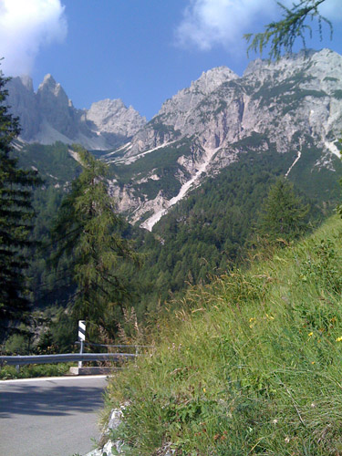
This all took half an hour and I got a bit restless and wanted to get going. The road down here has been improved recently in places and now a tunnel lower down was open to traffic, which they had not gotten far building when I was here last time several years ago. On the way down here I passed by a hooded old lady mowing the fields with a scythe in her hands and you would think that Italy is a modern country these days? ;-) (Wished I had taken a photo.)
After getting to the Sella/Cima Corso (866m), I went down the nice descent to Ampezzo (559m), where I planned to do the first new and more ambitious climb for the day. I missed the sign in the middle of the village (even though I have spent a night here before) and went through the city down to a bridge and returned back again and took off on a wrong road where I found someone to ask about how to get to Voltois (which is not pronounced in a French way). I found the way and descended a small road to the river (477m) behind Ampezzo, where the little known and vey hard climb up to Forca di Pani (1139m) starts. I wondered if maybe the name was misspelled (Forca di Pain?).
The climbs starts a little gentle, but becomes tough already before reaching the Voltois village. It is not difficult to find the road through the nice little village. Then it continues very steep on a very narrow road to the top, with very few houses along the road. The climb is over 12% on average for over 5 km, which translates to long stretches around 18%. Nearly only Monte Zoncolan is harder than this, but there are some others too. Luckily this is a bit shorter than a climb like the Zoncolan one (and thus not as known). This is also a pass with a very boring pass point where there is absolutely nothing of interest to take a photo of – not even a sign. Now, what I was really curious about was whether the other side of Forca di Pani was fully asphalted, as I have found no evidence for this in maps or comments online and there exists no climb profile on the Internet. Satellite photos have suggested that even if it was not necessarily asphalted, it looked as though it would be usable with a road bike.
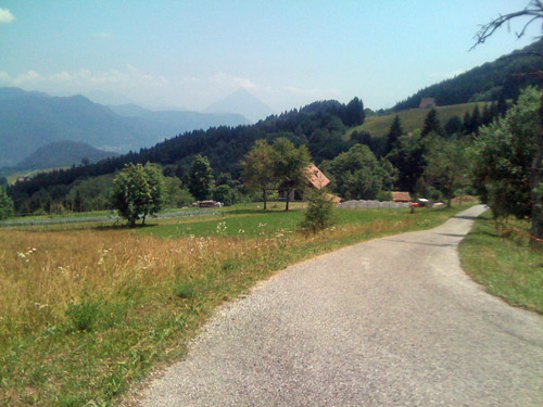
Pleasantly, it turned out that the east side of Forca di Pani is fully asphalted and also have very nice views, little traffic and was a fun road to descend to Enemonzo. Then I went back a little on the main road to Ampezzo before turning off at Preone (395m). Here I had thought to have somewhat easy climb on a small road to Sella Chiampon (789m) (highest point 799m a little before the pass). It is a relatively short climb and the road starts easy and nice. Then there is a descent down to a river and the road suddenly becomes very, very narrow and starts to climb the other side in serpentines. A car passed by me up here and he had to stop and reverse in order to be able to get around in the tight curves at one or two places and I had to think about the balance on the bicycle. It is here also quite steep and felt as hard as anything on the Forca di Pani, but thought it would soon be over. However, it was little longer than expected before the road suddenly becomes all flat more or less after ca. 2 km.
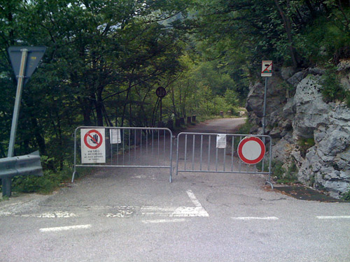
The top is a long saddle with pastures and a few houses. Quite a nice area that is difficult to get to from anywhere (at least on this day). Well, the continuing road looked even more suspicious as if it was only going to a house there perhaps. The road did not look as if it was used for through traffic and I got a little curious, but continued. After a while I came to the section where the road clings to the rock wall for quite a while and here they were working on securing the road from more rock falls. I had to lift my bicycle over some ropes they were using, but continued. Soon I came to the end of the road (699m) where it meets with the road over Sella Chianzutan (953m). Here they had put up barriers and a sign saying the road was closed. There were no way to enter the road on this side except with a bicycle or on foot. That is about time telling you the road is closed when I just left it … anyway it was good I was not deterred from taking this way as it was possible and was a nice road.
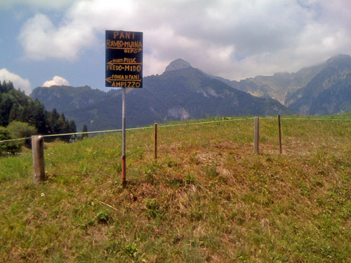
There were some serpentines up to the next long saddle pass, the Sella Chianzutan (953m), but this was an easy climb. The views got a bit better at the other end of the pass on the descent to Tolmezzo. The descent was nice and slightly confusing with bends, ups and downs and villages here and there. I tried to find a bar to serve me some pasta, but had no luck, so I continued. Instead of continuing to Tolmezzo I turned right/south just when coming down to the big valley below and went to Lago di Cavazzo. I could have taken the road on the west side of the lake to Alesso and it would likely had been much nicer, but I took the bigger road on the east side. (I had failed a bit in my planning there.)
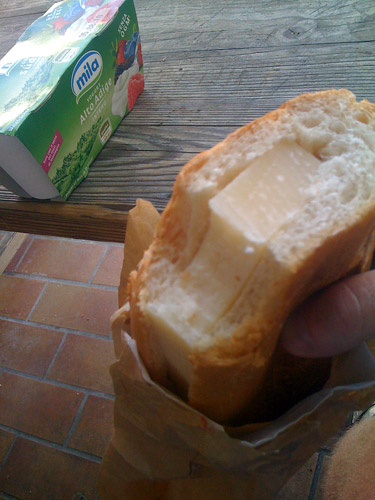
I followed the local road after the lake going near the motorway here until I turned off to Avasinis and now had to go back a little to that village. In Avasinis I asked a young boy on a bicycle about where one could find something to buy and eat in the village. He decided it was easier to show me, so I had to follow him to near the church where I found a grocery shop, which would indeed have been difficult to spot on my own as it had no sign and not even any lights on inside. I did manage to get a sandwich with cheese, yoghurt and a big bottle of water to drink (I think that was all the old man could find that was a bit cold).
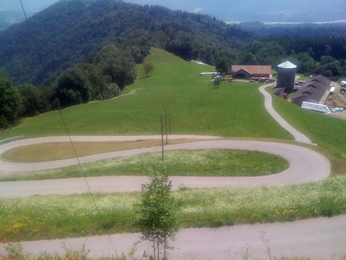
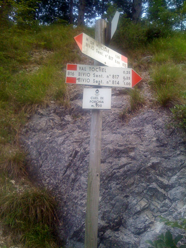
It was hot today as well and had been very hot on the Forca di Pani, but there were also some shade there and on the whole it was not too warm (maybe I was starting to get used). I sat down outside in the quiet village of Avasinis and felt a bit uneasy about the rest of the day as I still had in mind to do two more climbs and the clock was already around 16 in the afternoon now. But I try to tell myself to relax while I am on holiday and not hurry. Be flexible and reschedule if needed is the idea. Next up was the climb from Avasinis (188m) to Cuel di Forchia (908m) (top of the road is at 922m before the pass).
Some 600 metres of height difference could not be that tough, could it? Well, I knew that this should not be an easy climb and it has been part of the Giro d’Italia even though the road is quite an obscure little one, clearly not going to a ski resort or the like. I think this is probably among the 5 hardest climbs below 1000m in the Alps. It is extremely unevenly steep and it ranges from 0-20%. I met a cyclist right at the start coming down. It starts quite steep up from Avasinis. It also has two places along the road that makes you think you have reached the pass already. And then it actually descends a little before reaching the true pass. I should not have told you if you planned on going there, but the last steep part before the end is actually the hardest of all and may be above 20% on a somewhat rough surface in the woods. I had to fight to get up there! This is a climb that really impressed me and I put on my mind to tell you about this. You will be amazed. I surely would not want to compete up here (or down for that matter).
Down to Avasinis again (one could go down the other side on an asphalted road too (there may even be two alternatives), even though that is nowhere clearly noted, but I was not on my way in that direction). This pass was just a detour that I wanted to do, but nearly took out of my plans. Now I am happy I went up there – even if it was not beautiful, it was a fun pass. I went back on another road to the Cavazzo lake and again went on the east side to the middle where there is a road over between two mountain and down to the bigger valley down to Udine. Interneppo (248m) is the little village here by the lake where I had originally plan to stay for the night, but now had intended to get a little further. I stopped here for a coca-cola by a grocery that was has just closed (right after 19 now), but I manage to buy one anyway.
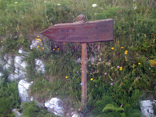
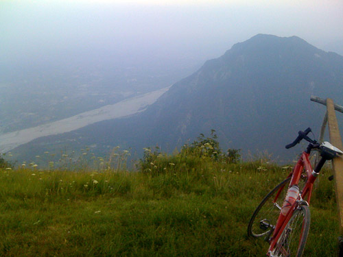
I was going up one of these two mountains – the Monte San Simone (1209m). One cannot reach anywhere near the actual top of the mountain which is higher, but one could see the highest point if one continues on the gravel road for some hundred metres at the end. It was late and this was no small climb I had read that the road had been improved in 2006 as it before then was strictly a climb for mountain bike cyclists and many, I would believe, still thinks that is the case. The surface is sometimes rough, but the road is fully surfaced to 1202m height (where there is a small wooden sign for a chapel up here). Parts are concrete pavement and there are 10 unlit numbered tunnels at some of the hairpin bends up the road. The road is fairly steep too and quite long (close to 11 km with ca. 9% on average).
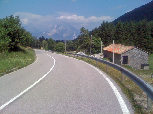
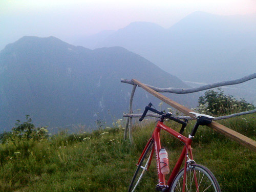
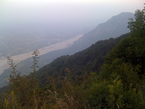
This was one of the climbs I most had most wanted to do this year and it was just as nice as I anticipated. At first it was a bit boring climb and I wondered if this would really be a nice road. When I noticed the surface was a bit rough and I was late, I started to have my doubts about this climb, but I kept going as I had started and now wanted to go ahead. The specific road starts at the high point of the little unnamed (?) pass between Interneppo (248m) and Bordano (217m) at 314m. It is the road going straight ahead (there is another military road taking off soon after the start). It takes some climbing to get up from the woods, but then the mountain starts to get steep and the road clings to the mountain wall and this opens up the views that are endless down toward Udine and later on you will see around the other mountain, even if it blocks some of the view.
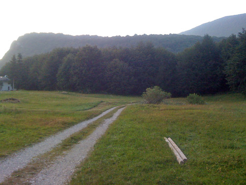
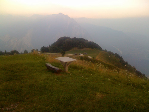
The surface actually got a bit better later on, but varied. Twilight started to appear as I was closing in on the top of the road. One eventually reaches a tiny plateau with a few houses and there were some military guys here (maybe those who had passed me by on the way up). I said ‘hi’, and continued up to the end of the asphalt road with a small sign for a chapel here. This is no good place for a photo, so I decided to continue up a bit further on the gravel road to see if I could get any new views and see if there was any pass up here as it has looked a bit like on the detailed maps. The gravel road was a bit bad, but was usable. I got up to a big flat plateau and could see the top of the mountain. There were a few houses up here too and a local just arrived at his house, but still this was the most disappointing place along the road – almost felt like home in Sweden somewhere and no good views (the mountain only looks like a wooded hill from here).
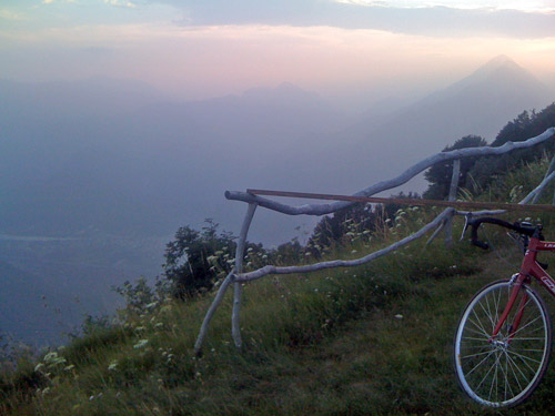
I snapped a photo and tried to get back down quickly now to be able to get down while it was still light enough outside so I would not have to put on my lights. But I had to stop a few times along the road to take more photos, but the sky were hazy and it was getting late so my photos does not really do justice to this nice climb. The best views are just before reaching the first houses up on the mountain. The road itself is quite special with its tunnels. I think I met one car on the way down and maybe they got a bit surprised seeing a bicyclist so late here. One has to be careful down here. This is a very recommended climb in the area!
I hurried down to Bordano, but it looked boring, so I decided to continue on the small road along the Monte Simone north. When I arrived in Pioverno it got dark. I was happy there were so little traffic up this road. I crossed on the long bridge over to Venzone (231m) and got into the fortified town and next to the central square I saw an Osteria and decided to ask if they had lodging. They had and I managed to get food and wine after a quick shower. It was quite a good and nice place for the money and the people running the place were also nice. Why plan when things can work out this great anyway?! ;-) It had been a good day again.
