Some facts

Another tour of the Alps for this Summer was being planned, but nearly had to be cancelled due to an accident in early June, when I fractured my collar bone and hurt my head and right leg. It was exactly 5 weeks before the tour should start and the doctor told me I would be back in 5-6 weeks. I had ONE proper training ride in those 5 weeks, but I was lucky in that I had planned to leave later than usual this Summer (July 14-August 4). This was going to be the 10 year celebration of my Summer mountain cycling tours which started with a week in the Dolomites in 2000.
I had the goal of completing climbing all asphalted pass roads in the Alps from 1700m and higher (which I have detailed in a list at the cycloclimbing.com site). One more asphalted pass, Col des Portes (1835m), had came to my knowledge since 2008 and I also planned to climb: Le Collet (1707m), Pas des Escaliers (1700m), La Croix (1700m), and Col de Gleize/Chaudun (1696m). This would leave me with Col d’Andrion (1681m) in the southern French Alps as the highest pass that I had not climbed. This was an easy goal in itself, but I also wanted to visit some gravel road passes, some of which I had previously planned to see, but have had to skip them and change plans.
There are not so many really high Alps passes with gravel roads which are possible to handle with a road bike, but as I am not thinking it is a good idea to do a long Alps tour on a mountainbike, I really want to find out about possible passes that are within the the reach of the road bicyclist. There are however several such passes that are both possible and quite worthwhile to visit with a road bike in the Alps! Good examples of these are: Colle di Fourclaz (2486m)*; Illpass (2482m)*; Col de Saluces (2444m)*; Col de la Traversette (2383m)*; Klammljoch/Passo di Gola (2288m); Pfitscher Joch/Passo di Vizze (2251m)*; Passo della Costazza (Baita Segantini) (2175m)*; (Col de la) Croix de Coeur (2173m); Gopplerlücke (2050m)*; Passo di Fraele (1952m)*; Giogo della Bala (2162m); Portes du Soleil (1950m)*; Raues Joch (Freiburger Hütte) (1918m)*; Col de Tende/Colle di Tenda (1871m); Bargällasattel (1742m)*; Kunkelspass (1357m). (*only one side worthwhile) In particular I recommend: Croix de Coeur, Giogo della Bala and Col de Tende, which are all somewhat good gravel and could be used as passes, while offering splendid views. I also decided to climb some cul-de-sac roads up valleys and mountains – notably the Alpe Giumello and the difficult Rionda and Furgge (Breithorn) in Wallis/Valais.

Note: Internet Explorer is not recommended. Instead use a good browser like Opera, Chrome, Safari or Firefox. These pages looks best in Safari on a Mac – it should look like this!)
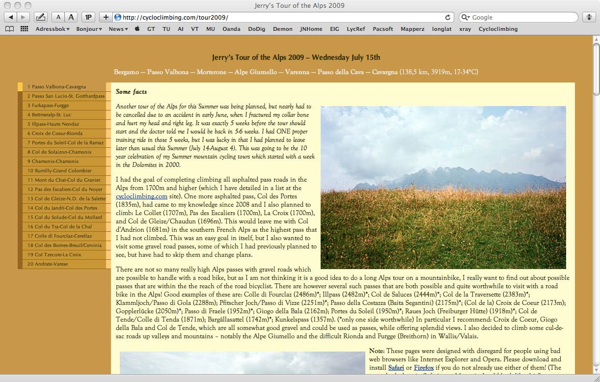
Just like last year the tour started and ended in Bergamo’s Città Alta – where I stayed at the same Bed & Breakfast (La Torre B&B). Since I spent the Easter week bicycling here around Bergamo too, I now know some of the roads in and out of the city (the area around the old town can be quite confusing and still is). I took the nice Via Beltrami road toward Almé. It started to rain almost directly! I had to take cover for a while and then cycled slowly up the Valle Imagna until the rain disappeared and the road got nearly dry. As I was heading straight up to a gravel road, the prospect of rain was not too welcome, but I figured that I might well be lucky and it also turned out that it was nearly dry up there.
When one comes up the nice road and eventually reach Fuipiano (1019m) at the end of Valle Imagna the road that continues further up is easy to find (I think the name is Via Milano). I went through the short cut through the village and the road that continues to climb is well asphalted for longer than I had suspected up to ca. 1200m height (somewhat steep). Near the end of the asphalt you have to take left. I could partly cycle on the continuing gravel road, but it turned out to be a bit more stony than I had hoped and the steeper sections are nearly impossible to tackle successfully. A bit higher up where the landscape opens up, you get a road choice (again) and here I was not sure as both satellite views and maps were unclear here. I followed the road taking off for a while to see what kind of choices there were. I soon noticed the ridiculously steep road that climbed up the mountain above me and after walking back through the grass to the road I had followed I realised that it was indeed that steep road which I should take.
")
I saw a jeep coming down, so that seemed promising. After a while one comes to a bar across the road which is locked where I had to walk around. On the other side the road soon becomes asphalted again and the steep ramp that I saw from below was in fact fully asphalted! I could not resist to try and cycle up even though I had already changed shoes to the new Nike Lunarlite running shoes that I had bought for this year’s expedition, I changed back and attacked the ramp as good as I could. It soon went up to 26% percent inclination and I had to give up, considering that the road had just started to get steep … – it is 34%! After reaching the top of the ramp a grassy track leaves off directly for Passo Valbona (1427m), which was where I was heading, but I got curious about the road that continued towards Bocca del Grassello (1390m) and decided to try it out as anyway was so close. Soon one had to walk up the grassy hill following (perhaps) some of the vaguely traceable jeep tracks. It was kind of nice here and I did not mind walking back over the hill (though I had noticed in a map that the path between Grassello and Valbona was marked as only for experienced walkers/climbers, but it was only a bit steepish and of no special problem.
Got my two first photos for the day on this walk over the hill separating the two passes! I got slightly wet in my Nike shoes. As I came to the gravel road which is decent from the Alpe you see here, I changed back to my cycling shoes. But in trying to tuck down my Nike shoes in my backpack I managed to force one of my (just healed) fingers into the shaver so that I started to bleed copiously. Luckily I had a few strips of plaster with me that I thought I would not get any use of, but they were hopeless in getting to stay in place as I was sweaty and bloody. Very annoying as it tend to take long before such scars heals and it was annoying for a few more days as it went open every now and then.

Down at Morterone (1038m) I stopped for lunch (sandwich and coca-cola) at the only restaurant in the village and they were kind to give my another piece of plaster to put on my scar. The weather was good for cycling now that it was not raining, nor sunny and hot. The next pass, the Forcella d’Olino (1156m), is an easy climb from Morterone. One wonders why there is no other road reaching Morterone as the road over the Olino pass does not come across as the most easy one that could be built. There is a gravel road that might be used in good weather from the Culmine San Pietro (1254m) pass, but why not build a road up the obvious Val Taleggio (there seems to be a gravel road most of the way here)? I guess access to the Lecco area might have been of more direct interest and there are probably good historic reasons as well. People has for centuries travelled over the Valbona pass to Fuipiano and perhaps more commonly over the nearby Passo del Pallio (1362m) to Brumano. I do not know if it would be easier to try this later route, but none is cyclable with a road bike throughout anyway.
The Olino pass road is quite spectacular down toward Ballabio (Lecco side) and has many nice hairpins. I stopped for two photos. Down at the busy road from Lecco over Colle di Balisio (723m) I went down to Taceno (429m). Here were road works on top of the traffic. I was starting to feel that I had not trained enough for this and still had some ache both in my shoulder and leg. I wanted to stop again, but decided to continue a bit up the road toward Alpe Giumello (same road as for the climb to Alpe Paglio/Pian delle Betulle) to avoid the increasingly hot weather and get out of the traffic. I made a short stop at Margno and now the sun had made its appearance.
The climb up to Alpe Giumello/Monte Croce di Muggio (1536m) is quite demanding and this was the first major climb for me on this trip. I had originally planned to also climb up another nearby mountain, but this was enough for me this time and I did not feel like it was a good idea anyway to do climbs nearby that would give me similar views.
There are gravel roads continuing up further to the Monte Croce di Muggio from where the asphalt ends at Alpe Giumello, but I was happy enough to have reached the Alpe and returned back to Narro and took the narrow and nice road down to Bellano and then took the ferry from Varenna to Menaggio, that I have now used a couple of times, but it is still a very nice ride! The views from Alpe Giumello were slightly disappointing as I could hardly see the Lago Como from there. (I stopped and bought a Radler (German version of the English Shandy) and yoghurt at a shop in Bellano.)
The road to Porlezza from Menaggio is always a bit tiresome with the heavy traffic there. Now it was already getting a bit late and I was to climb up toward Passo della Cava (1142m), the same way as I climbed it this Easter, but did not mind so much as I remembered it as a nice climb. The climb is also a bit steep! I was tired but was hopeful about finding a room for the night just before the pass as I vaguely remembered seeing a hotel there this Easter. It turned out that this hotel was closed and there was no place for lodging on this side of the pass (according to a woman nearby). If I did not want to go back to Porlezza I was suggested to visit Cavargna on the other side of the pass and so I did.

However, I also remembered that the steepest part up the Passo della Cava from that side was from Cavargna, so I had to do that climb again the next day as my plan to go up here involved getting up a gravel road over the border at Passo San Lucio (1542m) to Switzerland the next day. This was in order to avoid the Lugano area and to see a new pass.
It was really starting to get late and I had better found a place for the night at Cavargna (which also included some more climbing up there). It turned out that Cavargna is not so very touristic and I had to ask some people there for a place. A young kid insisted that a nearby restaurant had lodging and I asked there, but they were apparently not currently lodging people there. They suggested yet another restaurant which had no sign suggesting they had lodging at all. But after some thinking the lady there determined that they had a room for me. This was probably the most “rustic” of the 3 (?) restaurants in the village and I was the only guest. I got some food and was really happy for it. She asked if I wanted pasta and I said yes, but suggested I wanted something in it, like meat. That led to some misunderstanding as they usually serve pasta simply as a first course and later the main meal, so she thought I not happy only with the primo piatti and made me another plate with meat to my surprise. I also got a big beer and a litre of sparkling water and ice cream. This plus breakfast and the lodging cost me in total 30 euro! I gave her a couple more euros as it seemed like I was robbing her at this price. (The last photo of Cavargna was taken in the morning after while climbing back up the steep section to Passo della Cava.)


