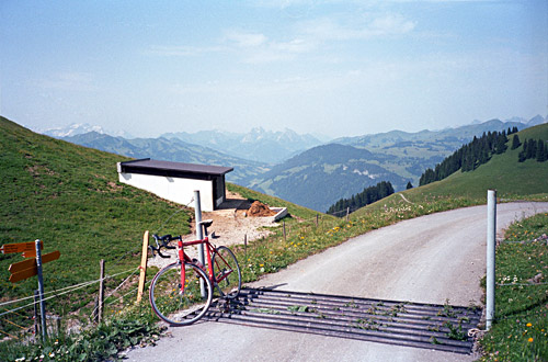
After breakfast at Reidenbach (840m), I started on the road back toward Saanenmöser (which is also a pass at 1279m), but turned off the main road before getting that far. At Lee (905m) one goes across the railroad and river to Grubenwald (940m) and here you follow the sign for Hofstetten. Here is also the only mention of Gestelenpass (on a bicycle sign), but I believe the more accepted pass name is actually ‘Meieberg’ as it only says at the pass and there are several ‘Berg’ in Switzerland that are not mountains but passes like Safierberg, Valserberg, Mittelberg and Stallerberg (this also happens in Austria).
Here In Grubenwald the long and hard climb up the Meieberg starts. It is often around 10% with some easier stretches and some steeper. It is nice up around Hofstetten, but then it becomes wooded again for some time and suddenly the asphalt ends and good gravel continues for almost a kilometre (if I remember correctly). Then the landscape opens up again and it is quite nice. Only a small disappointment to find the road descending a little before rising sharply again. The last stretcth to the pass is pretty steep but now it is so near so that it is not much of a problem.
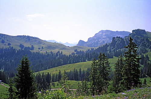
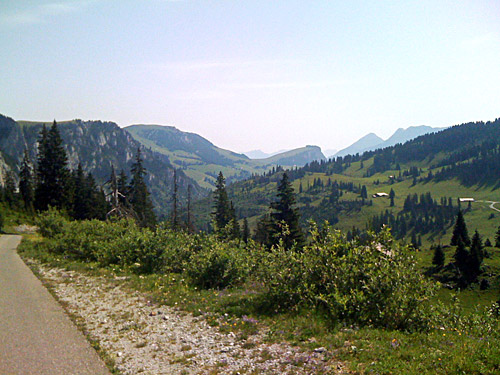
The views from the actual pass height are the best and especially in the western direction. Here starts a lightly sloping ca. 300 metre section of gravel from where one has great views of nearby Seeberg (1800m). Seeberg is also possible to climb on an asphalt road from a bit below, but even though Seeberg looks like a pass just like Meieberg on the map, there is in fact no way down the other side of this pass, so here it makes little sense to regard it as a pass, but it is known to be a nice alternative climb and there is a restaurant at the top there.
The descent is on good asphalt but with some drainage canals made in the asphalt that make you want to go slowly down and the road is also narrow and difficult to descend quickly up here. After meeting the Seeberg road the descent is much quicker. The road is often steep until you get down to the Diemtigtal at Zwischenflüh (1041m). I met a professional looking road cyclist ascending the road to Seeberg or Meieberg here, so apparently local talents like this road too. There were also some tourists on this side.
I had originally thought to explore what might be regarded as another asphalt pass here just above Zwischenflüh at Schwarmoos (1824m), but never went up there as I wanted to move on and find it somewhat unclear if Schwarzmoos could be regarded as a pass anyway (the real pass seems to be lower down, later on the same road after it has turned into gravel at Ramsli (also no proper pass name). The climb to Schwarzmoos might be a bit steeper than the Gestelenpass though and might have some good views. They are not very good on marking out passes here (much like in Austria).
So far so good, but now it started to get really hot! I stopped for yoghurt and coca-cola in Oey (670m) and found it almost too warm in the shadows outside the grocery shop. I gathered myself and started out calmly toward Thun.
On the way to Thun (560m) I met some cyclists, which is no surprise as there are few alternative roads to take in the area. I circled around in Thun for some time hoping to find a nice place for a real lunch, but it was all too busy and I found nothing appealing, so I moved on and found the right way out of town after asking a guy waving cars in different directions at a roundabout.
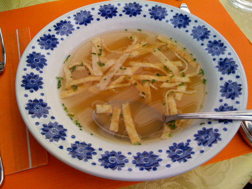
Maybe there would be a good place to stop at out of town, I hoped. I came to Steffisburg and at the Oberdorf area (I think) I found some restaurants and stopped at one place that looked like it was part of an older hotel (not so charming). It turned out they had a menu for a good price. The soup I got was a bit of surprise as I have never seen a soup made on a slice of pancake before, but it was fine and it looked nice (see the photo here). It was much better to stop here out of the busy city.
So now I thought I was prepared to continue up on the Schallenberg road, which should be somewhat easy. In fact the whole day would be somewhat easy compared to most others on my tour this year, apart from the hard climb up to the Meieberg. However, there were other challenges. It was all a wonderful climb up the road on the not too busy road, which is known to be rather busy, especially since it is very popular with motorcyclists. I kept overtaking a small Circus travelling with a not so good lorry who had to stop now and then maybe not to overheat the poor engine.
Eventually I got up past Kreuzweg (828m) where the road starts to go rather flat ahead with occasional rises along the road. But already around Schwarzenegg (910m) I found I got very tired and stopped at a small grocery to buy a bottle (1.5 litre) of grapefruit soda that I quickly consumed hanging with my head wondering if I could get going again. Even though I had been going very gently up in the heat and drank a lot at the lunch place, it had been so hot that I simply could not take it. I saw one other cyclist, but few would go out cycling in this heat. It was around 37-39°C in the sun and that is were I was. I just waited until I felt better then I continued.
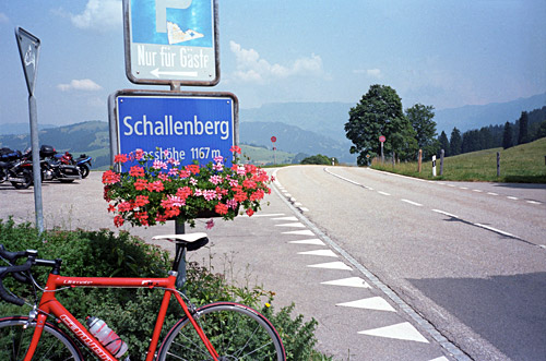
It is a nice road without any spectacular views, but with a lot of open landscape and curves on the road. I felt better again and the three serpentines up to the Schallenberg passhöhe (1168m) were not too demanding. There is a restaurant at the top very popular with motorcyclists. Down I went the other side and turned right at a crossing. The descent stops at a bridge over a river (841m), from where a small climb up to Schangnau (988m) starts. The it is down again to Marbach (871m), where I again stopped to try and find a place that served coffee, but there are not any cafés in villages out here for some reason. I got a coffee at a hotel, but then they asked me to leave as they were really closed and it started to rain, so I was not in the mood of cycling on right away.
I waited for a while and the rain eventually stopped. Funnily the road was dry just a kilometre ahead, I later noticed, so best would have been if I had not stopped here at all. But I was on my way to another climb and there would likely not be anything open along that road. I was really doubting the idea of going over the Hilferenpass, which should have a stretch that I might have to walk on a track, when heavy clouds and rain was in the vicinity. It might have been a swamp already up there if it had rained there just recently, but I decided to be a little crazy and try it anyway. The bad stretch should be rather short, so it could not be too much of an ordeal even if I was unlucky.
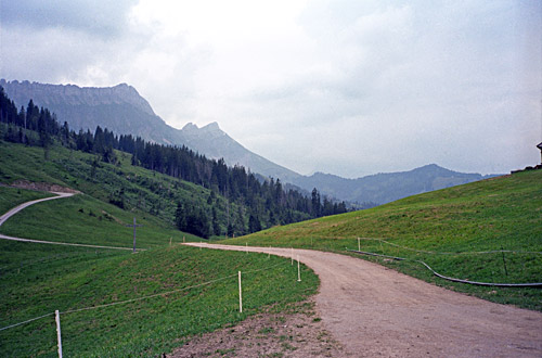
I found the way (turned off the main road at the 830m point) and followed the nice road and remembered to keep left on the way up here and it all worked out very well. At Torbach (1093m) I found water. Sometimes the road is through woods, but on the whole it is a nice and lonely road that works as a fun “short cut” to Flühli (883m) in Mariental. Hilferenpass (1290m) (or Hilferepass) is a nice place. It is pretty obvious which track to take here to get to the asphalt road on the other side. One wonders why they have never thought of making this a proper crossing as it would be very easy to make this short track asphalted too, but probably some people living up here are against it.
The track is not really cyclable with a road bike, but the walk is only like 10 minutes to get to the asphalt road that you vaguely can see (you see the farm to where it goes). The track is grassy and it was not wet, so no problem at all. Apparently the crossing is popular with mountain bikers. The other side of the Hilferenpass is much steeper and you get down to Flühli (883m) in no time (as long as you keep to the road descending). The asphalt is nearly perfect on both sides, so only the short track is stopping road cyclists from using this road a lot.
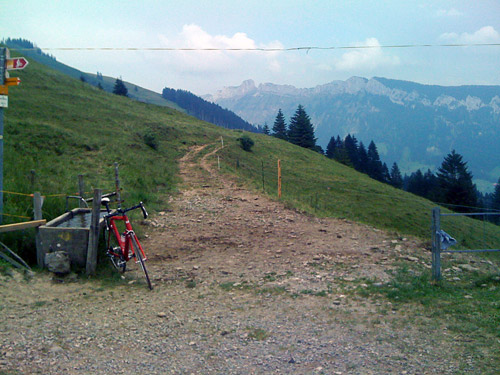
I went up somewhat hurriedly to Sörenberg (1162m), feeling that rainy weather was coming in on me from all sides. I stopped by a small supermarket with almost no customers and got a coca-cola as some sort of preparation for making a decision and trying to attack the next pass. I decided to tackle the Glaubenbielen/Glaubenbüelen Pass (1611m) even though it looked like chances to get over it without getting caught in bad weather were quite slim.
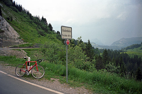
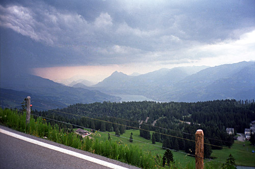
Now, all of a sudden, I had a lot of power and went up this pass in a speed that would few would follow me in. Full speed all the way to the top (1565m), from where the road continues to climb to the 1611m point which is merely the high point of the road, but as everyone refers to this later point as the pass, I follow suite here. (Actually there is no direct path down at the 1565m point, so it makes some sense to use the 1611m as designating the pass here.) Only just before reaching the top did I realise that I would make it without having rain. It was actually quite nice up here in this weather. On the descent I did not know if the rain would come in either, but I took the time to stop for two photos at least. I was lucky and got down without rain as well.
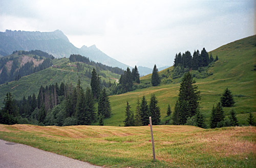
I went down the busy side of the Sarnersee which I had not planned, but as it looked to be a little bit more away from the rain this made more sense. I found it hard to find the right way down here as they were working on roads and you were not allowed to cycle on the big road everywhere. Some local cyclists pointed me right. When I got down to Sachslen (483m) I turned off up the mountainside and climbed the normal road to Flüeli (700m). Just before reaching the village the rain at last caught up with my manoeuvres in trying to avoid it. There is a huge old hotel here that I think is famous, but thought it might be expensive, so looked around a little before walking into a very crowded hotel that looked rather modern. They had not much to offer me, but what they had was simply too expensive and being a modern place also makes it less valuable in my mind. I was also too hot and crowded.
I asked if they knew of a cheaper place nearby. They just off-handedly said that I could try up the road in the next little village, but would think prices were like this here around. I actually think the big first hotel would have been cheaper and better. I continued up the rain to the houses above Flüeli and found a hotel that although it looked a bit big as well, it did not look quite as modern. I stepped in and they had a room, which was not much cheaper, but with dinner and breakfast it was agreeable considering that I had not much choices now. It was just under a 100 € (if I remember correctly), but they were very friendly here and the place was quite good. I even had a balcony to look out through the rain in the night ;-).
