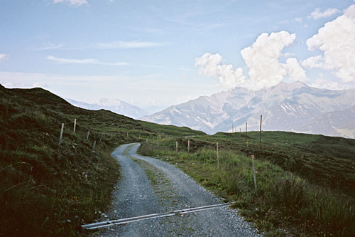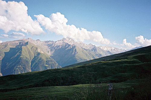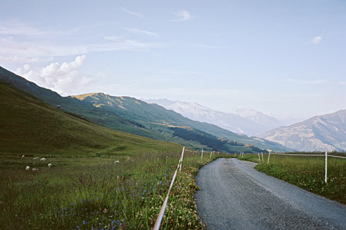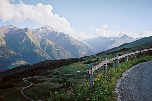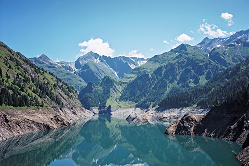
Last day was rather miserable, but had a big highlight in the climbing of the great Lago del Narèt. This day was a new day and it was going to be maybe the best day of the whole tour this Summer. I was still not fully recovered from the cold I caught on day 3 and I was not completely rid of it until day 16 or so, but it was not having much impact. The bicycle was still operational this morning and it had just about dried up outside, but was a little chilly in the air at first up to Olivone. I took the main road up there, but the alternative road over Prugiasco and Ponto Valentino looked nice across the valley and will be the one I would take the next time. There are also some nice climbs up the mountainside here as documented to a great extent (the whole area, actually) by a man at quaeldich.de, as an example you could see the roads to Gorda described.
I usually do want to move on and not do too much up and down climbs, unless they are really fantastic in some ways, but maybe I come back to the area to do more climbing another time. For now I had merely two goals in the area and it was Lago Luzzone and a second visit to Lukmanierpass. In Olivone (891m) the bicycle shop was open and a girl there got hold of the owner who helped me out changing the rim tape to a Velox tape! (I noticed he also had bad BBB tapes for sale.) He seemed to know what he was doing and adjusted the brakes a little (seems like they always do that to suggest they do a bit more than asked for …) and he tried to adjust my rear derailleur which I actually have a problem with insofar as not being able to put in the highest gear (53-12), but he shook his head, just like I had done before in trying to fix it, but noticed that it has been bent a little and bent it back, but that did not quite solve things (nor did it thankfully have any adverse effect which I was a little worried over). It seems like either the cassette is bad or the frame has actually been bent a little when I had a bad accident with a car in March-April 2010. I only have a problem to hang on to the best riders at home when we go with the wind in the back.
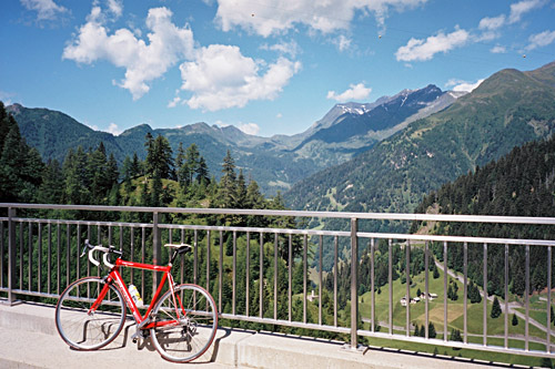
Then I also had a coca-cola and yoghurt at the grocery store (I think they have two). Now all was fine again and the tyres were getting the right pressure again, which always feels very good. The sun was shining and the temperature ideal.
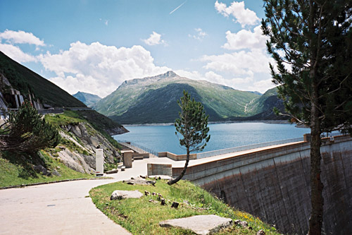
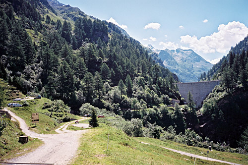
At the first bend of the road up from Olivone the road to Lago di Luzzone (1609m) takes off. Soon one comes to a long straight tunnel, which is lit. After a while when comes to Campo (1205m), where one could turn left to Alpe Pradasca (1742m), but instead one continues and cross the river to take off on the next road going right (continuing takes one to Pian Geirètt (2012m), where I would like to go another time). The road is now steep up through serpentines to the dam at Lago di Luzzone. When you arrive at the dam you are met by a multiple choice of tunnels – no less than four choices in fact (one going inside the dam and starting a below the others). One brings you to the restaurant here, another one climbs the left hand side and continues the climb for another hundred height metres until it comes to a sudden end. The third choice takes you up on the dam and the tunnel below runs inside the dam building to the other side.
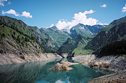
I went up on the dam building and stopped for photos before trying the tunnel at the other side, which was quite long but paved with concrete and it is also wide and lit. Just when you get out of the tunnel the rod turns to gravel and continues to another restaurant, but I stopped and turned around. Then I stopped when I came out the tunnel again looking at the road that comes out of the tunnel on this side and noticed a staircase leading down to the road. So, I took my bicycle in one hand and stepped down there. Here a single lane road wind its way up in very steep and tight serpentines to yet another tunnel ca. 75m higher.
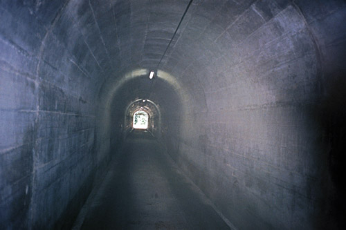
This tunnel is quite a special one. I have been down in deep mine shafts and this is the sense you get when entering here. The tunnel is not all straight, but is lit enough and with perfect pavement. This tunnel is small! I wondered how cars could really use it as it looked like it no wider than a normal car. I would guess you cannot go three bicyclists side-by-side here and it looks like two might be difficult too. It is also just high enough so you do not have to bow down. Luckily I did not meet any car in here. The sun hit me like coming up from a mine shaft (as it was) when coming back out in the sun on the other side. Unfortunately the pavement also ends here, but the gravel roa is fine enough so one could take a road bike the ca. 500m on the gently sloping road to Passo Muazz (1697m).
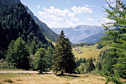
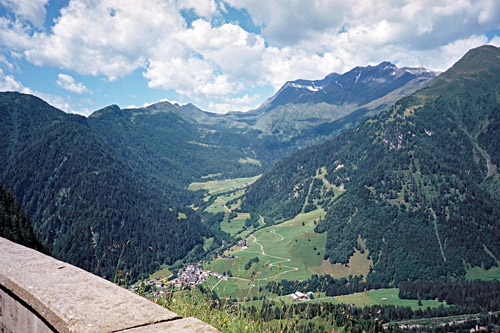
The gravel road is not perfect, but I do suggest to get down just a 100-200m more on the other side to get a view down toward Olivone and the little group of houses in Compietto on the Piano di Compietto (1570m). You can then also see that the road down there is indeed asphalted again, so one could well go down there, but it is the same way back and I did not see any point in going down there now, so I returned. (With a mountain bike it is possible to get down to Olivone here on a path.) I was more interested in the possibility of cycling up the next valley – Val di Carassino, which starts with a little dam you can see in a photo here, but the road seemed to get a little less good and again it would be the same way back as there are only paths at the end of that valley.
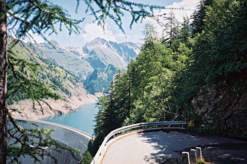
I went back again and had possibly the nicest photo of all this Summer on the steep descent to the Luzzone dam. I was soon back down at Campo and looked for a place for lunch there, but found nothing, so I continued down toward the long tunnel as I remember there was a restaurant on the way down there and I stopped there for lunch and it was fine.
Always nice to start with a descent after one has eaten, but the descent is quick and soon the climb up to Passo del Lucomagno/Cuolm Lucmagn/Lukmanierpass (1915m) started. I had thought that this climb would not be so hard, but it turned out to be quite a bit harder than I had thought, partly because I was going a bit fast and partly because it was now very hot on the way up from Olivone (951m). I passed by a lady on a road bike on this steep and hot section and later met two other cyclists on the way down from the pass, but otherwise had no more cyclists in sight this day.
After the steep section, one could possibly take a small road going straight up on the right side of the valley, but I was clear on whether this was partly gravel or not, so I stayed on the main road, which also gave me some shade. I stopped where the two roads meet up again and took a photo back toward Olivone. From here it starts to get really nice. I had remembered this pass as being rather boring without much attraction when I passed over here in 2002, but the weather was no good then and I went from north to south. Now, I thought it must be one of the nicer passes in the Alps – strange how much the impression can vary depending on the situation and weather (which is why it is always a very subjective business in rating the attractiveness of passes).
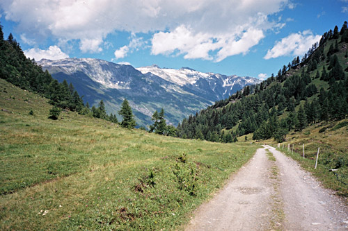
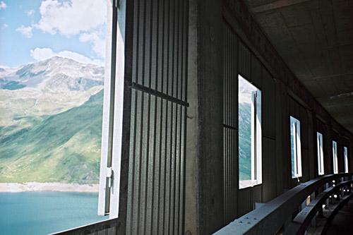
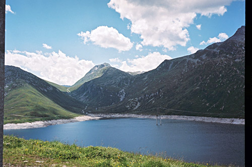
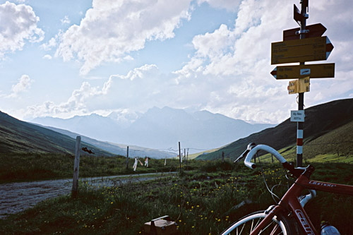
The road is quite long up here to the pass, but given the lovely weather and low gradients up here, it was just a relaxing pleasure cycling up here. I stopped for another photo and then again at the pass itself. The road continues up along the Lai da Sontga Maria to 1972m, where I stopped for photos out of the gallery windows. The second photo here looks back up Val Termine across the lake and the Passo dell’Uomo (2218m), where a bad track goes over to Lago Ritom on the other side. If that track would have been improved enough to allow for road bikes, it would have been a great alternative road up here! (Apparently it is a bit difficult using a mountain bike there too now, but maybe I give it a try another time. Here is a photo from the other side by André Rudaz.)
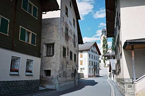
The road down the north side of the pass to Disentis/Mustér (1075m) is quite nice and would have been super to descend if it was not for the concrete pavement with regular bumps between the big blocks (just like on some other mountain roads in Switzerland like the southeast side of Nufenenpass). I guess most cyclists go full speed down here anyway, but as I am not the lightest guy and want to keep my wheels intact, I am always a bit worried when going down over drainage gullies and even minor bumps like here (you also never know if all of a sudden a worse bump is upcoming and then it would be too late to brake). I went down in somewhat good speed anyway, but also stopped for a photos along the way and there were roadwork at the bottom. There is then a short little climb up to the village at 1142m, where I stopped at the café Goldmann for a coffee and pastry (inside).
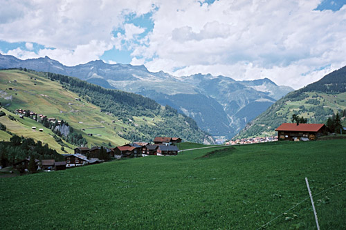
I continued down the main road from Oberalppass/Alpsu/Cuolm d’Ursera (2044m) and even here there is long passages on concrete pavement. I stopped again in Sumvitg (1044m) for a yoghurt and coca-cola and ha a photo of the nice village. On the way down the Surselva valley, I had to make up my mind about what to do next. It was already getting a bit late, but not too late for another climb. I had more or less made up my mind to go straight ahead to gain time and focus on the only asphalt roads ahead. I had originally planned to turn of and go up to Obersaxen and then follow the high road around the mountain (up and down and up) to Vella in Lumnezia and then up to a partly gravel road pass at Alp Nova that I found out from a website about the history of Obersaxen that it was called Nallpass, when it was used more frequently back in old days.
But, now it was nice enough going down to Ilanz (698m) and I better get going, I thought. Besides, I doubted that I would manage to get up to the pass this evening and be back down to find lodging successfully. As I arrived in Ilanz and looked up the valley, I thought that it could not possibly be any fun in just going ahead on the busy and boring road to Chur and where would I stop for the night there which could be a good place. Anyway, I thought that I had looked into this Nallpass enough beforehand so that it felt like a major betrayal of my original plan not to go there. I could cheat later on, but not here! So I turned off in Ilanz and started the climb on the somewhat steep, but wide road up Luminezia. The road was busy with car drivers going home from work, so I had as much traffic here as on the main road, which was a bit irritating and then there was roadwork. But, later on the roadwork had been finished and the road is really in splendid quality up here and a delight to descend.
The climbing comes to a stop when one reaches Vella (1244m) and it is not always steep up there. One could turn off in Vella and go to Nallpass/Alp Nova (2074m), but it did not look too fun and there should be a steeper later alternative road up there, so I went ahead to Vattis (Surval) (1252m) where one could also go up (but I was not totally sure it would be asphalted all the way, but think it is) and it was too similar to the Vella climb, so I continued to Vignogn (1263m), where I took the short-cut road so I did not have to descend to the village centre at 1239m to climb back up (do as you like).
Now this road turned out to be the one to take. It is a quite steep road with much nicer scenery then if you went up from Vella (as I understood on the way down, I must say). (There is yet another alternative road up from Lumbrein (1400m), but think it is partly gravel and not very clever alternative as one has to descend back to the road from Vignogn a hundred metres down.) At 1721m you meet the road coming up from Vella and get a look down that side for the first time. The road continues nicely and steeply up the mountain and at ca. 1940m the asphalt ends (the Swiss maps suggests at 1935m, but I think it was asphalted slightly longer). The gravel road that continues is quite good and soon you arrive at Alp Sezner (1990m), where there were cows and I think I had to wait for some of them to pass here.
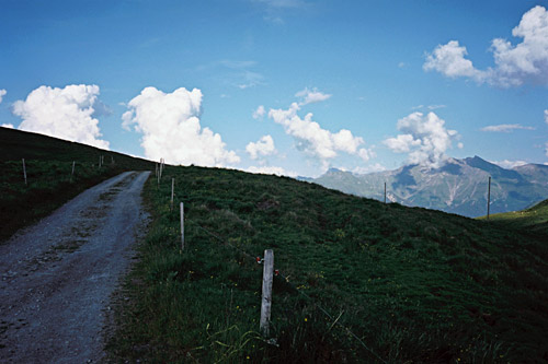
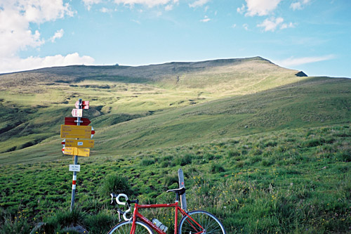
The road is slightly bad around this alp, but goes back to similar quality as before again and then it is easier as it becomes less steep for the last stretch to the pass. The road goes to 2080m, before a little dip to the pass itself. There are great views from the pass and a little gravel road goes down to Alp Naul (maybe related to the Nallpass name). From there one could probably walk down the grassy track to Alp Prada (1971m), from where I believe you can bicycle again with a road bike down to asphalt above Obersaxen. I did turn around instead.
There were people up at most of the alps and even at Alp Nova. Also many people go up to Summer houses in Luminezia. There are great views on the descent and better the higher up one is. At the crossroad for Vella I started to go down to Vella to explore that road, but it was so relatively uninteresting, that I turned around and went back the same way I came and I also hoped that I could find a place to stay at for the night in Vignogn or possibly a place in Vattis that I had noticed on the way here. Unfortunately I found no lodging in Vignogn and the place in Vattis was not open even if there were people there. I heard that I would be able to find a hotel in Vella, although it did not look to interesting to me I went there to see. I found an open hotel in Vella up a road at the upper part of the village. I asked for the price and a girl said 75 SFr, which I thought was a little steep up on the mountain like this. Then came a man who told me the price was 80 SFr. Both the place and the man did make a rather bad impression on me and in combination with a relatively steep price I went ahead. (I could absolutely not recommend this place.)
I noticed a sign for another place to stay at in Vella but it did not seem open and I reluctantly continued down to Cumbel (1138m), but could not find any place for lodging here either. So, I descended to back to Ilanz (698m), which was quick. After fooling around a little in the old city centre, I got advise to ask down in the centre of the town where I had arrived before. A big hotel with good prices seemed fine and I went there to ask for a room, but they were fully booked. I heard there was one more hotel to ask at and went there. This second hotel seemed like the nicest so far, but a helpful lady there told me it was also fully booked and that it might be difficult to find any place to stay at nearby. She explained carefully where along the road to Chur where I could possibly find lodging. I told her I knew there was a hotel in Versam along the alternative road to Chur, but she had a better idea of a closer laying place (as it was starting to get late now). She told me to go to Schluein (next village along the main road) and turn of to Sagogn, where there should be lodging by a golf course there.
That sounded expensive to me, but I thought I better go there and have a look. I saw the golf course and the house by it and went there, but there was no evidence they had any lodging, so guessed I must have misunderstood this and that it was nearby. In Sagogn I saw a nice old big hotel, but soon noticed it was closed (and the lady had said she was not sure it was open). I asked a man there and he pointed to yet another little hotel, but we determined it looked closed as well and he suggested I go to Laax. From Sagogn (779m) there is a quite steep little road up to the main road (942m), from where it is easy going to Laax. I took the first road into Laax (1016m) and asked the first lady I saw there if she knew where there was lodging in Laax. She pointed me up the road and said there would be no problem getting a room there.
I went up there and had a room, got a shower and went down to eat. Then it turned out the lady I had asked was together with the man at the hotel, so that’s why she knew it would be no problem getting a bed there. It was an all right place and I had something eat and a beer sitting outside. This had been a very successful day!!
