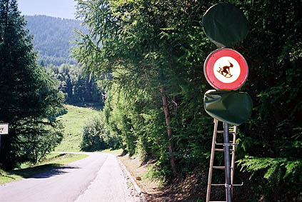
Breakfast and then away a little late since I had to wait for fresh bread to turn up, but the place at Plan-Cernet 1340 m was good. It is always nice to start the day with sunny weather and perfect temperature and an exciting downhill road. I had to by an extra film roll and then continued to Saxon 466 m. From Saxon a small road goes up the mountainside. It is easy to find – just go into the centre of the village and proceed straight until the road starts to climb in somewhat steep serpentines. You should go to Sapinhaut and Pas du Lin (as it is spelled on all signs).
The road is pleasant, but totally devoid of any flat stretch. You cycle up among apricot trees and I felt a bit tempted to have some (no one was selling apricots here, though they sold apricots approximately every 2 km of the way along the main road down in the valley). It was quite hot for some time, but it got more agreeable near the top of the pass. It is a longer climb than one might think and is comparable to most of the big climb in the Alps. Pas du Lein 1658 m is a 1200 m climb and steeper than most famous Alp passes.
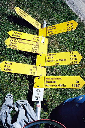
I had forgotten that I had read somewhere that some of the three cols up there should be unsurfaced. Just a few hundred metres before the Pas du Lein, the gravel road starts. The gravel road is, however, never problematic with a road bike (unless perhaps if it is raining). The col sign was lying on the ground, but thought it had a lot of interesting facts on it and took a photo.
The road is gravelled to Col du Tronc 1606 m and Col des Planches 1411 m. It is very nice up here and it is obviously a recreational area for people living around Martigny and elsewhere. Col des Planches is a tarmacced pass as the road coming up from Martigny and that goes over and down to Sembrancher is totally surfaced.
I had another photo on the way down to Sembrancher 714 m in the direction of Col du Grand St. Bernard. I felt the time was beginning to run away from me again. I was a bit nervous since I was totally determined to go over a difficult crossing this day – Grand Col Ferret. I kept a good speed up the Val Ferret (it is called the same on the Italian side).
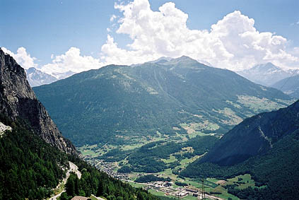
It is a very impressive valley and the mountains of the northern part of the Mont Blanc range is on your right side. They look much higher than the mountains in most other valleys and they are also much above 3000 metres. I was looking after a place to have a late lunch and finally stopped at the next to last village, La Fouly, up the valley. I spent my last Swiss francs and asked the girl at the place whether she would think it would be possible to get over to Italy this day. I was thinking maybe she knew something about the weather forecast that was of interest, but she thought it should not be a problem (even though she threw an eye on her watch).
It was now 15 in the afternoon and I had read that it should take approximately 5 hours from Ferret on the Swiss side to Pré de Bard on the Italian side in the very interesting Rough-Stuff Cycling in the Alps by Fred Wright (sold via OCD in England). This would mean that I would be over to a road (possibly cyclable gravel road) around eight in the evening and then probably had to go down to Courmayeur at least to find shelter for the night.
I was determined to cycle as far as possible and the road was tarmacced up to Les Ars 1800 m, where one has to cross the river on a gravel road that winds up the mountainside very steeply. I had to walk through three difficult bends, but could cycle all the rest of the way to the last farm, La Peule 2071 m (as per the Michelin map).
Here the path began. I put on my shoe covers that I have modified with a sturdy sole and then I have Look cleat covers (Kool Covers) that one has to keep looking for so they do not fall off. I still wish to find a better solution without resorting to MTB shoes and spd cleats, which I do not like. No one has managed to come up with any other solution around the globe (including me) to my surprise. Tell me if you have an idea! If you recommend having some extra shoes with, they have to be easy to walk in on mountain paths and not weigh more than 150 grams! If you can come up with a durable solution, I would probably be prepared to pay a lot for it!!! (And I guess others would be interested too.)
The path is also quite steep at first and I got even more exhausted here than on cycling up the steep gravel road. There are sometimes choices of paths, but I stuck to the main path and the longest alternative almost always, as the shortcuts usually are steeper and more difficult with a bicycle and might even lead somewhere else. There was only one place where it was a little dangerous on the way up. Otherwise the main problem was that it took some time, was exhausting and that there were several snow fields to cross later on. It begun without any problem, but I was rather hurried as there seemed to be less good weather in the vicinity of the Col du Grand St. Bernard.
I saw some MTBers coming behind me, but they never caught up with me (maybe they turned around). The closer the pass I came the fewer people I met and the worse the weather got and I began to hear thunder in the distance (and you know how that usually ends …).
I asked the last two guys I met on the way to the top about the possibilities of getting down to Italy with my bicycle, since I knew it should be very steep on Italian side and it would probably be totally impossible if rain came (or thunder and rain). They told me that I could as well turn around at once since at least one of them were certain I would not get down there alive. I said that I had heard mountainbikers to get up from that side (I had seen a photo of mountainbikers carrying up bicycles taken apart and hanging around them on a photo on the web). Well, they still did not think I could succeed but wished me luck and had no consolation to offer regarding the weather. I did not want to turn around and thought I should at least have a look for myself and thought I could probably get back even if worse came to worst.
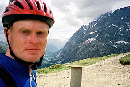
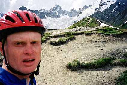
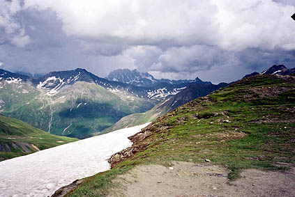
I hurried on (no time to loose now) and coming the pass height, the bad weather was really close and I very hastily took the four photos here in four directions. You can see both that I am looking tired and stressed. You can see the marvellous valley in Italy behind me and the frightening clouds toward Col du Grand St. Bernard. You can also see in the last photo that it is rather steep down to Pré de Bard below, but the photo does no justice to the actual steepness – the path you see below is not the one you will come to, but it is a much steeper path going down just below and it is almost never possible to see it long ahead before getting most of the way down.
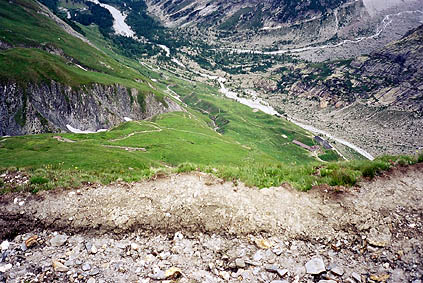
I met another man coming up and was somewhat relieved and asked him if I was taking the right way (it is the obvious one going left at first). I began to make my way very, very carefully down the path. I had to tell myself to be in full focus and concentrate hard on every move I made and never hurry. It is mostly around 30% steep and of similar quality to most mountain paths. It is no doubt easier and safer going up, but it turned out to be possible to get down and I even mostly led or had the cycle on my side. I had to lift it almost everywhere, but since I am not used to carry the cycle on me I did not dare to try and do that.
From Pré de Bard 2062 m a rough gravel road starts down the Italian Val Ferret. It is just about cyclable on a road bike, with care, slowly. The rain was in the air and I really escaped it very narrowly. I looked at the time and it had actually not taken me more than 1 hour and 35 minutes from cycling to cycling (I still feel a bit unsure whether I am telling the truth here, but it was roughly 1,5 hour as I remembered it. 1 hour up to the pass and 30 minutes down approximately. So the 5 hours of walking turned out to be very inaccurate for me on this pass. I suspected it would not take more than 3 hours for me, but half the time of that I had never thought of.
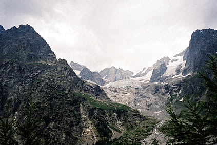
It took some time before I could start to cycle faster down the Italian valley though. After nearly driving into a thin rope across the road for cattle (a farmer waved at me and I understood what he meant at the very last time), the road was fine. The scenery along the road down made it hard to look at the road. I stopped at one place to take a photo up the Grandes Jorasses.
I was very happy to have made this pass so relatively easy. I could not help myself: coming up on the side of a man walking down the road from Pré de Bard I said, ”Hello, you should have taken the bicycle instead!” He took it the right way. I swished down the valley victoriously to Courmayeur and was much amazed by the views up there. I surely understood there must be very good views near the Mont Blanc massive, but I was still impressed.
After Courmayeur I wondered what to do with the extra time I got – maybe it was just to get ahead over to France as I had planned via Morgex and Colle San Carlo and Col du Petit St. Bernard? I would have continued over Colle San Carlo to La Thuile if it had been good weather, but it started raining soon after Courmayeur and I went into Morgex and was there before 19 pm so the shops were still open even. I had a sandwich in a very good little grocery shop. I sat eating and waiting to see what would happen with the weather. However, it just started to rain more and more. Soon I had no other choice than finding a place for the night and asked at a very nice candy shop where I bought a gift for my parents and some candy for myself. They suggested the only hotel in town (there was apparently one soon after the town also).
It was a somewhat old-looking hotel in all ways, but those I like best and I had dinner in the hotel as I could get dinner and room for 45 euro, which is reasonable. I never went out more that evening as it rained too much.
Day 1 – Day 2 – Day 3 – Day 4 – Day 5 – Day 6 – Day 7 – Day 8 – Day 9 – Day 10 – Day 11 – Day 12 – Day 13 – Day 14 – Day 15 – Day 16 – Day 17 – Day 18 – Day 19 – Next Day – Day 21 – Day 22 – Day 23