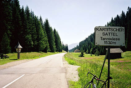
Perfect weather in the morning, good breakfast and it is very beautiful in this region. That made for a perfect start of the day. A smooth slightly sloping road into Austria also gave me a gentle start. A few kilometres into Austria (in Tassenbach 1072 m) a road turns off toward Gailtal. This climbs with moderate steepness up to Kartitsch (where I stopped to send off some postcards written on the train to Milano).
Just after Kartitsch, the Kartitscher Sattel 1529 m is easily reached. Then it was down the wonderful Gailtal valley to Obertilliach, where I stopped for some snacks and a soda. From here I was going to go over a newly (partly) rebuilt old road over the Tilliacher Joch and into Italy. The tarmac ends at the low point (1342 m) below Obertilliach and here a decent gravel road starts. It was slightly muddy in places (the reason for this was that many lorries were going back and forth and drove into the little river). Later, I was presented with a choice of roads at a small lake, and I was not totally clear on which to take, but stopped a car and asked. You should go left here (I believe). Here the roads starts to get slightly less good but was no big problem for me on the road bike still.
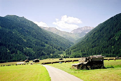
After several hairpins I eventually reached the Neue Porzehütte (1942 m). From here a newly prepared road continues to the pass and the main problem here was that it was rather loose, but was just about rideable (with some effort) up to near the pass where there is suddenly a gate that ends the road. Here a wide walking path (also newly serviced) continues, but it was too steep and difficult to be possible to cycle up on a road bike. (Down on a mountainbike should be fine, with some care. Up might be tough even on an MTB. I doubt any 4-wheel vehicles could use it, so one could not really claim that a road had been rebuilt to the pass as they do.)
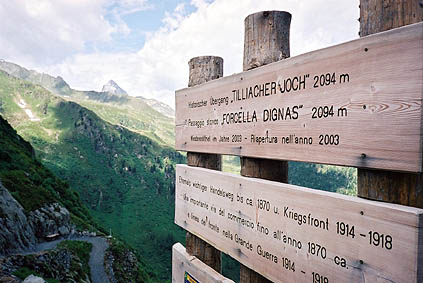
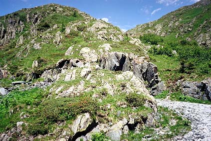
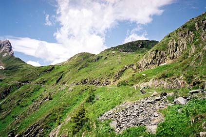
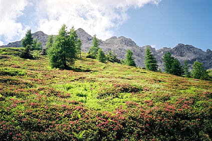
Tilliacher Joch/Forcella Dignàs 2094 m might be one of the nicest passes I visited this year. I have never seen such a variety of wild flowers up on any Alp pass before and the views from the pass were very good too. There were plenty of different signs up at the pass, but despite this, it was far from obvious how to get down on the Italian side – where was the supposed road?!? Far down below I could see a gravel road and started first at a dead end slightly to the left and then walked straight down the slope to meet the road (not very difficult). Apparently I should have gone to the right at the pass, even though that looked the least likely when I was up there. I took two photos back up to document that the road actually went up or almost up to the pass on the Italian side too.
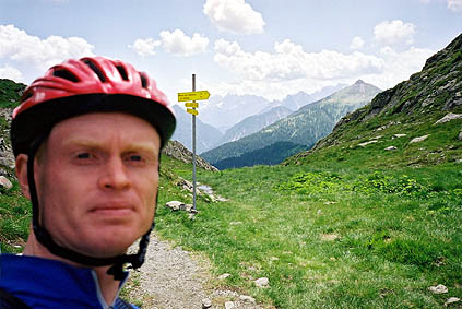
The problem on the Italian side was that it was certainly not serviced since World War I at least. But there remained some evidence that it in fact had been a well-built road once upon a time. I practically had to walk down the whole length of the road until it met another road when it first became good and then soon again very bad, but only for a short stretch. (Walking was approximately needed for 3 km.) Soon thereafter it was tarmacced all the way down. It was in fact so bad early on that most MTBers would likely find it very hard going (I met some lower down, wondering where I came from, I suppose).
The last stretch down to the road that goes up to Sappada was very varied and some care should be taken at one or two places (some traffic also). It seems like there was a popular vacation area on the way down here at a very open flat green area.
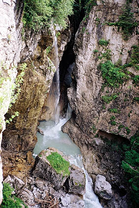
The main road up to Sappada had almost less traffic than the small dead-end road I came from (maybe it was just on this occasion). This road to Cima Sappada is a very nice road and it passes a waterfall (photo). The Cima Sappada and Mühlbach villages are very tourist oriented, but business seemed to be bad (probably too early in the Summer). But it was something I saw at many attractive not so big winter resorts all around the Alps – that they tried to sell houses, hotels and everything else. It seems like business is not as good as it might have been earlier outside of the well-known resorts. This however is having both advantages and disadvantages for the tourist: better prices, more interest in tourists, some breathing space from (other) tourists, less accommodation, fewer open shops.
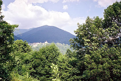
I had a sandwich and a double espresso at Cima Sappada, and then an ice cream to go at another place. I crossed the Valico di Cima Sappada 1276 m and rolled down on a road with shifting quality. Somewhere after Rigolato I was looking for a possible alternative road on the right hand side (I think there is one higher up too) and turned up a road called ’Strada Turistico’. It turned out to be a very steep road and took me up a few hundred meters of height, I believe. The last photo on this page was taken soon after the high point of the road. The photo shows Tuális on the other side of the valley, where I was heading. I recommend this alternative road
After a long and seemingly steeper descent on the very narrow road I reached the main road again at around 560 m above sea level. Here I went across the road and up to Tuális, which is on the way to another and more impressive touristic route – the Panoramica delle Vette. Panoramica delle Vette is a high mountain road that reaches 1967 m after a relentless climb via Tuális. The inclination is usually somewhere between 12-18% and there is no flat stretch. I think it is on average around 11% for the 1400 meters of height, but I do not know.
It was perfect weather at start, but just when I came out of the woods I heard some thunder far away and knew that this would probably not work out all right as it almost never does when you can hear thunder in the mountains. I hope for a while that it was not coming my way, but I was amusingly wrong in this naive hope. It was also going to be a gravel road after the top (so I had heard anyway). The rain started when I was 150 meter from the highest point, but I could not go there because I was almost literally driven off the mountain.
I was trying to hurry down, but I hardly came longer than the first hairpin bend before the sky opened and I got a heavy sustained rain and somewhat big ice cubes coming down on me almost destroying the helmet it sounded like. The road turned into a river and the rain was like a high waterfall splashing down on me constantly for the whole stretch down to Tuális. After just a hairpin bend or two, I noticed that my brakes did not want to help stop the bicycle. I slowed down and had to use all my strength to pull the brake levers, still it happened that the speed just went up. I got scared the first time it happened and thought I just have to make sure I do not let the speed go too high, but then it happened again and I was afraid the wires would break (no chance) or the brake pads slide of the rims (they did to some degree) and I prepared myself to jump off the bicycle in full speed. I took one hairpin bend in maximum speed (not high, maybe 25 km/h, but felt like it was 80 km/h) and loosened one foot and was just about to lay myself down on the side when I suddenly got a grip on my last trial again. After that I never went above 5 km/h for the whole way down below Tuális.
I have never been as tired in my hands as after this downhill ride and despite having put new water resistant wax spray on my wind/rain jacket, I was nearly totally soaked.
For some reason I thought I had heard somewhere that the place to stay at in Comeglians should not be good, so I therefore went on to Ovaro, but learned that the nearest place to spend the night was in Comeglians. I tried at yet another little village on the other side of the river that had a sign for a small hotel, but it was closed. So I had to go back to Comeglians after all. Now it had stopped raining, but I was not in the mood of going anywhere else this evening. The hotel was actually quite suitable to me considering how I looked. It is a quite rustic place. I had a dinner there conversing with some other guests who confirmed my suspicion that there were no place else to eat in this village or sleep, for that matter.
Day 1 – Day 2 – Day 3 – Day 4 – Day 5 – Day 6 – Day 7 – Day 8 – Next Day – Day 10 – Day 11 – Day 12 – Day 13 – Day 14 – Day 15 – Day 16 – Day 17 – Day 18 – Day 19 – Day 20 – Day 21 – Day 22 – Day 23