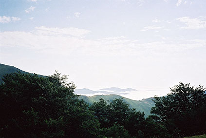
I managed to get some kind of breakfast at the restaurant, but got some bread that was almost too hard to eat. There was however nice views in the morning from the restaurant. I went down a few hundred metres to the east to visit another nearby pass – Col d'Orgambidesca (1284) – where the first photo was taken of the oceans of clouds below. The landscape looked like small islands out on the sea and I was happy to be above the clouds.
I went back west the way I had arrived here yesterday, but went up a side road at nearby Col Heguichouria (1319). This road is paved but steep at first. If one continues this road one would eventually come to the road I came into France in the late evening before. I was however trying to escape the unpaved part and only to visit the several passes around the highest point on the road: Col Mehatze (1383); Col Ilharre Murru (1465a); Col Sensibile (1547); Leherra Murkhuillako Lepoua (1528). I took a photo on the road continuing down at the last of these cols and it looked paved as far as I could se, so it seems it is more paved than what I had heard from earlier reports. I turned around here and took another ”cloud ocean” photo from around the highest point at Col Sensibile.
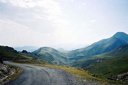
This was rather easy pass collecting and the road was also worthwhile as it was indeed very nice up here. Going up to Col Sensibile from the valleys far below would be very hard though! (It is one of the harder passes in the Pyrenées if taking one of the more difficult approaches there from the north.)
I soon came down to the crossroads I came to yesterday at Iratyko Etchola (1000) and took another detour to the nearby classic pass – Col de Burdincurutcheta/Burdinkurutz (1135). I felt a bit like cheating when climbing these passes from the very much more easy side, but there are often nice views from many of these passes and this one was no exception (had another photo there). Then I returned to the crossroads to get out of the area finally via the western road over Col de Sourzay (1135); Col d'Irau (1008); Col d'Asqueta (986); and Col d'Arthe (937). I also visited one more side road col Col d'Oyhanbeltze (895), which is on a rather odd small road that goes very much up and down but totally straight on a ridge, very near deep valleys on three sides.
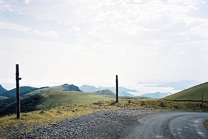
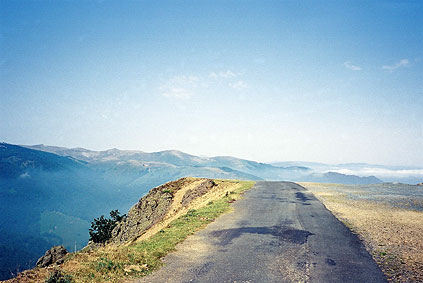
The wonderful photo of a road seemingly going out straight into space was taken soon after the last of these passes, Col d'Arthe. It was in fact almost as it looks as the road down there was terribly steep and narrow. The roads above was often steep here and there also and there is very little shade up on these mountains. (There are even more side roads that could be explored here in this area. I skipped at least two more paved road passes.)
After coming down the terribly steep road I had not been happy climbing this day in the heat (maybe it was 14% on average), I came down to a small village soon after turning toward southwest again. Here there was a Logis de France and I decided to have a real french lunch to escape the heat outside for some time. Sure enough, it took time to get the whole lunch and it was not cheap either, but it was a nice place and the food and wine was good.
Then, more than an hour later, I started much less happily the climb up to Col d'Arnosteguy (1236). I knew beforehand that in the heat and the steepness ahead it would not be easy. This is nonetheless the easy side up to Col d'Arnosteguy as there is only 10-12% slopes to conquer. The way up to Col d'Arnosteguy from Arnéguy that I went down later, would probably have proven too much for me this day (and I guess most mortals otherwise as well). The climb gets easier when you get out of the woods, but then it is totally exposed to the blazing sun instead. The water was hot and I had to drink very little to make it last.
I visited one col not far from the main road – Col d'Orgambide (988), from where a concrete road (a bit odd with concrete up on a totally flat road in this region – maybe built for the military invasion of France! ;-)) goes over to Spain (this road is not marked as a road on any map!)
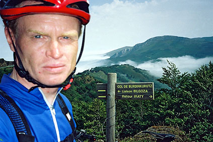
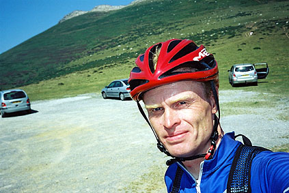
After a long and sometimes nice slog up to Col d'Arnosteguy I took a photo at the parking site, very tired (as you see). One could walk over on a path to Spain and Puerto de Ibañeta [1057) from here, and I am not actually sure it was faster taking the main road as I did. However, still my plan was not getting up to Puerto de Ibañeta. I had thought to get over to the Aldudes valley across a possible gravel crossing I had seen on a map. However down at Arnéguy I rejected that idea as implausible and decided to get up to Puerto de Ibañeta and cross over to France again via Col de Lindus from there.
The road down to Arnéguy from Col d'Arnosteguy first passes two cols, Col d'Elhursaro (1152) and Col Heganzo (1065), and then goes very irregularly steep down. Sometimes the road is much steeper than 20% and I am not sure I can think of a more terrible road to climb – this must be one of the most horrible roads anywhere to climb in sunny weather in a race (I doubt anyone has been crazy enough to try and arrange a race on this road though). (I saw a tiny road taking off from this, but had to bend over the side of the road to see it as it was that steep! Not very cycling friendly … .)
I stopped shortly in Arnéguy and then went up in a regular speed on a somewhat high gear all the way to Puerto de Ibañeta, which is a somewhat long road that I went down in 2001 and remembered it was a delight to descend this side. However, the surface was less smooth now.
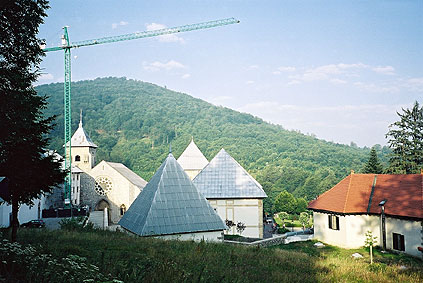
At Puerto de Ibañeta I now had more moderate temperatures. I had heard there should be road over to Col de Lindus from this pass and I started out on a steep road up from the pass to the west (there is a famous steep road to the east also). This road ended soon and abruptly and two workers suggested the path ahead was not very intelligent to use, so I returned and looked for other possible roads over lower down, knowing there should be some kind of track over from Burguete at least. After trying out another rod that only went to a private house, I took a road leading off in the right direction from Burguete (had a photo of the monastery in Roncesvalles just above Burguete).
I had to ask someone about the way to Col de Lindus (1166) as it was far from clear on the map I saw at Burguete, which road to take here. I got advised to take one that traversed a nearby watershed, but it was concrete here so no problem cycling through the water, but later there were other bridgeless crossing across small streams, just about negotiable with 4-wheel vehicles on a gravel road (had to carry my bicycle over ca. 2 times). Eventually I came to a place where the road/track went up the hillside and I managed to cycle all the way up there to a grassy field where I was met with clouds. I could not see any road up there and got worried as I should have been at the right place and as I know there should be a paved road coming up to the border just at Col de Lindus. There was only some horses and a cattle fence marking the border.
I started to walk to the left/west and found the road/track (not cyclable any longer) again and followed it for some time to another posible crossing, but I could only see at most 100 metres away in the clouds a could not understand where the road on the other side was. I continued and eventually kept following the cattle fence and a tractor path that got increasingly more faint. At one point I understood I must have been going in the wrong direction and started on my way back again, but then got second thoughts and decided I should try and get over yet another hill to see if the view cleared up or if I encountered something. What I encountered was the end of the fence and any track.
Now I was a bit worried as it started to get late, but I counted on that I would always be able to find my way back to Burguete if nothing else, but I really wanted to get over here this evening and there was no obvious way down the french side that I had encountered (only one path that did not seem right). I hurried a bit back, but it took some time as I had walked for some kilometres – according to Navarra online maps it seems like I was visiting these passes: Uztarketako Lepoa (1112) and Kurutxispileko Lepoa/Mendiaundilepoa (1139) (but I am not certain). I came back to where I had entered the grassy field and where I had taken for granted that the crossing to France was, but now decided to try and go down to the track and follow it in the other direction up there (as was possible and it was mostly cyclable this way too). Just before I was thinking to return to escape the dark I noticed a road on the other side in the clouds less than 50 metres on the other side of the fence and just jumped over the fence with my bicycle, not thinking twice about seeing where the paved road ended I took off downhill as fast as I could to try and get as far down as possible before darkness would fall.
I believe I was very close to Col de Lindus. I later passed by a lonely farm where a woman stood sprinkling water over her flowers outside the house in the almost dark and I guess she wondered what crazy cyclist came down there at this hour. Not far afterwards I got a puncture and it was now almost totally dark and I had a little trouble finding my things while fixing the puncture as fast as I could. I guess this might have been nice to cycle on in daylight without clouds. After a little longer I came to a crossroad at Col d'Hauzay (965) (I should have passed Col de Burdincurutcheta (1092) somewhere up there also). Thankfully I had studied the maps carefully enough to know which road surely would be paved all the way down. However, many roads in this area has been paved very recently and thus maybe some of the two other road choices might actually have been a better choice down, but as I had no way to know, I had to take the one down to Banca I knew would be paved.
Now it was a bit steeper down into the woods and there the road got worse and the darkness got compact with no sign of any guiding moonlight. For a while I managed to sort of guess where the road was, but could not avoid any bumps (and there were some!). I was hoping to get down to some houses to ask how far it was to Banca and was hoping to find a place to stop for the night before all places would be closed. After a while of having to go very slowly and sort feel the road with one shoe in order not to drive right out in the woods, I found the first house with lights on. I just had to stop and ask how far it was to Banca (next village). They were a bit surprised about me and told me from a window it was only 5 more kilometres. I thanked and continued. After a little while a car came from behind – they had come after me to help me get down securely to Banca (which was still quite some distance to go to I noticed while sitting in the car and the road down there was very bumpy). I was very thankful and they drove me all the way to the little hotel in Banca where the nice man was still awoke and happy to have me for the night. I thanked the lady and her daughter who drove me down there and went to bed (may I got a sandwich before, I think so).
Day 1 – Day 2 – Day 3 – Day 4 – Day 5 – Day 6 – Day 7 – Day 8 – Day 9 – Day 10 – Day 11 – Day 12 – Day 13 – Day 14 – Next Day – Day 16 – Day 17 – Day 18 – Day 19 – Day 20 – Day 21 – Day 22 – Day 23 – Day 24 – Day 25 – Day 26 – Day 27