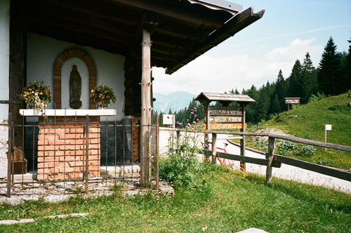
The climb from Ampezzo (560m) to Passo del Pura (1428m) is a true Alps pass road of the best variety – lovely serpentines steeply climbing up a mountain with views every now and then and this should be a somewhat warm climb most of the time as it is on the very south side of the Alps, with only minor passes down south. It is fascinating to think of that people in the area of Sáuris used back in previous centuries to travel over this pass during the Winter to trade with people outside their very isolated valley (which is a German-speaking enclave, though most seem to speak Italian there these days). The travel must have been done over more than a day. The surface is fine. I am sitting on a bench taking the photo here.
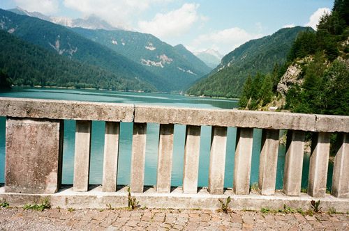
There should be a steep kilometre of alternative road up here at the pass, but I never understood (nor explored) which road this could be. The way down to Lago di Sáuris is wooded and not so interesting. The end of the road is a bit of a surprise however, with a very narrow road through tunnels with cobblestones, but here it is flat by the lake. The next photo is taken at the bridge over to the regular road (I guess this was built later) up from Ampezzo through the gorge.
Soon the main road up to Sáuris di Sotto and Sáuris di Sopra starts to climb again. I had originally planned to do much more in the area, like climbing up Forca Frumeibn (1408m) from Lago di Sáuris/La Máina and then try and see if I could climb up with the road bike on the last unsurfaced stretch to Forcella Ielma (1902m) and/or Forcella Pièltinis (1881m) – the connecting road from these down to Sáuris di Sopra should be a bit too rough for a road bike, so the plan was to go back to La Máina and then up on the asphalted road, but decided to save it for another journey! There are some other interesting roads in the area too – many very unknown to cyclists (apart from locals perhaps). You clearly do not meet many cyclists around here though!
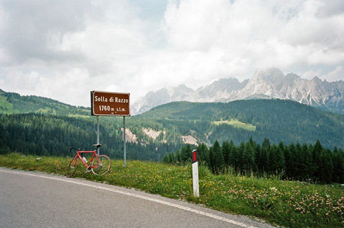
I stopped by a grocery in Sáuris di Sotto where I talked a bit with a local (Italian-speaking man) while having a yoghurt, banana and coke. He said the road up to ‘Casera Razzo’ (which is what locals refer to as the pass) was very steep toward the end, but that I of course already knew having seen the profile at salite.ch. Seeing this profile was also the first confirmation I found of this road having been surfaced. I also noted on a motorcycle webpage that they claimed it had been asphalted from Sáuris di Sopra to the top in 2004. This is thus one of the newest paved passes in the Alps above 1700 m and thus on my list of all these pass climbs.
This road is a bit steep toward the end but on the whole it is not very steep. It is a nice road and one could understand there were considerable problems in turning this road into a road that would stay in good conditions as the mountains are very prone to erosion, it seems like. I think they had dynamited a lot of the mountainside in order to make the road survive longer. There is actually an alternative road up this stretch, but I do not believe it is fully asphalted, but is suggested for mountainbikes (I think). It is a very unusual pass road on the whole from Ampezzo to the top, which is actually a pass in itself – namely Sella di Rioda (1800m), which is noted on the Tabacco map as being 90 degrees off the road just besides it at the top. I saw a gravel road going off there and we could say the the real pass is 2m from the road, but I think it makes more sense to say it is the pass you reach when you climb this road! The local man had never thought of it and was a bit puzzled and mumbled that it is “going off there … ”. Of course they do not think of it as a pass as they usually have no business going down that gravel road when arriving up here, but instead goes over the road to Vigo/Laggio di Cadore (944m) via the Sella Ciampigotto/Valico di Cima Ciampigòtto (1790m) or simply down the valley of Pesariis. The odd thing is that the road sign for the Sella di Razzo (1760m) pass is placed on the road from Laggio to Pesariis and there is no pass sign on the road from Ampezzo to Pesariis, which is not exactly in accordance with how things are in reality. Thus there are confusions surrounding this pass and typically the Sella di Rioda pass is taken as being the Razzo pass (as I understand it). I pass over the Ciampigotto pass in year 2000 on my first tour of the Alps and never saw any Razzo sign on the road and thus always thought it was on the road down to Sáuris and I had even read about this being so, but maybe the Razzo sign is new (it looked suspiciously new). In logic it should be after the Rioda pass just before entering the Ciampigotto pass road just as it is on the Michelin map (one could also argue that the real pass is actually at the Casera Razzo on a gravel road). Where it stands now one could claim it actually confuses this pass with the lower Forcella Lavardêt (1541m) pass that takes one into the valley “straight across”.
When descending to the Pesariis valley one comes after a little while to an asphalted road going over the Forcella Lavardêt (1541m) pass. This pass is often shown at the main road but it is actually located where the asphalt ends (200m away) on the road taking off here down to Campolongo to the north. This road has been damaged since decades back and might never be asphalted again. It is unrideable with a road bike for several kilometres and thus I did not try it out (a motorcyclist at the pass confirmed this to me). If that road had been paved I would probably have taken this over to Sappada in order to climb up the Passo di Col Caneva (1844m) which is the pass with least gravel above 1700m height that I have not yet visited. There should only be gravel the last 200m to the pass and I was curious if they perhaps had asphalted that part too, which is not likely as the road goes to a mountain hut where the asphalt ends and the other side should not offer a proper road of any kind. (One could here possibly also visit (one way with a road bike) nearby Passo del Roccolo (1785m) and Passo Avanza (1734m) on gravel.)
I had wanted to do the Panoramica delle Vette road properly this time (Tuális to Sella Valcalda) and I had wanted to try and climb the gravel road to Forcella Morareeto/Morarêt (2120m) from Forni Avoltri (888m) east of Sappada. But in order to try and save a day on my scheme – if I did not tell you earlier, I noted on the way down to the Alps that I had marked two days with the same date and thus had a plan for one day more than I had thought and thus needed to cut down the plan in some way – I skipped these excursions (partly due to uncertainty about the weather also). I stopped at the only bar I could find down Val Pesariina in Prato (I think) and had a sandwich and coke. Then I took the rather uneventful passage east (as in 2000) over Sella Valcalda (959m), which is a small pass but not totally easy – only so in relation to the nearby alternative road east – the infamous Monte Zoncolan climb which counts as among the hardest in Europe with 6 kilometres above 15% on average (harder than the more famous Mortirolo/Foppa pass).
Here in Udine things comes across as more remote and people more poor than in neighboring Italian regions (esp. westward). I guess this must have some historical reasons to it, but it feels like one is distinctly taking a step toward the eastern Alps here. Maybe my impression is false, but it's in the air so to speak. This is actually one of the better parts for tourism in the Alps if you want to explore really nice places without tourists. Over the Plöckenpass/Passo di Monte Croce Carnico (1357m) some tourists does travel however, but it is much less used to more western crossings. With the opening up of former Yugoslavia, there are increasing traffic down to the coastal areas of Croatia through the Eastern Alps, but such tourists usually avoid the higher crossings. Plöckenpass comes across as a proper Alps pass despite not being so high. It is a bit bleak and remote, but overall a moderately nice climb. Here I saw a few cyclists.
I just escaped rain on my way over Plöckenpass, but it started just as I arrived at Mauthen, which was ok as there was an open shopping centre there where I could have a rest and buy something to eat (they even had clean public toilets here). Just as the rain sort of stopped I started out slowly again. – I do not want to get wet if I can avoid it without losing too much time, so I often go slowly when the road bed is wet if there is any hope of reaching a dry road sometime soon. Soon the weather got better again and the road is pretty flat and easy to Hermagor and beyond. A bit after Presseggersee I found a place to wash my bicycle at a strategically located place: with a long slowly rising road afterwards, so I did not have to brake while the wheels were wet! A nice lady at the place wished me luck with the next pass on my way. The next little pass is reached by turning off the main road soon afterwards north. Windische Höhe (1110m) is only a 2,5 km long climb, BUT it is often above 15%.
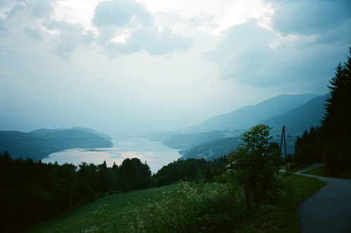
Then at a fork I took the road going straight ahead over Auf der Eben, which is a small road which offers one steep section similar to the Windische Höhe. This ought to be a pass in itself, but I know of no proper pass name for it. Then a quick downhill ride to Feistriz an der Drau. Now it was getting late, but Feistriz did not look like the most exciting place to stay at for the night, so I continued on the planned road up over Laas and via Glanz in the direction of Milstätter See and Döbriach. This was yet another good climb up the mountainside and it looked very nice at first and in theory, but up on the top it was a long wooded stretch where there was massive road work and I had to go on a very dusty gravel road for several kilometres here, which made me a bit tired. After the gravel finished I was at the end where the road was starting to drop down to the very big Millstätter See. It was getting even more late now and I saw a sign for a gasthaus and thought it was on the road (at the crossing here) going up the mountain and I started out up there and went 2-3 km before I saw a sign for a name that I thought was the gasthaus name and went down on a small road to a big house and knocked on the door and asked the guy who opened (well, the door was open and I walked in) if he was the hauswirt, but it turned out I had gone the wrong way at the crossing. It was just a farmhouse. I took a photo up here over the Millstätter See as the sun was setting and the view were really great here (last photo). The man who owned the house saw me outside and doubted I would get down to Döbriach while it was possible to see the road, but I thought I would perhaps find a room at the gasthaus which was on the main road down to Döbriach.
The gasthaus (in Glanz?) was fully booked and I hurried down to Döbriach and got down just as it turned really dark. Down there by the see there was a huge camping and several boring touristy hotels. I went through Döbriach to the other end and the last place was announcing ‘Zimmer’ and I stopped there. This lady also had a problem making up her mind as to whether she wanted me to stay and was worried the rooms were not good enough for me (what gives – do I really look like I am a wealthy tourist looking for luxury living?!?). It turned out the reason was that she had no other guests, but had many of her relatives staying for celebrating her mother’s 80th birthday, though her mother had suddenly become sick … . Anyway I stayed there and it was nice and they were happy since it was the first person from Sweden that they had ever had there.
I was recommended a nearby pizzeria and cycled down there and it was quite good.
