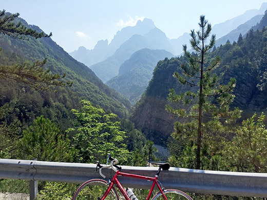
Ok, finally we get going, though I do like Italy a lot, but on we had to move. Saying goodbye a last time at Rosa dei Venti and down to Dogna. Already it was blazingly hot again outside. The Dogna valley looked very deserted apart from the occasional tourist and local and horribly hot this day. It all looks quite nice in this photo, but it was all too warm here to really enjoy the views.
I had originally planned to climb from Pietratagliata up an interesting road to Sella Monte Agar (1702m), which is asphalted to ca. 1450m height and should be a great climb that far. It has only recently been oticed by others, but I still have to do this climb. I still do not know if the remainder of the climb is possible on a road bike though and had hoped to find out and go down the other side to Sella Bieliga (1473m) and to Chiout in Valle Dogna. It was likely wise that I did not try and do that.
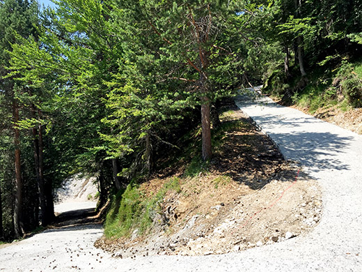
However, when arriving at Chiout (849m) or Chiut as the sign says here, I could not resist to try out the road up to Sella Bieliga (1473m) as few roads have been so hard to locate on any kind of map as this and one cannot make out much of available satellite images. It looked rather poor from the start and I expected it to turn into a gravel road rather soon, but it just continued paved but with much debris on the road for a long time and it even improves a bit, so I kept going and it was moderately steep, even though I had read somewhere that it should have some steep asphalt sections, which was not true.
Eventually the road turned to gravel, but it was easy and almost better surface than before, so I continued and then came the concrete surface that I managed to climb early on, but soon had to give up on and walked a bit further, but then it became even steeper so that walking was hard and I decided to call it a day as I was still not quite near that pass, but only like 200 height metres below. This road was almost as steep as the infamous Scanuppia/Malga Palazzo road – a bit strange that no one has noticed this yet. Anyway, it is all too steep for a road bike with the ramps where I turned around at ca. 30% constant slope (and not 18% or something like I had read, but maybe 18% on average … right).
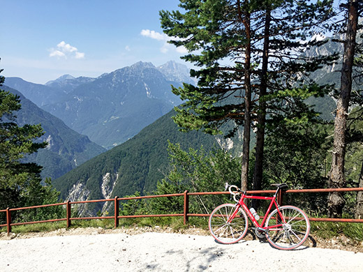
At least I got up to the only real viewpoint along this forestry road and got some nice photos there – this is just a serpentine below where I turned around (above photo) and it can be reached with a road bike from below. Probably this is at the 1150m height according to the CTR map for Friuli which shows the road accurately. Then I turned around at 1197m or so (yes, that must be correct, even though I thought I was even higher up, but as always). (Asphalt to ca. 1100m.)
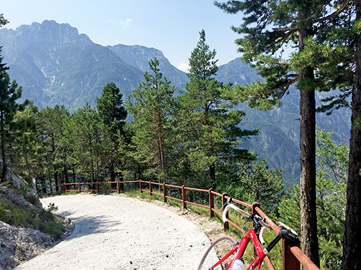
And another photo across the valley. A forestry protection car driver was passing me by looking very puzzled over how come I was up here on a road bike, but that was the only one I saw on this road.
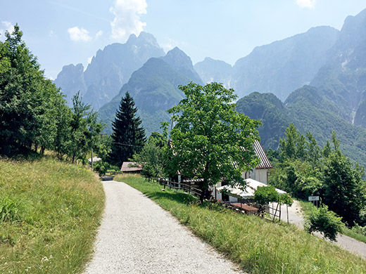
The descent to Chiout went well and I there had another photo up the valley from the Bieliga road. The main road up the valley then goes a bit up but then is flat also descends a little as it clings the side of the valley.
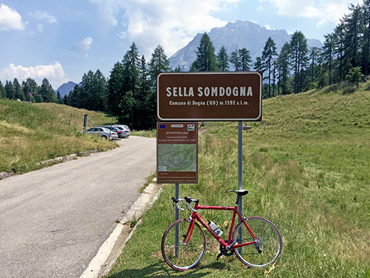
Then comes a series of wide hairpins where I had planned to take a photo, but as I got higher up I eventually lost sight of them all, so skipped it. There are then another two switchbacks before eventually reaching the pass itself, which is written Sella di Sompdogna (1392m) on maps, but the signs says Sella Somdogna and the map also mentioned the farm nearby is called Somdogna, so maybe the Sompdaogna is the wrong name after all or maybe both are correct (not sure). The pass itself is not outstanding, but it is worthwhile to try and get over to Rifugio Grego, which I thought would be easier than it was.
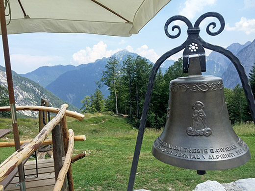
The gravel road continues steeply down and then up again as it crosses a river, but the road is decently good and I could cycle all the way to the rifugio (more or less). There could be a lot of walkers along the track here. The rifugio offers great views and also food and lodging if needed. I had some pasta here and took some photos.
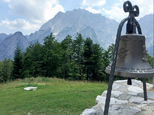
I changed shoes as I knew there would be walking ahead. I had thought to wait until I came up here to decide if I wanted to walk down the other side or go back and around on the normal road via Pontebba. Even though it was at least 45 mins of walking down the steep path and then gravel road it was still considerably faster than going back and around, so I do not regret walking down there. I had hoped to bicycle parts of the gravel road and managed to cycle a few metres, but then it got to steep and bad and then it improved and I met a mountain biker sweatily making his way up on the very wide and well-built road, but it was only good enough for a short stretch to cycle on here too. Basically I had to walk all the way down to the parking place.
I talked with a man in the bicycle shop up at Sella di Camporosso another time and he had hopes that they would complete the road from Somdogna to Malga Saisera and asphalt it for the Giro d’Italia. Although it would likely be possible to build a road there, I cannot see how it could follow the path as it is now, given how steep the path was and the steepness of the mountainside. So do not think that will happy anytime soon, but it would surely be great to have an alternative road up here for cyclists at least.
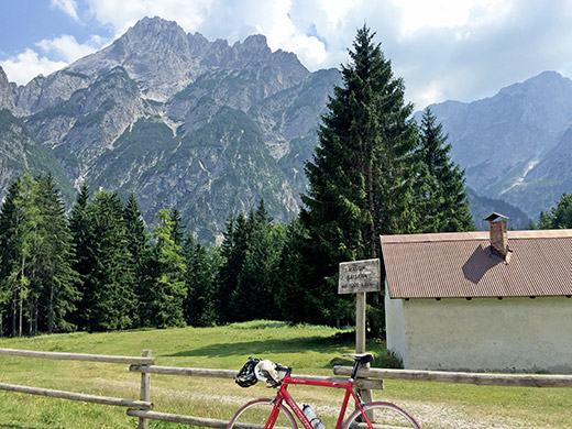
Down at the parking place, Malga Saisera (1004m), I changed shoes after taking this photo and rolled down the almost flat road in Val Saisera to Valbruna (787m) and up the little stretch to Sella di Camporosso/Saifnitzer Sattel (816m). The rolled down to Tarvisio (753m) where I stopped in the heat for an ice cream and coca-cola before proceeding down to Austria on the main road, a road that I have not used before (mostly because it is a boring alternative). Before rolling over the border it was actually quite nice in a few places and thought to take a photo, but there were a rusty fence on the side of the road making the views a little less compelling and I waited too long, so no more photos for some time now.
When getting down to the very bottom in Austria, I stopped again in Arnoldstein (564m) and had the same as usual, I believe: coca-cola and yoghurt and maybe something else. It was hot and I was not feeling all that enthusiastic about going on, but on I had to go. Originally I had planned to go up the Villacher Alpenstrasse/Rosstratte (1742m), but again I decided to skip it as I just was not in the mood for doing a climb in the area when it was hot like this and then I would also likely have had to stay for the night somewhere near Villach, which I would rather avoid staying in. Thus I just continued on the main road, not always clear if I was allowed on it as it was a busy road with heavy traffic and a few sections of it was perhaps not exactly recommended for cyclists, but chosing that road made it easier to quickly (relatively) get through Villach (it went straight through the centre).
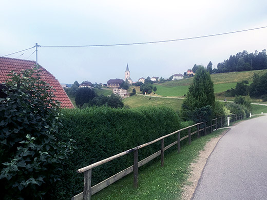
Eventually I found the right road on the other side of Villach to the south side of the Ossiacher See, that I believed would be nicer as it looked like the smaller of the two alternatives, but in retrospect I would have chosen the north side road no matter what. The small road was a very touristy road where yu were supposed to use some stupid bike path along, with camping places and whatnot along the road. It was on the warmer sunny side and therefore possibly more scenic, but it did not matter much really this day. I went on the road istelf just as a local cyclists overtaking me and soon I overtook him to in order to get ahead a bit faster.
I looked for a grocery shop along the road, but there was no serious shops along this road and on the other side of the lake I took the road crossing over to the other side and went to Feldkirchen, where I avoided the big supermarkets before the village hoping to find a smaller shop in town and did find it just at 6 pm when they just have locked the doors, nor could I find any water anywhere, and rather tired just continued out a strange small road via the church. I took off the main road up the Gurktal as planned to Zammelsberg. Eventually I found a little water in a garden by a house along the road after St. Ulrich and no more shops this day. Very tired I fought my way up the hills ahead. Came by a nice looking gasthaus in Goggau (or before) near the lake here, but it looked very busy and I wanted to get up the mountain ahead – to Zammelsberg at least, and as planned the evening before.
Eventually I got up to Zammelsberg (1099m), now feeling a bit better again in the less hot evening. The restaurant/pub at the crossroads had no lodging, but they said that maybe they had in Zammelsberg. It all looked like the gasthaus there should be ideal and there were some people eating at the restaurant, but unfortunately (as the man said) there were no lodging available anywhere near Zammelsberg. There were also a little rain in the air now, but luckily I escaped any rain. I continued down to Weitensfeld (702m) and after asking at a hotel that looked like they would have free rooms, they asked me to go to another little hotel by the sport area in the village. Indeed I found it and it was an agreeable place that had not really any other guests than me as far as I could make out. They had some easy type of pizzas on offer to eat, but two of them was fine and they were actually good. Later in the evening heavy rain and immense thunder and lightening were all around and it kept going for a long time. Lucky I escaped that!
